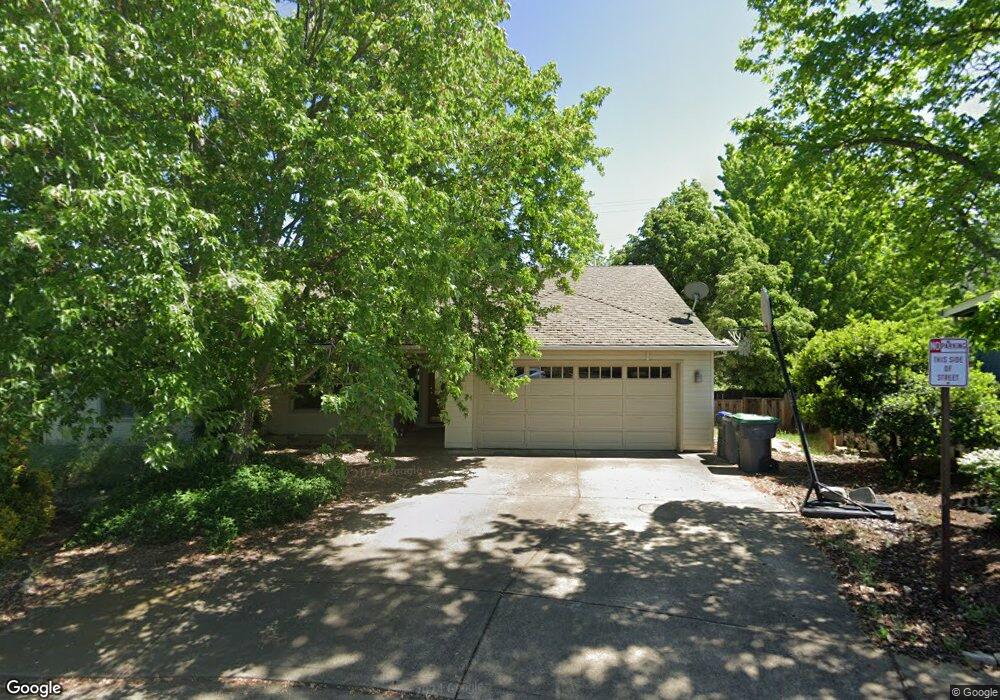
769 St Andrews Cir Ashland, OR 97520
Oak Knoll NeighborhoodEstimated Value: $455,000 - $498,000
3
Beds
2
Baths
1,461
Sq Ft
$323/Sq Ft
Est. Value
About This Home
This home is located at 769 St Andrews Cir, Ashland, OR 97520 and is currently estimated at $472,263, approximately $323 per square foot. 769 St Andrews Cir is a home located in Jackson County with nearby schools including Bellview Elementary School, Ashland Middle School, and Ashland High School.
Ownership History
Date
Name
Owned For
Owner Type
Purchase Details
Closed on
Jun 9, 2011
Sold by
Federal Home Loan Mortgage Corporation
Bought by
Norton Sabra J
Current Estimated Value
Purchase Details
Closed on
Sep 13, 2010
Sold by
Sullivan Robert D
Bought by
Federal Home Loan Mortgage Corp
Purchase Details
Closed on
Feb 14, 2006
Sold by
Savage Kenneth R and Savage Carol M
Bought by
Sullivan Robert D
Home Financials for this Owner
Home Financials are based on the most recent Mortgage that was taken out on this home.
Original Mortgage
$296,000
Interest Rate
5.77%
Mortgage Type
Fannie Mae Freddie Mac
Purchase Details
Closed on
Dec 28, 1999
Sold by
Lallo Anthony and Lallo Construction
Bought by
Savage Kenneth R and Savage Carol M
Home Financials for this Owner
Home Financials are based on the most recent Mortgage that was taken out on this home.
Original Mortgage
$90,000
Interest Rate
7.72%
Create a Home Valuation Report for This Property
The Home Valuation Report is an in-depth analysis detailing your home's value as well as a comparison with similar homes in the area
Home Values in the Area
Average Home Value in this Area
Purchase History
| Date | Buyer | Sale Price | Title Company |
|---|---|---|---|
| Norton Sabra J | $214,000 | Service Link | |
| Federal Home Loan Mortgage Corp | $285,000 | Fa | |
| Sullivan Robert D | $370,000 | Ticor Title | |
| Savage Kenneth R | $166,000 | Jackson County Title | |
| Lallo Anthony | $38,000 | Jackson County Title |
Source: Public Records
Mortgage History
| Date | Status | Borrower | Loan Amount |
|---|---|---|---|
| Previous Owner | Sullivan Robert D | $296,000 | |
| Previous Owner | Savage Kenneth R | $90,000 |
Source: Public Records
Tax History Compared to Growth
Tax History
| Year | Tax Paid | Tax Assessment Tax Assessment Total Assessment is a certain percentage of the fair market value that is determined by local assessors to be the total taxable value of land and additions on the property. | Land | Improvement |
|---|---|---|---|---|
| 2025 | $4,370 | $287,410 | $96,400 | $191,010 |
| 2024 | $4,370 | $279,040 | $93,590 | $185,450 |
| 2023 | $4,228 | $270,920 | $90,870 | $180,050 |
| 2022 | $4,092 | $270,920 | $90,870 | $180,050 |
| 2021 | $3,952 | $263,030 | $88,230 | $174,800 |
| 2020 | $3,841 | $255,370 | $85,660 | $169,710 |
| 2019 | $3,782 | $240,720 | $80,730 | $159,990 |
| 2018 | $3,570 | $233,710 | $78,370 | $155,340 |
| 2017 | $3,546 | $233,710 | $78,370 | $155,340 |
| 2016 | $3,454 | $220,310 | $73,880 | $146,430 |
| 2015 | $3,348 | $220,310 | $73,880 | $146,430 |
| 2014 | $3,239 | $207,670 | $69,640 | $138,030 |
Source: Public Records
Map
Nearby Homes
- 488 Crowson Rd
- 938 Cypress Point Loop
- 2799 Siskiyou Blvd Unit 7
- 2799 Siskiyou Blvd Unit 36
- 854 Twin Pines Cir Unit 7
- 805 Oak Knoll Dr
- 767 Twin Pines Cir
- 738 Fairway Ct
- 690 Spring Creek Dr
- 697 Oak Knoll Dr
- 799 E Jefferson Ave
- 288 Maywood Way
- 601 Washington St
- 996 Spring Way
- 3152 Siskiyou Blvd
- 551 Sutton Place
- 2969 Barbara St
- 1369 Tolman Creek Rd
- 933 Bellview Ave Unit 2
- 933 Bellview Ave Unit 1
- 725 St Andrews Cir
- 763 St Andrews Cir
- 775 Saint Andrews Cir
- 766 St Andrews Cir
- 778 St Andrews Cir
- 787 St Andrews Cir
- 772 St Andrews Cir Unit 92
- 772 St Andrews Cir
- 786 St Andrews Cir
- 793 St Andrews Cir
- 0 Saint Andrews Cir
- 761 Salishan Ct
- 792 St Andrews Cir
- 760 Salishan Ct
- 392 Crowson Rd
- 799 St Andrews Cir
- 798 St Andrews Cir
- 741 Salishan Ct
- 740 Salishan Ct
- 1111 Oak Knoll Dr