Estimated Value: $142,807 - $215,000
2
Beds
1
Bath
866
Sq Ft
$207/Sq Ft
Est. Value
About This Home
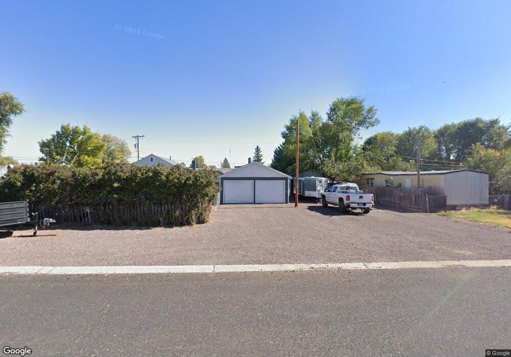
This home is located at 769 W Taylor St, Burns, OR 97720 and is currently estimated at $178,904, approximately $206 per square foot. 769 W Taylor St is a home located in Harney County with nearby schools including Henry L. Slater Elementary School, Hines Middle School, and Burns High School.
Ownership History
Date
Name
Owned For
Owner Type
Purchase Details
Closed on
Dec 23, 2021
Sold by
Ross Ann T and Ann T Ross Revocable Trust
Bought by
Roozeboom Harold J
Current Estimated Value
Home Financials for this Owner
Home Financials are based on the most recent Mortgage that was taken out on this home.
Original Mortgage
$77,232
Outstanding Balance
$60,313
Interest Rate
2.27%
Mortgage Type
New Conventional
Estimated Equity
$118,591
Purchase Details
Closed on
Sep 23, 2021
Sold by
Mccoy Travis S and Mccoy Wendy L
Bought by
Ross Ann T and Ann T Ross Revocable Trust
Purchase Details
Closed on
Jun 30, 2021
Sold by
Wensenk Judy
Bought by
Mycoy Travis S and Mycoy Wendy L
Create a Home Valuation Report for This Property
The Home Valuation Report is an in-depth analysis detailing your home's value as well as a comparison with similar homes in the area
Home Values in the Area
Average Home Value in this Area
Purchase History
| Date | Buyer | Sale Price | Title Company |
|---|---|---|---|
| Roozeboom Harold J | $81,297 | Amerititle | |
| Ross Ann T | $80,000 | Amerititle | |
| Mycoy Travis S | -- | None Available |
Source: Public Records
Mortgage History
| Date | Status | Borrower | Loan Amount |
|---|---|---|---|
| Open | Roozeboom Harold J | $77,232 |
Source: Public Records
Tax History Compared to Growth
Tax History
| Year | Tax Paid | Tax Assessment Tax Assessment Total Assessment is a certain percentage of the fair market value that is determined by local assessors to be the total taxable value of land and additions on the property. | Land | Improvement |
|---|---|---|---|---|
| 2024 | $1,362 | $76,740 | -- | -- |
| 2023 | $1,362 | $74,510 | $0 | $0 |
| 2022 | $1,280 | $72,340 | $0 | $0 |
| 2021 | $831 | $70,240 | $0 | $0 |
| 2020 | $808 | $70,240 | $0 | $0 |
| 2019 | $786 | $66,220 | $0 | $0 |
| 2018 | $764 | $64,290 | $0 | $0 |
| 2017 | $746 | $62,420 | $0 | $0 |
| 2016 | $722 | $60,610 | $0 | $0 |
| 2015 | $703 | $58,850 | $0 | $0 |
| 2014 | $681 | $57,140 | $0 | $0 |
Source: Public Records
Map
Nearby Homes
- 0 Tl 700 Harney Lake Rd
- 420 S Juntura Ave
- 480 S Diamond Ave
- 436 S Diamond Ave
- 781 S Kearney Ave
- 668 S Liberty Ave
- 845 S Egan Ave
- 104 S Egan Ave
- 35 S Grand Ave
- 145 N Grand Ave
- 420 W Grant St
- 421 W Grant St
- TBD N Imperial Ave
- 464 N Harney Ave
- 400 S Shasta Place
- 111 E Railroad Ave
- 566 N Fairview Ave
- TL 300 Pierce St
- 242 E Madison St
- 444 N Broadway Ave
- 610 S Grand Ave
- 640 S Grand Ave
- 495 S Harney Ave
- 492 S Grand Ave
- 630 S Harney Ave
- 476 S Grand Ave
- 465 S Harney Ave
- 482 S Harney Ave
- 658 S Harney Ave
- 459 S Harney Ave
- 796 W Filmore St
- 857 W Taylor St
- 623 S Imperial Ave
- 472 S Harney Ave
- 708 W Filmore St
- 454 S Grand Ave
- 668 S Harney Ave
- 493 S Grand Ave
- 475 S Imperial Ave
- 653 S Imperial Ave