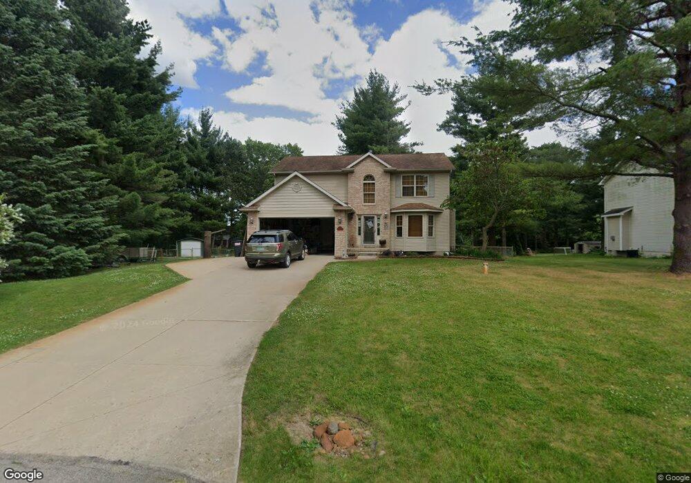
7692 Badger Ct Owosso, MI 48867
Estimated Value: $246,574 - $294,000
--
Bed
--
Bath
--
Sq Ft
0.46
Acres
About This Home
This home is located at 7692 Badger Ct, Owosso, MI 48867 and is currently estimated at $278,894. 7692 Badger Ct is a home located in Shiawassee County with nearby schools including Perry Elementary School, Perry Middle School, and Perry High School.
Ownership History
Date
Name
Owned For
Owner Type
Purchase Details
Closed on
Apr 26, 2004
Sold by
Fleming Nevada M and Fleming Geneva E
Bought by
Vanderkarr Paula J and Vanderkarr Linda L
Current Estimated Value
Home Financials for this Owner
Home Financials are based on the most recent Mortgage that was taken out on this home.
Original Mortgage
$143,900
Outstanding Balance
$67,279
Interest Rate
5.46%
Mortgage Type
Purchase Money Mortgage
Estimated Equity
$211,615
Purchase Details
Closed on
Jun 3, 2003
Sold by
Louis J Eyde Limited Family Partnership
Bought by
Fleming Nevada M and Fleming Geneva E
Create a Home Valuation Report for This Property
The Home Valuation Report is an in-depth analysis detailing your home's value as well as a comparison with similar homes in the area
Home Values in the Area
Average Home Value in this Area
Purchase History
| Date | Buyer | Sale Price | Title Company |
|---|---|---|---|
| Vanderkarr Paula J | $180,000 | -- | |
| Fleming Nevada M | $26,900 | -- |
Source: Public Records
Mortgage History
| Date | Status | Borrower | Loan Amount |
|---|---|---|---|
| Open | Vanderkarr Paula J | $143,900 |
Source: Public Records
Tax History Compared to Growth
Tax History
| Year | Tax Paid | Tax Assessment Tax Assessment Total Assessment is a certain percentage of the fair market value that is determined by local assessors to be the total taxable value of land and additions on the property. | Land | Improvement |
|---|---|---|---|---|
| 2025 | $2,684 | $126,900 | $0 | $0 |
| 2024 | $2,540 | $124,600 | $0 | $0 |
| 2023 | $1,211 | $113,500 | $0 | $0 |
| 2022 | $1,154 | $102,700 | $0 | $0 |
| 2021 | $2,242 | $93,100 | $0 | $0 |
| 2020 | $2,233 | $93,900 | $0 | $0 |
| 2019 | $2,193 | $77,900 | $0 | $0 |
| 2018 | $2,145 | $67,600 | $0 | $0 |
| 2017 | $1,963 | $66,800 | $0 | $0 |
| 2016 | -- | $66,800 | $0 | $0 |
| 2015 | -- | $66,400 | $0 | $0 |
| 2014 | $11 | $64,000 | $0 | $0 |
Source: Public Records
Map
Nearby Homes
- 3062 Innsbrook Dr
- 3110 Innsbrook Dr
- 3287 Oakview Dr
- 7697 Riverview St
- 25 Bennington Greens Dr
- 26 Bennington Greens Dr Unit 26
- 20 Bennington Greens Dr
- 24 Bennington Greens Dr
- 38 Bennington Greens Dr
- 14 Bennington Greens Dr
- 54 Bennington Greens Dr
- V/L Tyrrell Rd
- 2973 W Brewer Rd
- 2628 W Brewer Rd
- 0 Gale Rd Unit 50124635
- 7202 Fenner Rd
- 4458 S M 52
- 4650 Waugh Rd
- 0 E Lansing Rd
- 10980 S M 52
- 7704 Badger Ct
- 7684 Badger Ct
- 7690 Badger Ct
- 7702 Grove Ridge Rd
- 7688 Grove Ridge Rd
- 7695 Badger Ct
- 7716 Grove Ridge Rd
- 7707 Badger Ct
- 7674 Grove Ridge Rd
- 3199 Whitetail Ln
- 3241 Whitetail Ln
- 7730 Possum Heights Cir
- 3253 Whitetail Ln
- 3167 Innsbrook Dr
- 3145 Innsbrook Dr
- 7659 Maple Ln
- 3265 Whitetail Ln
- 0 Innsbrook Dr
- 3191 Whitetail Ln