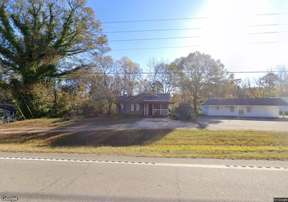
7693 Westpoint Rd West Point, GA 31833
Estimated Value: $106,000 - $164,000
2
Beds
1
Bath
1,236
Sq Ft
$98/Sq Ft
Est. Value
About This Home
This home is located at 7693 Westpoint Rd, West Point, GA 31833 and is currently estimated at $121,575, approximately $98 per square foot. 7693 Westpoint Rd is a home located in Troup County with nearby schools including West Point Elementary School, Long Cane Elementary School, and Berta Weathersbee Elementary School.
Ownership History
Date
Name
Owned For
Owner Type
Purchase Details
Closed on
Dec 19, 2011
Sold by
Brown Gordon Lewis
Current Estimated Value
Purchase Details
Closed on
Jun 23, 2005
Sold by
Mccarden Willie
Bought by
Smith Mccarden Annies L
Purchase Details
Closed on
Oct 23, 2002
Sold by
Bank One Na
Bought by
Willie Mccarden
Purchase Details
Closed on
Dec 4, 2001
Sold by
Cowan Anthony and Cowan Velinda E
Bought by
Bank One Na
Purchase Details
Closed on
Mar 2, 2000
Sold by
Lindsey Henriette R
Bought by
Cowan Anthony and Cowan Velinda E
Purchase Details
Closed on
Apr 16, 1996
Sold by
Mckay L E
Bought by
Lindsey Henriette R
Purchase Details
Closed on
Oct 6, 1968
Sold by
Mckay C E
Bought by
Mckay L E
Create a Home Valuation Report for This Property
The Home Valuation Report is an in-depth analysis detailing your home's value as well as a comparison with similar homes in the area
Home Values in the Area
Average Home Value in this Area
Purchase History
| Date | Buyer | Sale Price | Title Company |
|---|---|---|---|
| -- | $35,000 | -- | |
| Smith Mccarden Annies L | -- | -- | |
| Willie Mccarden | $14,500 | -- | |
| Bank One Na | $23,900 | -- | |
| Cowan Anthony | -- | -- | |
| Lindsey Henriette R | $20,000 | -- | |
| Mckay L E | -- | -- |
Source: Public Records
Tax History Compared to Growth
Tax History
| Year | Tax Paid | Tax Assessment Tax Assessment Total Assessment is a certain percentage of the fair market value that is determined by local assessors to be the total taxable value of land and additions on the property. | Land | Improvement |
|---|---|---|---|---|
| 2024 | $929 | $34,080 | $3,520 | $30,560 |
| 2023 | $797 | $29,240 | $3,520 | $25,720 |
| 2022 | $764 | $27,360 | $3,520 | $23,840 |
| 2021 | $660 | $21,892 | $2,720 | $19,172 |
| 2020 | $660 | $21,892 | $2,720 | $19,172 |
| 2019 | $538 | $17,844 | $2,712 | $15,132 |
| 2018 | $497 | $16,472 | $2,712 | $13,760 |
| 2017 | $497 | $16,472 | $2,712 | $13,760 |
| 2016 | $492 | $16,321 | $2,712 | $13,609 |
| 2015 | $493 | $16,321 | $2,712 | $13,609 |
| 2014 | $472 | $15,604 | $2,712 | $12,892 |
| 2013 | -- | $16,240 | $2,712 | $13,528 |
Source: Public Records
Map
Nearby Homes
- 1599 Highway 29
- 0 Ga Highway 0116 Unit 10619139
- 1903 Ridgewood Dr
- 508 Pine St
- 1505 Wisteria Dr
- 0 Sunset Dr Unit 10451831
- 1008 E 12th St
- 1410 Roper Ave
- 4517 Georgia 18
- 4509 Georgia 18
- 4523 Georgia 18
- 4527 Georgia 18
- 1314 4th Ave
- 1095 County Road 212
- 111 Tudor Way
- 0 Arrowhead Dr Unit 10451860
- 713 Avenue H
- 1007 4th Ave
- 1103 Clara Dr
- 1109 Clara Dr
- 7703 & 7701 W Point Rd
- 7681 W Point Rd
- 7703 W Point Rd
- 7703 Westpoint Rd
- 7703 Hwy 29
- 7681 Westpoint Rd
- 7681 Westpoint Rd
- 7682 Westpoint Rd
- 7717 Westpoint Rd
- 7710 Westpoint Rd
- 55 Samples Rd
- 7682 W Point Rd
- 7733 Westpoint Rd
- 7668 W Westpoint Rd
- 7726 Westpoint Rd
- 7915 W Point Rd
- 90 Samples Rd
- 7737 Westpoint Rd
- 41 Samples Rd
- 7703 U S 29