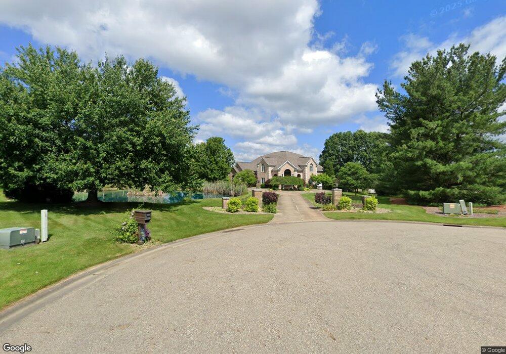
7699 Bethany Cir NW North Canton, OH 44720
Estimated Value: $867,859 - $1,327,000
6
Beds
7
Baths
6,768
Sq Ft
$157/Sq Ft
Est. Value
About This Home
This home is located at 7699 Bethany Cir NW, North Canton, OH 44720 and is currently estimated at $1,065,953, approximately $157 per square foot. 7699 Bethany Cir NW is a home located in Stark County with nearby schools including Strausser Elementary School, Jackson Memorial Middle School, and Jackson High School.
Ownership History
Date
Name
Owned For
Owner Type
Purchase Details
Closed on
Jun 28, 2010
Sold by
Rini Doreen L and Rini Darryl R
Bought by
Musser Joseph M
Current Estimated Value
Home Financials for this Owner
Home Financials are based on the most recent Mortgage that was taken out on this home.
Original Mortgage
$417,000
Interest Rate
3.37%
Mortgage Type
New Conventional
Purchase Details
Closed on
Aug 1, 2000
Sold by
Rini Darryl R and Rini Doreen L
Bought by
Rini Doreen L
Purchase Details
Closed on
Oct 16, 1990
Create a Home Valuation Report for This Property
The Home Valuation Report is an in-depth analysis detailing your home's value as well as a comparison with similar homes in the area
Home Values in the Area
Average Home Value in this Area
Purchase History
| Date | Buyer | Sale Price | Title Company |
|---|---|---|---|
| Musser Joseph M | $602,500 | Attorney | |
| Rini Doreen L | -- | -- | |
| -- | $41,000 | -- |
Source: Public Records
Mortgage History
| Date | Status | Borrower | Loan Amount |
|---|---|---|---|
| Previous Owner | Musser Joseph M | $417,000 |
Source: Public Records
Tax History Compared to Growth
Tax History
| Year | Tax Paid | Tax Assessment Tax Assessment Total Assessment is a certain percentage of the fair market value that is determined by local assessors to be the total taxable value of land and additions on the property. | Land | Improvement |
|---|---|---|---|---|
| 2025 | -- | $257,680 | $60,660 | $197,020 |
| 2024 | -- | $257,680 | $60,660 | $197,020 |
| 2023 | $10,801 | $216,830 | $36,960 | $179,870 |
| 2022 | $10,743 | $216,830 | $36,960 | $179,870 |
| 2021 | $10,785 | $216,830 | $36,960 | $179,870 |
| 2020 | $10,337 | $191,030 | $33,460 | $157,570 |
| 2019 | $9,953 | $191,050 | $33,470 | $157,580 |
| 2018 | $10,011 | $191,050 | $33,470 | $157,580 |
| 2017 | $10,224 | $185,680 | $28,840 | $156,840 |
| 2016 | $9,905 | $178,680 | $28,840 | $149,840 |
| 2015 | $10,026 | $178,680 | $28,840 | $149,840 |
| 2014 | $651 | $181,520 | $29,300 | $152,220 |
| 2013 | $5,236 | $181,520 | $29,300 | $152,220 |
Source: Public Records
Map
Nearby Homes
- 7316 Bentham Cir NW
- 8132 Arlington Ave NW
- 7035 Harvey Ave NW Unit 9
- 0 Strausser St NW Unit 5150265
- 8304 Arlington Ave NW
- 5768 Wales Ave NW
- 7412 Klingston St NW
- 7087 Emerson Cir NW
- 6541 Lorraine Ave NW
- 7718 Rolling Green Ave NW
- 6519 Lorraine Ave NW
- 6540 Lorraine Ave NW
- 8445 Morrilton Cir NW
- 7622 Greenview Ave NW
- 7498 Greenview Ave NW
- 259 Oak Dr NW
- 7750 Killeen St NW
- 8785 Strausser St NW
- 8932 Camden Rd NW
- 8322 Forest Ridge St NW
- 7421 Farmdale Ave NW
- 7677 Bethany Cir NW
- 7660 Bethany Cir NW
- 7631 Bethany Cir NW
- 7376 Farmdale Ave NW
- 7620 Bethany Cir NW
- 7694 Strausser St NW
- VL Farmbrook Ave
- 6.61 Acre Farmbrook Ave
- 3.04 Acre Farmbrook Ave
- 9.66 acres Farmbrook Ave
- 1.484ac Farmbrook Ave
- 2.875ac Farmbrook Ave
- 6.878ac Farmbrook Ave
- 5.93ac Farmbrook Ave
- 9.66 ac Farmbrook Ave
- 0 Farmbrook Ave
- 0 Farmbrook Ave
- 6.61 Acre Farmbrook Ave NW
- 0 1 484 Acres - Farmbrook Ave NW Unit 4242383