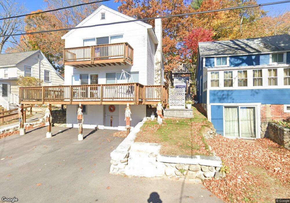
77 1/2 Lake Attitash Rd Amesbury, MA 01913
Estimated Value: $590,668 - $734,000
4
Beds
2
Baths
1,900
Sq Ft
$351/Sq Ft
Est. Value
About This Home
This home is located at 77 1/2 Lake Attitash Rd, Amesbury, MA 01913 and is currently estimated at $666,917, approximately $351 per square foot. 77 1/2 Lake Attitash Rd is a home located in Essex County with nearby schools including Amesbury High School and Amesbury Seventh-Day Adventist School.
Ownership History
Date
Name
Owned For
Owner Type
Purchase Details
Closed on
Jul 22, 2015
Sold by
Ward Ann M
Bought by
Ward Ann M
Current Estimated Value
Purchase Details
Closed on
Jul 9, 2003
Sold by
Ward Richard J
Bought by
Ward Ann Marie
Purchase Details
Closed on
Nov 18, 1974
Bought by
Ward Ann M
Create a Home Valuation Report for This Property
The Home Valuation Report is an in-depth analysis detailing your home's value as well as a comparison with similar homes in the area
Home Values in the Area
Average Home Value in this Area
Purchase History
| Date | Buyer | Sale Price | Title Company |
|---|---|---|---|
| Ward Ann M | -- | -- | |
| Ward Ann Marie | -- | -- | |
| Ward Ann M | -- | -- |
Source: Public Records
Mortgage History
| Date | Status | Borrower | Loan Amount |
|---|---|---|---|
| Previous Owner | Ward Ann M | $66,000 |
Source: Public Records
Tax History Compared to Growth
Tax History
| Year | Tax Paid | Tax Assessment Tax Assessment Total Assessment is a certain percentage of the fair market value that is determined by local assessors to be the total taxable value of land and additions on the property. | Land | Improvement |
|---|---|---|---|---|
| 2025 | $6,835 | $446,700 | $170,100 | $276,600 |
| 2024 | $6,603 | $422,200 | $166,000 | $256,200 |
| 2023 | $6,431 | $393,600 | $150,900 | $242,700 |
| 2022 | $6,068 | $343,000 | $120,700 | $222,300 |
| 2021 | $6,331 | $346,900 | $120,700 | $226,200 |
| 2020 | $6,001 | $349,300 | $120,700 | $228,600 |
| 2019 | $5,202 | $283,200 | $115,000 | $168,200 |
| 2018 | $5,220 | $274,900 | $109,500 | $165,400 |
| 2017 | $5,402 | $270,800 | $127,800 | $143,000 |
| 2016 | $5,275 | $260,100 | $127,800 | $132,300 |
| 2015 | $4,903 | $238,700 | $127,800 | $110,900 |
| 2014 | -- | $230,200 | $127,800 | $102,400 |
Source: Public Records
Map
Nearby Homes
- 4 Acadia Kimball Rd
- 1 Acadia Kimball Rd Unit 1
- 1 Tuxbury Ln
- 20 Hillside Ct
- 1 Bisson Ln
- 3 Greystone Rd
- 152 Kimball Rd
- 160 Haverhill Rd
- 188 Lions Mouth Rd
- 5 Moncrief St Unit 5
- 10 Sharon Cir
- 3 B St
- 6 B St
- 44 Pamela Ln
- 20 Mason Ct
- 10 Mason Ct Unit 10
- 16 Glen Devin St
- 31 Whitter Meadows Dr Unit 31
- 61 E Main St
- 21-23 E Main St
- 77 Lake Attitash Rd
- 79 Lake Attitash Rd
- 3 Beech Ln
- 5 Beech Ln
- 75 Lake Attitash Rd
- 81 Lake Attitash Rd
- 76 Lake Attitash Rd
- 78 Lake Attitash Rd
- 7 Beech Ln
- 74 Lake Attitash Rd
- 80 Lake Attitash Rd
- 9 Beech Ln
- 73 Lake Attitash Rd
- 83 Lake Attitash Rd
- 1 Beech Ln
- 82 Lake Attitash Rd
- 11 Beech Ln
- 11 Beech Ln Unit 11
- 72 Lake Attitash Rd
- 9 Lake Attitash Way