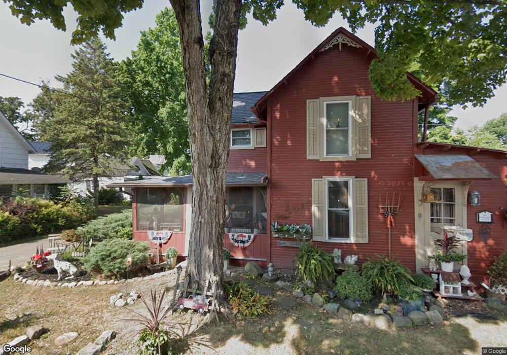
77 4th St Lancaster, OH 43130
Estimated Value: $78,576 - $89,000
1
Bed
2
Baths
754
Sq Ft
$110/Sq Ft
Est. Value
About This Home
This home is located at 77 4th St, Lancaster, OH 43130 and is currently estimated at $83,192, approximately $110 per square foot. 77 4th St is a home located in Fairfield County with nearby schools including General Sherman Junior High School, Lancaster High School, and St Mary Elementary School.
Ownership History
Date
Name
Owned For
Owner Type
Purchase Details
Closed on
Jun 24, 2016
Sold by
Daniels Michael R
Bought by
Joyce Muncy
Current Estimated Value
Home Financials for this Owner
Home Financials are based on the most recent Mortgage that was taken out on this home.
Interest Rate
3.56%
Create a Home Valuation Report for This Property
The Home Valuation Report is an in-depth analysis detailing your home's value as well as a comparison with similar homes in the area
Home Values in the Area
Average Home Value in this Area
Purchase History
| Date | Buyer | Sale Price | Title Company |
|---|---|---|---|
| Joyce Muncy | $33,000 | -- |
Source: Public Records
Mortgage History
| Date | Status | Borrower | Loan Amount |
|---|---|---|---|
| Closed | Joyce Muncy | -- |
Source: Public Records
Tax History
| Year | Tax Paid | Tax Assessment Tax Assessment Total Assessment is a certain percentage of the fair market value that is determined by local assessors to be the total taxable value of land and additions on the property. | Land | Improvement |
|---|---|---|---|---|
| 2025 | $1,140 | $12,400 | -- | $12,400 |
| 2024 | $1,140 | $12,680 | -- | $12,680 |
| 2023 | $461 | $12,680 | -- | $12,680 |
| 2022 | $463 | $12,680 | $0 | $12,680 |
| 2021 | $396 | $10,150 | $0 | $10,150 |
| 2020 | $379 | $10,150 | $0 | $10,150 |
| 2019 | $360 | $10,150 | $0 | $10,150 |
| 2018 | $320 | $8,550 | $0 | $8,550 |
| 2017 | $320 | $8,550 | $0 | $8,550 |
| 2016 | $0 | $8,550 | $0 | $8,550 |
| 2015 | $181 | $8,170 | $0 | $8,170 |
| 2014 | $181 | $8,170 | $0 | $8,170 |
| 2013 | $181 | $8,170 | $0 | $8,170 |
Source: Public Records
Map
Nearby Homes
- 331 16th St
- 82 W 5th St
- 81 W 5th St
- 115 6th N
- 3 1st St
- 32 2nd St
- 1174 Creekview Ct Unit 9-1174
- 2286 W Fair Ave
- 842 Lambton Cir W
- 2412 W Fair Ave
- 1829 Beacon St
- 0 W Fair Ave
- 2603 Misty Meadows Ave
- 2547 W Fair Ave
- 1616 W Fair Ave
- 461 N Shoshone Dr
- 539 N Ohio Ave
- 1829 Shoshone Dr
- 215 Summitview Dr
- 1125 Zimmer St
Your Personal Tour Guide
Ask me questions while you tour the home.