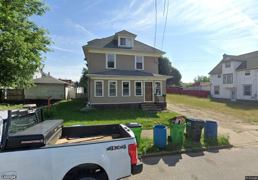
77 Antles Ave Barberton, OH 44203
Estimated Value: $107,000 - $169,000
4
Beds
3
Baths
1,790
Sq Ft
$74/Sq Ft
Est. Value
About This Home
This home is located at 77 Antles Ave, Barberton, OH 44203 and is currently estimated at $131,965, approximately $73 per square foot. 77 Antles Ave is a home located in Summit County with nearby schools including Barberton Middle School, Barberton High School, and St Augustine Elementary School.
Ownership History
Date
Name
Owned For
Owner Type
Purchase Details
Closed on
Jan 22, 2015
Sold by
Neighborhood Development Services Inc
Bought by
Roland Teresa M
Current Estimated Value
Home Financials for this Owner
Home Financials are based on the most recent Mortgage that was taken out on this home.
Original Mortgage
$20,000
Outstanding Balance
$15,375
Interest Rate
3.94%
Mortgage Type
Purchase Money Mortgage
Estimated Equity
$116,590
Purchase Details
Closed on
Jan 1, 2015
Sold by
Neighborhood Development Services Inc
Bought by
Roland Teresa M
Home Financials for this Owner
Home Financials are based on the most recent Mortgage that was taken out on this home.
Original Mortgage
$20,000
Outstanding Balance
$15,375
Interest Rate
3.94%
Mortgage Type
Purchase Money Mortgage
Estimated Equity
$116,590
Purchase Details
Closed on
Dec 18, 2014
Sold by
Neighborhood Development Services Inc
Bought by
Roland Teresa M
Home Financials for this Owner
Home Financials are based on the most recent Mortgage that was taken out on this home.
Original Mortgage
$20,000
Outstanding Balance
$15,375
Interest Rate
3.94%
Mortgage Type
Purchase Money Mortgage
Estimated Equity
$116,590
Purchase Details
Closed on
Oct 22, 2014
Sold by
Nationstar Mortgage Llc
Bought by
Neighborhood Development Services Inc
Purchase Details
Closed on
Dec 31, 2009
Sold by
Tesco Properties Llc
Bought by
Roland Teresa
Home Financials for this Owner
Home Financials are based on the most recent Mortgage that was taken out on this home.
Original Mortgage
$74,600
Interest Rate
9.5%
Mortgage Type
Seller Take Back
Purchase Details
Closed on
Apr 25, 2006
Sold by
Butcher Sherry and Butcher Tim
Bought by
Butcher Sherry and 77 Antles Avenue Land Trust
Purchase Details
Closed on
Apr 7, 2005
Sold by
Hud
Bought by
Butcher Tim and Butcher Sherry
Home Financials for this Owner
Home Financials are based on the most recent Mortgage that was taken out on this home.
Original Mortgage
$59,250
Interest Rate
5.89%
Mortgage Type
Purchase Money Mortgage
Purchase Details
Closed on
Aug 26, 2004
Sold by
Edwards James R
Bought by
Hud
Purchase Details
Closed on
May 31, 2000
Sold by
Edwards Thurlin D and Edwards Katheleen M
Bought by
Edwards James R and Edwards Kimberly A
Home Financials for this Owner
Home Financials are based on the most recent Mortgage that was taken out on this home.
Original Mortgage
$54,702
Interest Rate
8.18%
Mortgage Type
FHA
Create a Home Valuation Report for This Property
The Home Valuation Report is an in-depth analysis detailing your home's value as well as a comparison with similar homes in the area
Home Values in the Area
Average Home Value in this Area
Purchase History
| Date | Buyer | Sale Price | Title Company |
|---|---|---|---|
| Roland Teresa M | $20,000 | Diamond Title Co | |
| Roland Teresa M | $20,000 | Diamond Title Co | |
| Roland Teresa M | $20,000 | None Available | |
| Neighborhood Development Services Inc | -- | None Available | |
| Roland Teresa | $85,000 | None Available | |
| Butcher Sherry | -- | Americas Choice Title Agency | |
| Butcher Tim | $33,200 | -- | |
| Hud | $42,000 | -- | |
| Edwards James R | $60,000 | Endress/Lawyers Title |
Source: Public Records
Mortgage History
| Date | Status | Borrower | Loan Amount |
|---|---|---|---|
| Open | Roland Teresa M | $20,000 | |
| Closed | Roland Teresa M | $20,000 | |
| Previous Owner | Roland Teresa | $74,600 | |
| Previous Owner | Butcher Tim | $59,250 | |
| Previous Owner | Edwards James R | $54,702 |
Source: Public Records
Tax History Compared to Growth
Tax History
| Year | Tax Paid | Tax Assessment Tax Assessment Total Assessment is a certain percentage of the fair market value that is determined by local assessors to be the total taxable value of land and additions on the property. | Land | Improvement |
|---|---|---|---|---|
| 2025 | $1,535 | $28,480 | $5,264 | $23,216 |
| 2024 | $1,462 | $28,480 | $5,264 | $23,216 |
| 2023 | $1,535 | $28,480 | $5,264 | $23,216 |
| 2022 | $1,274 | $22,110 | $4,050 | $18,060 |
| 2021 | $1,273 | $22,110 | $4,050 | $18,060 |
| 2020 | $1,246 | $22,110 | $4,050 | $18,060 |
| 2019 | $1,438 | $16,900 | $4,670 | $12,230 |
| 2018 | $1,286 | $16,900 | $4,670 | $12,230 |
| 2017 | $1,193 | $16,900 | $4,670 | $12,230 |
| 2016 | $1,196 | $19,230 | $4,670 | $14,560 |
| 2015 | $1,193 | $19,230 | $4,670 | $14,560 |
| 2014 | $1,434 | $22,600 | $4,670 | $17,930 |
| 2013 | $1,392 | $22,740 | $4,670 | $18,070 |
Source: Public Records
Map
Nearby Homes
- 442 Wooster Rd N
- 46 Brown St
- 613 Wooster Rd N
- 320 Lincoln Ave Unit 322
- 0 Wooster Rd N
- 387 4th St NW
- 645 Madison Ave
- 412 Grandview Ave
- 583 Creedmore Ave
- 610 Creedmore Ave
- 44 W Summit St
- 690 Saint Clair Ave
- 334 E Tuscarawas Ave
- 103 Mitchell St
- 327 Robinson Ave
- 25 S Van Buren Ave
- 414 E Baird Ave
- 43 S Van Buren Ave
- 680 W Paige Ave
- 30 W Hiram St
- 73 Antles Ave
- 69 Antles Ave
- 437 Wooster Rd N
- 441 Wooster Rd N
- 433 Wooster Rd N
- 445 Wooster Rd N
- 63 Antles Ave
- 76 Etling Ave
- 72 Etling Ave
- 74 Antles Ave
- 449 Wooster Rd N
- 68 Etling Ave
- 423 Wooster Rd N
- 59 Antles Ave
- 68 Antles Ave
- 64 Etling Ave
- 453 Wooster Rd N
- 64 Antles Ave
- 78 Antles Ave
- 55 Antles Ave