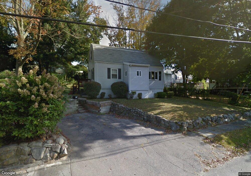
77 Apple Tree Ln Weymouth, MA 02188
Weymouth Landing NeighborhoodEstimated Value: $575,000 - $599,000
3
Beds
2
Baths
1,260
Sq Ft
$464/Sq Ft
Est. Value
About This Home
This home is located at 77 Apple Tree Ln, Weymouth, MA 02188 and is currently estimated at $584,248, approximately $463 per square foot. 77 Apple Tree Ln is a home located in Norfolk County with nearby schools including Frederick C Murphy, Abigail Adams Middle School, and Weymouth Middle School Chapman.
Ownership History
Date
Name
Owned For
Owner Type
Purchase Details
Closed on
Mar 2, 1993
Sold by
Harrington G M Est
Bought by
Harrington Robert F and Harrington Cathy
Current Estimated Value
Create a Home Valuation Report for This Property
The Home Valuation Report is an in-depth analysis detailing your home's value as well as a comparison with similar homes in the area
Home Values in the Area
Average Home Value in this Area
Purchase History
| Date | Buyer | Sale Price | Title Company |
|---|---|---|---|
| Harrington Robert F | $120,000 | -- |
Source: Public Records
Mortgage History
| Date | Status | Borrower | Loan Amount |
|---|---|---|---|
| Open | Harrington Robert F | $47,500 | |
| Open | Harrington Robert F | $121,600 | |
| Closed | Harrington Robert F | $34,000 |
Source: Public Records
Tax History
| Year | Tax Paid | Tax Assessment Tax Assessment Total Assessment is a certain percentage of the fair market value that is determined by local assessors to be the total taxable value of land and additions on the property. | Land | Improvement |
|---|---|---|---|---|
| 2025 | $4,910 | $486,100 | $222,600 | $263,500 |
| 2024 | $4,756 | $463,100 | $212,000 | $251,100 |
| 2023 | $4,487 | $429,400 | $196,300 | $233,100 |
| 2022 | $4,391 | $383,200 | $181,800 | $201,400 |
| 2021 | $4,102 | $349,400 | $181,800 | $167,600 |
| 2020 | $3,897 | $326,900 | $181,800 | $145,100 |
| 2019 | $3,803 | $313,800 | $174,800 | $139,000 |
| 2018 | $3,693 | $295,400 | $166,400 | $129,000 |
| 2017 | $3,616 | $282,300 | $158,500 | $123,800 |
| 2016 | $3,503 | $273,700 | $152,500 | $121,200 |
| 2015 | $3,327 | $257,900 | $145,500 | $112,400 |
| 2014 | $3,179 | $239,000 | $135,400 | $103,600 |
Source: Public Records
Map
Nearby Homes
- 107 Summer St
- 82 Lester Ln
- 15 Summer St
- 33 Congress St
- 11 Richmond St
- 122 Washington St Unit Twenty-two
- 25 Richmond St
- 19 Vine St Unit 3
- 19 Vine St Unit 2
- 37 Lantern Ln
- 41 Lantern Ln
- 31 Doris Rd
- 46 Roosevelt Rd
- 501 Commerce Dr Unit 2310
- 501 Commerce Dr Unit 4308
- 300 Commercial St Unit 23
- 116 Greenvale Ave
- 54 Edgemont Rd
- 211 Roosevelt Rd
- 16 Beechwood Rd
Your Personal Tour Guide
Ask me questions while you tour the home.