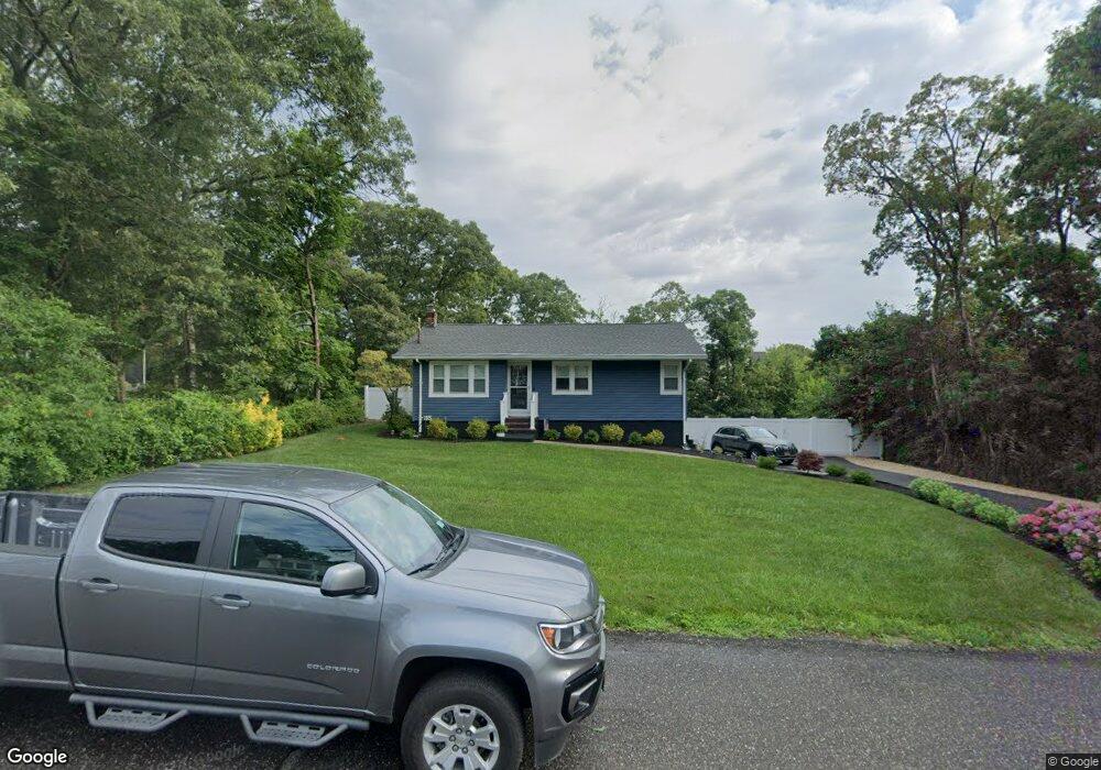
77 Aster Ave Holtsville, NY 11742
Estimated Value: $505,000 - $543,000
3
Beds
1
Bath
888
Sq Ft
$595/Sq Ft
Est. Value
About This Home
This home is located at 77 Aster Ave, Holtsville, NY 11742 and is currently estimated at $528,279, approximately $594 per square foot. 77 Aster Ave is a home located in Suffolk County with nearby schools including Sagamore Middle School, Sachem High School East, and Long Island Baptist Academy.
Ownership History
Date
Name
Owned For
Owner Type
Purchase Details
Closed on
Aug 4, 2021
Sold by
Doris R Haibon 2021 Irt
Bought by
Lorello Selena J and Libardi Theresa J
Current Estimated Value
Home Financials for this Owner
Home Financials are based on the most recent Mortgage that was taken out on this home.
Original Mortgage
$397,664
Interest Rate
2.88%
Mortgage Type
FHA
Purchase Details
Closed on
Jun 1, 2021
Sold by
Haibon Doris R
Bought by
Doris R Haibon 2021 Irt
Create a Home Valuation Report for This Property
The Home Valuation Report is an in-depth analysis detailing your home's value as well as a comparison with similar homes in the area
Home Values in the Area
Average Home Value in this Area
Purchase History
| Date | Buyer | Sale Price | Title Company |
|---|---|---|---|
| Lorello Selena J | $405,000 | None Available | |
| Doris R Haibon 2021 Irt | -- | None Available |
Source: Public Records
Mortgage History
| Date | Status | Borrower | Loan Amount |
|---|---|---|---|
| Previous Owner | Lorello Selena J | $397,664 |
Source: Public Records
Tax History Compared to Growth
Tax History
| Year | Tax Paid | Tax Assessment Tax Assessment Total Assessment is a certain percentage of the fair market value that is determined by local assessors to be the total taxable value of land and additions on the property. | Land | Improvement |
|---|---|---|---|---|
| 2024 | $7,768 | $1,800 | $150 | $1,650 |
| 2023 | $7,768 | $1,800 | $150 | $1,650 |
| 2022 | $3,688 | $1,800 | $150 | $1,650 |
| 2021 | $3,688 | $1,800 | $150 | $1,650 |
| 2020 | $3,869 | $1,800 | $150 | $1,650 |
| 2019 | $3,869 | $0 | $0 | $0 |
| 2018 | $3,543 | $1,800 | $150 | $1,650 |
| 2017 | $3,543 | $1,800 | $150 | $1,650 |
| 2016 | $3,539 | $1,800 | $150 | $1,650 |
| 2015 | -- | $1,800 | $150 | $1,650 |
| 2014 | -- | $1,800 | $150 | $1,650 |
Source: Public Records
Map
Nearby Homes
- 157 Wildwood Cir
- 174 Woodycrest Dr
- 64 Ridgedale Ave
- 337 Peconic Ave
- 19 Broadway
- 5439 Expressway Dr N
- 4 Bridle Path
- 15 Spurwoods Ln
- 109 Rexmere Ave
- 0 Old Medford Ave
- 541 Blue Point Rd
- 627 Blue Point Rd
- 7 Albermarle Ave
- 23 Allegheny Dr W
- 55 Woodycrest Dr
- 63 Robinson Ave
- 111 Cedar Oaks Ave
- 972 Old Medford Ave
- 16 Allegheny Dr W
- 17 Timber Ridge Dr
- 75 Aster Ave
- 121 Wildwood Cir
- 122 Wildwood Cir Unit 122
- 80 Aster Ave
- 82 Aster Ave
- 125 Wildwood Cir
- 126 Wildwood Cir
- 76 Aster Ave
- 120 Wildwood Cir Unit 20
- 120 Wildwood Cir
- 74 Aster Ave
- 155 Wildwood Cir Unit 155
- 132 Wildwood Cir Unit 132
- 72 Aster Ave
- 154 Wildwood Cir Unit 154
- 76 Blossom Ave
- 71 Aster Ave
- 134 Wildwood Cir Unit 134
- 134 Wildwood Cir
- 113 Wildwood Cir