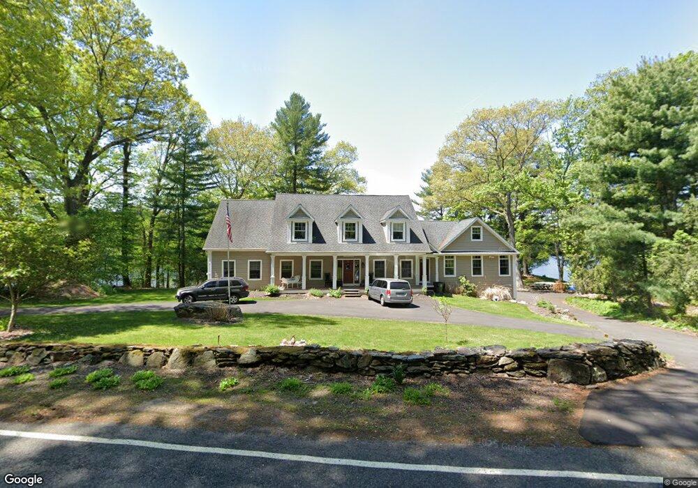
77 Canoe Brook Rd Trumbull, CT 06611
Tashua NeighborhoodEstimated Value: $683,000 - $1,654,223
5
Beds
5
Baths
4,863
Sq Ft
$283/Sq Ft
Est. Value
About This Home
This home is located at 77 Canoe Brook Rd, Trumbull, CT 06611 and is currently estimated at $1,376,306, approximately $283 per square foot. 77 Canoe Brook Rd is a home located in Fairfield County with nearby schools including Jane Ryan School, Madison Middle School, and Trumbull High School.
Ownership History
Date
Name
Owned For
Owner Type
Purchase Details
Closed on
Oct 4, 2017
Sold by
Jsdd Llc
Bought by
Salerno David and Salerno Deborah
Current Estimated Value
Home Financials for this Owner
Home Financials are based on the most recent Mortgage that was taken out on this home.
Original Mortgage
$586,600
Outstanding Balance
$490,501
Interest Rate
3.86%
Mortgage Type
New Conventional
Estimated Equity
$885,805
Purchase Details
Closed on
Feb 24, 2011
Sold by
Toth Judith M and Salerno Deborah S
Bought by
Jsdd Llc
Create a Home Valuation Report for This Property
The Home Valuation Report is an in-depth analysis detailing your home's value as well as a comparison with similar homes in the area
Home Values in the Area
Average Home Value in this Area
Purchase History
| Date | Buyer | Sale Price | Title Company |
|---|---|---|---|
| Salerno David | -- | -- | |
| Jsdd Llc | -- | -- |
Source: Public Records
Mortgage History
| Date | Status | Borrower | Loan Amount |
|---|---|---|---|
| Open | Jsdd Llc | $107,500 | |
| Open | Jsdd Llc | $586,600 | |
| Previous Owner | Jsdd Llc | $77,867 |
Source: Public Records
Tax History
| Year | Tax Paid | Tax Assessment Tax Assessment Total Assessment is a certain percentage of the fair market value that is determined by local assessors to be the total taxable value of land and additions on the property. | Land | Improvement |
|---|---|---|---|---|
| 2025 | $28,902 | $786,560 | $317,954 | $468,606 |
| 2024 | $28,085 | $786,560 | $317,954 | $468,606 |
| 2023 | $27,637 | $786,560 | $318,010 | $468,550 |
| 2022 | $27,191 | $786,560 | $317,980 | $468,580 |
| 2021 | $22,681 | $623,750 | $277,040 | $346,710 |
| 2020 | $22,245 | $623,750 | $277,040 | $346,710 |
| 2018 | $21,748 | $623,750 | $277,040 | $346,710 |
| 2017 | $21,345 | $623,750 | $277,040 | $346,710 |
| 2016 | $20,796 | $623,750 | $277,040 | $346,710 |
| 2015 | $20,738 | $619,600 | $272,900 | $346,700 |
| 2014 | $20,298 | $619,600 | $272,900 | $346,700 |
Source: Public Records
Map
Nearby Homes
- 21 Histon Rd
- 40 Rose Terrace
- 215 Fernwood Rd
- 253 Mayfield Dr Unit 253
- 177 Mayfield Dr
- 4725 Madison Ave
- lot 194 Prospect Ave
- 132 Merrimac Dr
- 26 Grove St
- 39 Zephyr Rd
- 71 Cider Mill Ln
- 25 Plymouth Ave
- 0 Main St
- 35 Sturbridge Rd
- 28 Hillside Dr
- 16 Deepdene Rd
- 18 Ridgebury Dr
- 93 Tersana Dr
- 40 Toll House Ln
- 5763 Park Ave
- 87 Canoe Brook Rd
- 82 Canoe Brook Rd
- 74 Canoe Brook Rd
- 86 Canoe Brook Rd
- 89 Canoe Brook Rd
- 90 Canoe Brook Rd
- 7 Lantern Hill Rd
- 13 Lantern Hill Rd
- 3 Lantern Hill Rd
- 17 Lantern Hill Rd
- 21 Lantern Hill Rd
- 100 Canoe Brook Rd
- 27 Lantern Hill Rd
- 97 Canoe Brook Rd
- 104 Canoe Brook Rd
- 31 Lantern Hill Rd
- 14 Lantern Hill Rd
- 18 Lantern Hill Rd
- 4 Lantern Hill Rd
- 10 Lantern Hill Rd
Your Personal Tour Guide
Ask me questions while you tour the home.