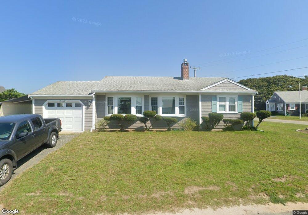
77 Captains Row Bourne, MA 2532
Estimated Value: $897,183 - $1,122,000
3
Beds
1
Bath
1,188
Sq Ft
$814/Sq Ft
Est. Value
About This Home
This home is located at 77 Captains Row, Bourne, MA 2532 and is currently estimated at $967,546, approximately $814 per square foot. 77 Captains Row is a home with nearby schools including Bourne High School.
Ownership History
Date
Name
Owned For
Owner Type
Purchase Details
Closed on
Apr 1, 1999
Sold by
Introini Natalina E
Bought by
Oneil William A and Oneil Anne M
Current Estimated Value
Home Financials for this Owner
Home Financials are based on the most recent Mortgage that was taken out on this home.
Original Mortgage
$195,000
Outstanding Balance
$48,311
Interest Rate
6.78%
Mortgage Type
Purchase Money Mortgage
Estimated Equity
$919,235
Create a Home Valuation Report for This Property
The Home Valuation Report is an in-depth analysis detailing your home's value as well as a comparison with similar homes in the area
Home Values in the Area
Average Home Value in this Area
Purchase History
| Date | Buyer | Sale Price | Title Company |
|---|---|---|---|
| Oneil William A | $245,000 | -- | |
| Oneil William A | $245,000 | -- |
Source: Public Records
Mortgage History
| Date | Status | Borrower | Loan Amount |
|---|---|---|---|
| Open | Oneil William A | $195,000 | |
| Closed | Oneil William A | $195,000 |
Source: Public Records
Tax History Compared to Growth
Tax History
| Year | Tax Paid | Tax Assessment Tax Assessment Total Assessment is a certain percentage of the fair market value that is determined by local assessors to be the total taxable value of land and additions on the property. | Land | Improvement |
|---|---|---|---|---|
| 2025 | $6,090 | $779,800 | $521,100 | $258,700 |
| 2024 | $5,956 | $742,600 | $496,300 | $246,300 |
| 2023 | $5,790 | $657,200 | $439,200 | $218,000 |
| 2022 | $5,668 | $561,700 | $388,700 | $173,000 |
| 2021 | $6,817 | $540,700 | $383,200 | $157,500 |
| 2020 | $5,614 | $522,700 | $379,600 | $143,100 |
| 2019 | $5,408 | $514,600 | $379,600 | $135,000 |
| 2018 | $5,096 | $483,500 | $361,500 | $122,000 |
| 2017 | $5,330 | $517,500 | $396,700 | $120,800 |
| 2016 | $4,984 | $490,600 | $396,700 | $93,900 |
| 2015 | $4,940 | $490,600 | $396,700 | $93,900 |
Source: Public Records
Map
Nearby Homes
- 77 Captains Row
- 76 Rope Walk Rd
- 75 Captains Row
- 80 Captains Row
- 78 Captains Row
- 112 Rope Walk Rd
- 80 Captains Row
- 114 Captains Row
- 110 Rope Walk Rd
- 74 Rope Walk Rd
- 73 Wianno Rd
- 81 Captains Row
- 73 Wianno Rd
- 14 Captains Row
- 108 Rope Walk Rd
- 113 Mashnee Rd
- 14 Captains Row
- 72 Rope Walk Rd
- 115 Captains Row
- 111 Mashnee Rd