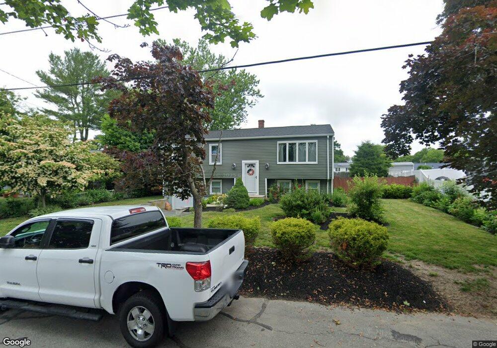
77 Cottonwood Rd New Bedford, MA 02745
Estimated Value: $421,056 - $458,000
3
Beds
1
Bath
1,025
Sq Ft
$427/Sq Ft
Est. Value
About This Home
This home is located at 77 Cottonwood Rd, New Bedford, MA 02745 and is currently estimated at $438,014, approximately $427 per square foot. 77 Cottonwood Rd is a home located in Bristol County with nearby schools including Casimir Pulaski Elementary School, Normandin Middle School, and New Bedford High School.
Ownership History
Date
Name
Owned For
Owner Type
Purchase Details
Closed on
Mar 28, 2018
Sold by
Sylvia Cindy P and Ponte Brian A
Bought by
Ponte Steven A
Current Estimated Value
Purchase Details
Closed on
Oct 12, 2016
Sold by
Ponte Ft
Bought by
Sylvia Cindy P and Ponte Brian A
Purchase Details
Closed on
Sep 6, 2013
Sold by
Ponte Jorge A
Bought by
Ponte Ft and Sylvia
Purchase Details
Closed on
Jul 17, 2009
Sold by
Vigeant Mary A
Bought by
Ponte Jorge A and Ponte Veneranda
Purchase Details
Closed on
Feb 11, 2009
Sold by
Mary A Vigeant Ft
Bought by
Gonsalves Alice and Vigeant Mary A
Purchase Details
Closed on
Jan 31, 2007
Sold by
Gonsalves Alice and Vigeant Mary A
Bought by
Mary A Vigeant Ft
Create a Home Valuation Report for This Property
The Home Valuation Report is an in-depth analysis detailing your home's value as well as a comparison with similar homes in the area
Home Values in the Area
Average Home Value in this Area
Purchase History
| Date | Buyer | Sale Price | Title Company |
|---|---|---|---|
| Ponte Steven A | -- | -- | |
| Ponte Steven A | -- | -- | |
| Sylvia Cindy P | -- | -- | |
| Sylvia Cindy P | -- | -- | |
| Ponte Ft | -- | -- | |
| Ponte Ft | -- | -- | |
| Ponte Jorge A | $209,000 | -- | |
| Ponte Jorge A | $209,000 | -- | |
| Gonsalves Alice | -- | -- | |
| Gonsalves Alice | -- | -- | |
| Mary A Vigeant Ft | -- | -- | |
| Mary A Vigeant Ft | -- | -- |
Source: Public Records
Tax History Compared to Growth
Tax History
| Year | Tax Paid | Tax Assessment Tax Assessment Total Assessment is a certain percentage of the fair market value that is determined by local assessors to be the total taxable value of land and additions on the property. | Land | Improvement |
|---|---|---|---|---|
| 2025 | $3,828 | $338,500 | $132,100 | $206,400 |
| 2024 | $3,942 | $328,500 | $143,700 | $184,800 |
| 2023 | $3,890 | $272,200 | $115,600 | $156,600 |
| 2022 | $3,677 | $236,600 | $107,400 | $129,200 |
| 2021 | $3,547 | $227,500 | $107,400 | $120,100 |
| 2020 | $3,515 | $217,500 | $107,400 | $110,100 |
| 2019 | $3,439 | $208,800 | $103,200 | $105,600 |
| 2018 | $3,351 | $201,500 | $103,200 | $98,300 |
| 2017 | $3,196 | $191,500 | $101,200 | $90,300 |
| 2016 | $3,065 | $185,900 | $99,100 | $86,800 |
| 2015 | $2,802 | $178,100 | $95,000 | $83,100 |
| 2014 | $2,624 | $173,100 | $92,900 | $80,200 |
Source: Public Records
Map
Nearby Homes
- 64 Blaze Rd
- 34 Poplar Rd
- 210 Heritage Dr
- 145 Heritage Dr
- 1063 Westgate St
- 1069 Cherokee St
- 16 Swallow St
- 13 Luscomb Ln
- SS Charbonneau Ln
- 26 Blueberry Dr
- 62 Longview Rd
- ES Phillips Rd
- 1573 Braley Rd Unit 39
- 2 Woodland Rd
- 8 Holly Tree Ln
- 1599 Braley Rd Unit 68
- 700 Pine Hill Dr
- 3 Elaine Ave
- 888 Hillcrest Rd
- 4597 Acushnet Ave