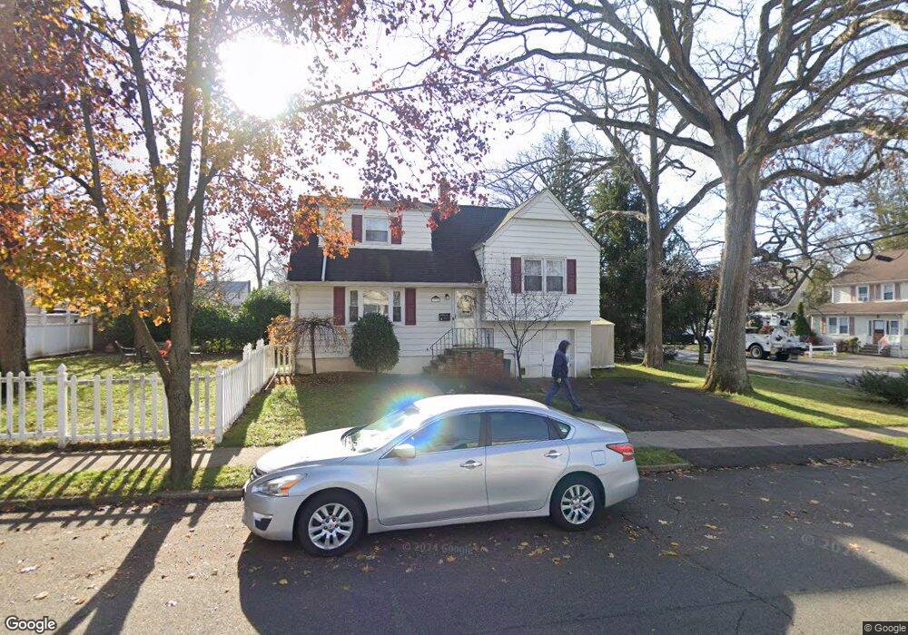
77 Davies Ave Dumont, NJ 07628
Estimated Value: $525,886 - $659,000
--
Bed
--
Bath
1,292
Sq Ft
$466/Sq Ft
Est. Value
About This Home
This home is located at 77 Davies Ave, Dumont, NJ 07628 and is currently estimated at $602,472, approximately $466 per square foot. 77 Davies Ave is a home located in Bergen County with nearby schools including Dumont High School, Englewood on the Palisades Charter School, and Lubavitch On The Palisades.
Ownership History
Date
Name
Owned For
Owner Type
Purchase Details
Closed on
Sep 23, 2004
Current Estimated Value
Purchase Details
Closed on
Feb 19, 2003
Sold by
Schaefer Kelly
Bought by
Schaefer Frank
Home Financials for this Owner
Home Financials are based on the most recent Mortgage that was taken out on this home.
Original Mortgage
$34,000
Interest Rate
5.9%
Purchase Details
Closed on
Oct 26, 2001
Sold by
Klarer Ethel T
Bought by
Schaefer Frank and Schaefer Kelly
Home Financials for this Owner
Home Financials are based on the most recent Mortgage that was taken out on this home.
Original Mortgage
$230,000
Interest Rate
6.67%
Create a Home Valuation Report for This Property
The Home Valuation Report is an in-depth analysis detailing your home's value as well as a comparison with similar homes in the area
Home Values in the Area
Average Home Value in this Area
Purchase History
| Date | Buyer | Sale Price | Title Company |
|---|---|---|---|
| -- | -- | -- | |
| Schaefer Frank | -- | -- | |
| Schaefer Frank | $243,000 | -- |
Source: Public Records
Mortgage History
| Date | Status | Borrower | Loan Amount |
|---|---|---|---|
| Previous Owner | Schaefer Frank | $34,000 | |
| Previous Owner | Schaefer Frank | $230,000 |
Source: Public Records
Tax History Compared to Growth
Tax History
| Year | Tax Paid | Tax Assessment Tax Assessment Total Assessment is a certain percentage of the fair market value that is determined by local assessors to be the total taxable value of land and additions on the property. | Land | Improvement |
|---|---|---|---|---|
| 2025 | $8,943 | $458,500 | $284,800 | $173,700 |
| 2024 | $8,723 | $220,000 | $154,000 | $66,000 |
| 2023 | $8,543 | $220,000 | $154,000 | $66,000 |
| 2022 | $8,543 | $220,000 | $154,000 | $66,000 |
| 2021 | $8,010 | $220,000 | $154,000 | $66,000 |
| 2020 | $8,270 | $220,000 | $154,000 | $66,000 |
| 2019 | $8,072 | $220,000 | $154,000 | $66,000 |
| 2018 | $7,907 | $220,000 | $154,000 | $66,000 |
| 2017 | $7,755 | $220,000 | $154,000 | $66,000 |
| 2016 | $7,575 | $220,000 | $154,000 | $66,000 |
| 2015 | $7,401 | $220,000 | $154,000 | $66,000 |
| 2014 | $7,256 | $220,000 | $154,000 | $66,000 |
Source: Public Records
Map
Nearby Homes
- 207 Depew St
- 83 Davies Ave
- 201 Depew St
- 70 Davies Ave
- 89 Davies Ave
- 74 Davies Ave
- 212 Depew St
- 208 Depew St
- 208 Depew St Unit 2
- 208 Depew St Unit 1
- 92 Delaware Ave
- 92 Delaware Ave Unit 2
- 92 Delaware Ave Unit 1
- 93 Davies Ave
- 82 Delaware Ave
- 223 Depew St
- 204 Depew St
- 76 Davies Ave
- 220 Depew St
- 200 Depew St