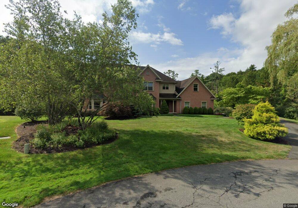
77 Devonshire Dr Slingerlands, NY 12159
Estimated Value: $847,000 - $1,111,000
4
Beds
4
Baths
4,564
Sq Ft
$225/Sq Ft
Est. Value
About This Home
This home is located at 77 Devonshire Dr, Slingerlands, NY 12159 and is currently estimated at $1,027,455, approximately $225 per square foot. 77 Devonshire Dr is a home located in Albany County with nearby schools including St. Thomas the Apostle School and Academy of the Holy Names.
Ownership History
Date
Name
Owned For
Owner Type
Purchase Details
Closed on
Dec 13, 2024
Sold by
Taranto Robert and Taranto Margaret
Bought by
Taranto Family Irrevocable Trust and Taranto
Current Estimated Value
Purchase Details
Closed on
Jul 1, 2003
Sold by
Sonmar Devlp Corp
Bought by
Quinn David
Purchase Details
Closed on
Jun 17, 2003
Sold by
Sommar Devlp Corp
Bought by
Taranto Robert
Create a Home Valuation Report for This Property
The Home Valuation Report is an in-depth analysis detailing your home's value as well as a comparison with similar homes in the area
Home Values in the Area
Average Home Value in this Area
Purchase History
| Date | Buyer | Sale Price | Title Company |
|---|---|---|---|
| Taranto Family Irrevocable Trust | -- | None Listed On Document | |
| Quinn David | -- | -- | |
| Taranto Robert | $75,000 | -- |
Source: Public Records
Tax History
| Year | Tax Paid | Tax Assessment Tax Assessment Total Assessment is a certain percentage of the fair market value that is determined by local assessors to be the total taxable value of land and additions on the property. | Land | Improvement |
|---|---|---|---|---|
| 2024 | $23,344 | $700,000 | $226,800 | $473,200 |
| 2023 | $22,722 | $700,000 | $226,800 | $473,200 |
| 2022 | $22,137 | $700,000 | $226,800 | $473,200 |
| 2021 | $22,290 | $700,000 | $226,800 | $473,200 |
| 2020 | $22,157 | $700,000 | $226,800 | $473,200 |
| 2019 | $19,054 | $700,000 | $226,800 | $473,200 |
| 2018 | $21,147 | $700,000 | $226,800 | $473,200 |
| 2017 | $20,630 | $700,000 | $226,800 | $473,200 |
| 2016 | $20,630 | $700,000 | $226,800 | $473,200 |
| 2015 | -- | $700,000 | $226,800 | $473,200 |
| 2014 | -- | $700,000 | $226,800 | $473,200 |
Source: Public Records
Map
Nearby Homes
- 3 Bradstreet Ct
- 26 Muterfield Ct
- 25 Canterbury Ln
- 23 Canterbury Ln
- 10 Canterbury Ln
- 91 Daniel St
- 1575 New Scotland Rd
- 38 Capricorn Ln
- 268 Waldenmaier Rd
- 54 Normanside Dr
- 65 Wood Terrace
- 26 Mohican Place
- L23 Maple Rd
- 70 Orchard Hill Rd
- 3 Groesbeck Place
- 10 Wood Terrace
- L23.2 Unionville Feura Bush Rd
- L15.4 Youmans Rd
- 32 Fairway Ct
- 264 Kenwood Ave
- 76 Devonshire Dr
- 71 Devonshire Dr
- 72 Devonshire Dr
- 61 Devonshire Dr
- 188 Orchard St
- 82 Crystal Ln
- 202 Orchard St
- 58 Devonshire Dr
- 176 Orchard St
- 55 Devonshire Dr
- 70 Crystal Ln
- 170 Orchard St
- 48 Devonshire Dr
- 47 Devonshire Dr
- 30 Birkdale Ct
- 81 Crystal Ln
- 67 Crystal Ln
- 214 Orchard St
- 34 Birkdale Ct
- 26 Birkdale Ct
Your Personal Tour Guide
Ask me questions while you tour the home.