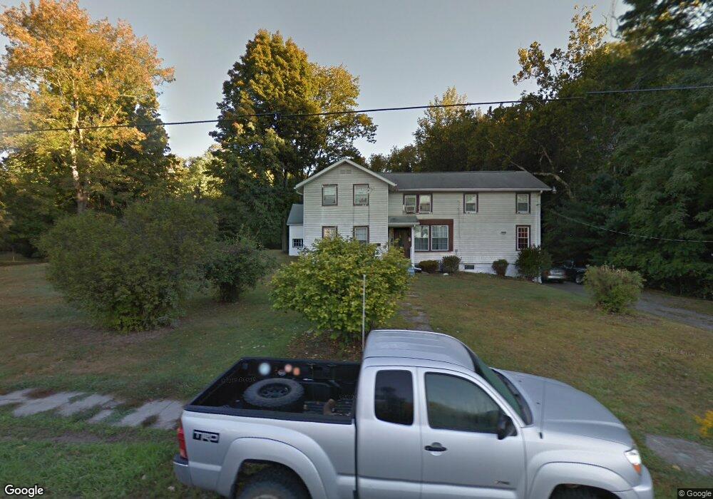
77 E Carson St Unit 79 Canton, PA 17724
Estimated Value: $154,000 - $251,000
--
Bed
8
Baths
--
Sq Ft
80,150
Sq Ft Lot
About This Home
This home is located at 77 E Carson St Unit 79, Canton, PA 17724 and is currently estimated at $198,842. 77 E Carson St Unit 79 is a home located in Bradford County with nearby schools including Canton Area Elementary School and Canton Junior/Senior High School.
Ownership History
Date
Name
Owned For
Owner Type
Purchase Details
Closed on
Sep 21, 2012
Sold by
Stanton Eleanor Jane
Bought by
Ambruch John D and Trick Nichole J
Current Estimated Value
Home Financials for this Owner
Home Financials are based on the most recent Mortgage that was taken out on this home.
Original Mortgage
$100,000
Outstanding Balance
$68,967
Interest Rate
3.5%
Mortgage Type
Purchase Money Mortgage
Estimated Equity
$129,875
Create a Home Valuation Report for This Property
The Home Valuation Report is an in-depth analysis detailing your home's value as well as a comparison with similar homes in the area
Purchase History
| Date | Buyer | Sale Price | Title Company |
|---|---|---|---|
| Ambruch John D | $125,000 | None Available |
Source: Public Records
Mortgage History
| Date | Status | Borrower | Loan Amount |
|---|---|---|---|
| Open | Ambruch John D | $100,000 |
Source: Public Records
Tax History
| Year | Tax Paid | Tax Assessment Tax Assessment Total Assessment is a certain percentage of the fair market value that is determined by local assessors to be the total taxable value of land and additions on the property. | Land | Improvement |
|---|---|---|---|---|
| 2025 | $2,491 | $36,300 | $0 | $0 |
| 2024 | $2,340 | $36,300 | $0 | $0 |
| 2023 | $2,340 | $36,300 | $0 | $0 |
| 2022 | $2,337 | $36,300 | $0 | $0 |
| 2021 | $2,328 | $36,300 | $0 | $0 |
| 2020 | $2,307 | $36,300 | $0 | $0 |
| 2019 | $2,305 | $36,300 | $0 | $0 |
| 2018 | $2,241 | $36,300 | $0 | $0 |
| 2017 | $2,217 | $36,300 | $0 | $0 |
| 2016 | -- | $36,300 | $0 | $0 |
| 2015 | -- | $36,300 | $0 | $0 |
| 2014 | $1,135 | $36,300 | $0 | $0 |
Source: Public Records
Map
Nearby Homes
- 386 Troy St
- 490 N Center St
- 85 N Minnequa Ave
- 94 N Center St
- 127 Troy St
- 108 S Washington St
- 49-51 T-329
- 55 Clinton St
- 151 Montague St
- 374 S Minnequa Ave
- 20 E South Ave
- 203 De-Morgan Acres Ln
- 14751 Route 14
- 7129 Route 14
- 15130 Route 14
- 1751 Douglas Rd
- 13632 Route 414
- 9 Farmall Ln
- 2537 Ogdensburg Rd
- PARCEL 030 Glory Ridge Rd
- 57 E Carson St
- 74 E Carson St
- 39 E Carson St
- 50 E Carson St
- 268 N Minnequa Ave
- 340 N Center St
- 318 N Center St
- 358 N Center St
- 366 N Center St
- 411 N Minnequa Ave
- 254 N Minnequa Ave
- 384 N Center St
- 53 E Tioga St
- 59 E Tioga St
- 47 E Tioga St
- 2 W Carson St
- 416 N Center St
- 282 N Center St
- 33 E Tioga St
- 311 N Center St
Your Personal Tour Guide
Ask me questions while you tour the home.