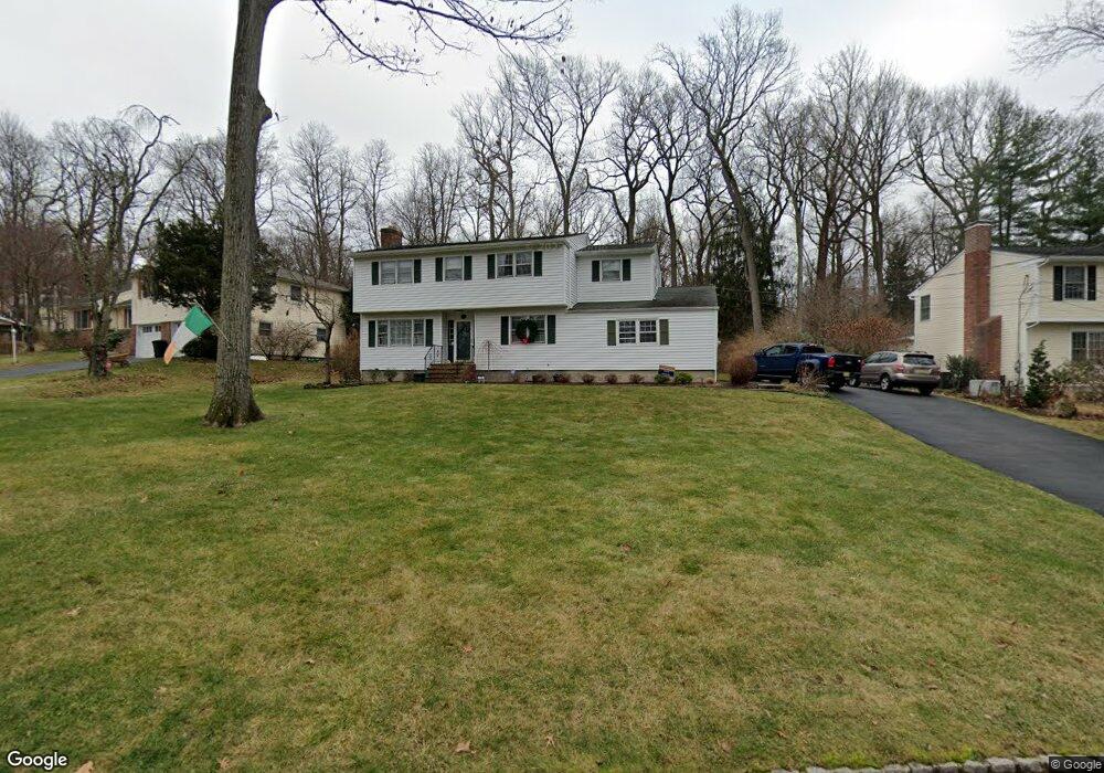
77 Exeter Dr Berkeley Heights, NJ 07922
Estimated Value: $938,266 - $1,269,000
Studio
--
Bath
2,689
Sq Ft
$413/Sq Ft
Est. Value
About This Home
This home is located at 77 Exeter Dr, Berkeley Heights, NJ 07922 and is currently estimated at $1,109,817, approximately $412 per square foot. 77 Exeter Dr is a home located in Union County with nearby schools including Columbia Middle School, Governor Livingston High School, and The Academy of Our Lady of Peace.
Ownership History
Date
Name
Owned For
Owner Type
Purchase Details
Closed on
Jan 4, 1999
Sold by
Fogarty Peter J and Fogarty Marjorie A
Bought by
Roth Thomas D and Roth Eileen F
Current Estimated Value
Home Financials for this Owner
Home Financials are based on the most recent Mortgage that was taken out on this home.
Original Mortgage
$195,000
Outstanding Balance
$44,879
Interest Rate
6.67%
Estimated Equity
$1,064,938
Purchase Details
Closed on
Aug 15, 1994
Sold by
Fogarty Peter J and Fogarty Marjorie A
Bought by
Fogarty Peter J and Fogarty Marjorie A
Create a Home Valuation Report for This Property
The Home Valuation Report is an in-depth analysis detailing your home's value as well as a comparison with similar homes in the area
Home Values in the Area
Average Home Value in this Area
Purchase History
We collect this data history from publicly available records. To have your information removed, we recommend requesting removal directly through your county’s website.
| Date | Buyer | Sale Price | Title Company |
|---|---|---|---|
| Roth Thomas D | $400,000 | -- | |
| Fogarty Peter J | -- | -- |
Source: Public Records
Mortgage History
We collect this data history from publicly available records. To have your information removed, we recommend requesting removal directly through your county’s website.
| Date | Status | Borrower | Loan Amount |
|---|---|---|---|
| Open | Roth Thomas D | $195,000 |
Source: Public Records
Tax History
| Year | Tax Paid | Tax Assessment Tax Assessment Total Assessment is a certain percentage of the fair market value that is determined by local assessors to be the total taxable value of land and additions on the property. | Land | Improvement |
|---|---|---|---|---|
| 2025 | $17,319 | $404,000 | $180,000 | $224,000 |
| 2024 | $17,069 | $404,000 | $180,000 | $224,000 |
| 2023 | $17,069 | $404,000 | $180,000 | $224,000 |
| 2022 | $16,964 | $404,000 | $180,000 | $224,000 |
| 2021 | $16,871 | $404,000 | $180,000 | $224,000 |
| 2020 | $16,960 | $404,000 | $180,000 | $224,000 |
| 2019 | $16,875 | $404,000 | $180,000 | $224,000 |
| 2018 | $16,524 | $404,000 | $180,000 | $224,000 |
| 2017 | $16,322 | $404,000 | $180,000 | $224,000 |
| 2016 | $16,035 | $404,000 | $180,000 | $224,000 |
| 2015 | $15,946 | $404,000 | $180,000 | $224,000 |
| 2014 | $15,530 | $404,000 | $180,000 | $224,000 |
Source: Public Records
Map
Nearby Homes
- 262 Timber Dr
- 126 Wentworth Dr
- 75 Hillside Ave
- 48 Hastings Rd
- 3 Whispering Way E Unit 3
- 15 Wilson Dr
- 36 Brambling Rd
- 25 Robbins Ave
- 41 Brambling Rd
- 70 Sycamore Ave
- 34 Berkshire Dr
- 157 Pearl St
- 27 Brambling Road Carriages
- 126 Snyder Ave
- 11 Park Edge Unit 11
- 7 Meadow View Lane Ondo
- 81 Park Edge Unit 2K
- 37 Park Edge
- 21 Kuntz Ave
- 119 Cambridge Dr
Your Personal Tour Guide
Ask me questions while you tour the home.