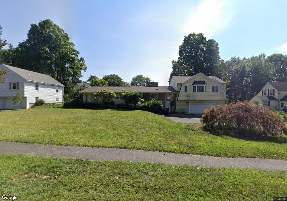
77 Flagg Rd West Hartford, CT 06117
Estimated Value: $552,000 - $625,000
4
Beds
4
Baths
2,215
Sq Ft
$266/Sq Ft
Est. Value
About This Home
This home is located at 77 Flagg Rd, West Hartford, CT 06117 and is currently estimated at $589,230, approximately $266 per square foot. 77 Flagg Rd is a home located in Hartford County with nearby schools including Norfeldt School, King Philip Middle School, and Hall High School.
Create a Home Valuation Report for This Property
The Home Valuation Report is an in-depth analysis detailing your home's value as well as a comparison with similar homes in the area
Home Values in the Area
Average Home Value in this Area
Tax History Compared to Growth
Tax History
| Year | Tax Paid | Tax Assessment Tax Assessment Total Assessment is a certain percentage of the fair market value that is determined by local assessors to be the total taxable value of land and additions on the property. | Land | Improvement |
|---|---|---|---|---|
| 2025 | $11,171 | $249,460 | $91,400 | $158,060 |
| 2024 | $10,565 | $249,460 | $91,400 | $158,060 |
| 2023 | $10,208 | $249,460 | $91,400 | $158,060 |
| 2022 | $10,148 | $249,460 | $91,400 | $158,060 |
| 2021 | $9,421 | $222,090 | $87,900 | $134,190 |
| 2020 | $9,050 | $216,510 | $79,800 | $136,710 |
| 2019 | $9,050 | $216,510 | $79,800 | $136,710 |
| 2018 | $8,877 | $216,510 | $79,800 | $136,710 |
| 2017 | $7,553 | $184,030 | $79,800 | $104,230 |
| 2016 | $6,870 | $173,880 | $61,460 | $112,420 |
| 2015 | $6,661 | $173,880 | $61,460 | $112,420 |
| 2014 | $6,498 | $173,880 | $61,460 | $112,420 |
Source: Public Records
Map
Nearby Homes
- 47 Flagg Rd
- 2581 Albany Ave
- 62 Blue Ridge Ln
- 50 Magnolia Hill
- 11 Rye Ridge Pkwy
- 592 Mountain Rd Unit A
- 21 Barksdale Rd
- 56 Fox Chase Ln
- 26 Berwyn Rd
- 124 High Ridge Rd
- 139 Mohawk Dr
- 148 King Philip Dr
- 75 Arlen Way
- 10 Ironwood Ln
- 40 Ferncliff Dr
- 16 Morningcrest Dr
- 37 W Normandy Dr
- 132 N Main St
- 1272 Trout Brook Dr
- 11 Lawler Rd