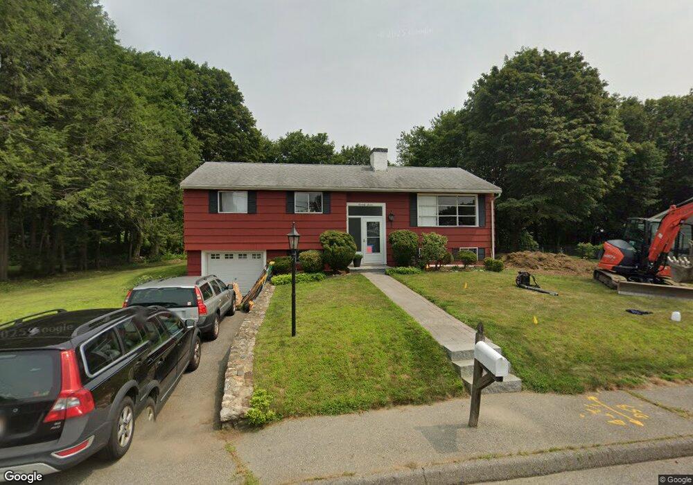
77 Highgate Rd Marlborough, MA 01752
Estimated Value: $315,000 - $514,000
3
Beds
2
Baths
1,103
Sq Ft
$407/Sq Ft
Est. Value
About This Home
This home is located at 77 Highgate Rd, Marlborough, MA 01752 and is currently estimated at $448,530, approximately $406 per square foot. 77 Highgate Rd is a home located in Middlesex County with nearby schools including Marlborough High School, New Covenant Christian School, and Glenhaven Academy - JRI School.
Ownership History
Date
Name
Owned For
Owner Type
Purchase Details
Closed on
Jun 6, 2025
Sold by
Mccluskey Peter and Mccluskey Joseph F
Bought by
Mccluskey Michael
Current Estimated Value
Home Financials for this Owner
Home Financials are based on the most recent Mortgage that was taken out on this home.
Original Mortgage
$350,000
Outstanding Balance
$347,546
Interest Rate
6.76%
Mortgage Type
Purchase Money Mortgage
Estimated Equity
$100,984
Purchase Details
Closed on
May 15, 2025
Sold by
Mccluskey Ft and Mccluskey
Bought by
Mccluskey Peter and Mccluskey Joseph F
Home Financials for this Owner
Home Financials are based on the most recent Mortgage that was taken out on this home.
Original Mortgage
$350,000
Outstanding Balance
$347,546
Interest Rate
6.76%
Mortgage Type
Purchase Money Mortgage
Estimated Equity
$100,984
Purchase Details
Closed on
Dec 16, 2014
Sold by
Mccluskey Joseph F and Mccluskey Jean H
Bought by
Mccluskey Ft and Mccluskey
Create a Home Valuation Report for This Property
The Home Valuation Report is an in-depth analysis detailing your home's value as well as a comparison with similar homes in the area
Home Values in the Area
Average Home Value in this Area
Purchase History
| Date | Buyer | Sale Price | Title Company |
|---|---|---|---|
| Mccluskey Michael | $320,000 | None Available | |
| Mccluskey Michael | $320,000 | None Available | |
| Mccluskey Peter | -- | None Available | |
| Mccluskey Peter | -- | None Available | |
| Mccluskey Ft | -- | -- | |
| Mccluskey Ft | -- | -- | |
| Mccluskey Ft | -- | -- |
Source: Public Records
Mortgage History
| Date | Status | Borrower | Loan Amount |
|---|---|---|---|
| Open | Mccluskey Michael | $350,000 | |
| Closed | Mccluskey Michael | $350,000 | |
| Previous Owner | Mccluskey Ft | $90,000 |
Source: Public Records
Tax History
| Year | Tax Paid | Tax Assessment Tax Assessment Total Assessment is a certain percentage of the fair market value that is determined by local assessors to be the total taxable value of land and additions on the property. | Land | Improvement |
|---|---|---|---|---|
| 2025 | $4,634 | $470,000 | $231,400 | $238,600 |
| 2024 | $4,633 | $452,400 | $210,400 | $242,000 |
| 2023 | $4,362 | $378,000 | $169,200 | $208,800 |
| 2022 | $4,309 | $328,400 | $161,200 | $167,200 |
| 2021 | $10,182 | $305,200 | $134,300 | $170,900 |
| 2020 | $9,922 | $291,500 | $127,900 | $163,600 |
| 2019 | $4,032 | $286,600 | $125,400 | $161,200 |
| 2018 | $9,035 | $271,300 | $100,000 | $171,300 |
| 2017 | $3,910 | $255,200 | $99,100 | $156,100 |
| 2016 | $3,766 | $245,500 | $99,100 | $146,400 |
| 2015 | $3,658 | $232,100 | $106,500 | $125,600 |
Source: Public Records
Map
Nearby Homes
- 38 Airport Blvd
- 244 Robert Rd
- 48 Cook Ln
- 181 Boston Post Rd E Unit 26
- 181 Boston Post Rd E Unit 64
- 69 Johansen Dr
- 24 Clinton St
- 84 Crosby Rd
- 70 Phelps St
- 70 Victoria Ln
- 0 Stevens St
- 40 Sheridan Rd
- 79 Royce Rd
- 20 Beauregard Cir
- 68 Upland Rd
- 61 Lincoln St
- 28 Ruth Dr
- 183 Sherwood Dr S
- 75 Lincoln St
- 24 Wilson St Unit 4
Your Personal Tour Guide
Ask me questions while you tour the home.