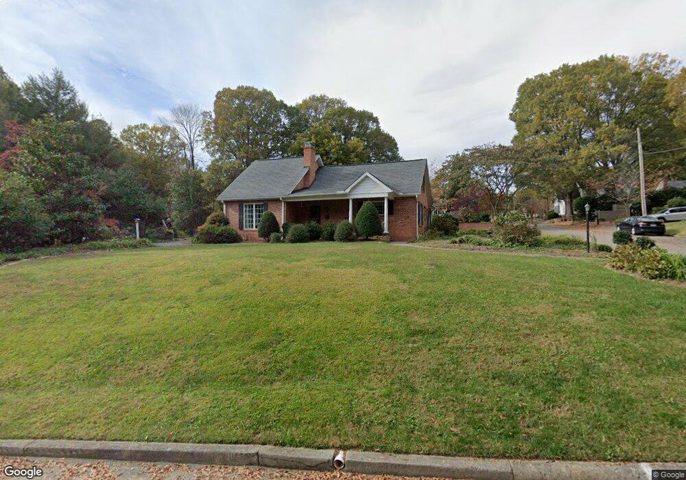
77 Ingleside Dr SE Concord, NC 28025
Estimated Value: $395,000 - $518,000
3
Beds
3
Baths
2,392
Sq Ft
$194/Sq Ft
Est. Value
About This Home
This home is located at 77 Ingleside Dr SE, Concord, NC 28025 and is currently estimated at $464,822, approximately $194 per square foot. 77 Ingleside Dr SE is a home located in Cabarrus County with nearby schools including R Brown Mcallister STEMElementary, Concord Middle School, and Concord High School.
Ownership History
Date
Name
Owned For
Owner Type
Purchase Details
Closed on
Apr 7, 2009
Sold by
Propst Timothy J and Propst Patricia L
Bought by
Lilly Sue Crosby and Propst Timothy J
Current Estimated Value
Home Financials for this Owner
Home Financials are based on the most recent Mortgage that was taken out on this home.
Original Mortgage
$121,600
Outstanding Balance
$77,693
Interest Rate
5.14%
Mortgage Type
Purchase Money Mortgage
Estimated Equity
$387,129
Purchase Details
Closed on
Jan 6, 2006
Sold by
Bryant Maxine F
Bought by
Propst Timothy J and Propst Patricia L
Home Financials for this Owner
Home Financials are based on the most recent Mortgage that was taken out on this home.
Original Mortgage
$119,600
Interest Rate
6.19%
Mortgage Type
Fannie Mae Freddie Mac
Create a Home Valuation Report for This Property
The Home Valuation Report is an in-depth analysis detailing your home's value as well as a comparison with similar homes in the area
Home Values in the Area
Average Home Value in this Area
Purchase History
| Date | Buyer | Sale Price | Title Company |
|---|---|---|---|
| Lilly Sue Crosby | $152,000 | None Available | |
| Propst Timothy J | $149,500 | None Available |
Source: Public Records
Mortgage History
| Date | Status | Borrower | Loan Amount |
|---|---|---|---|
| Open | Lilly Sue Crosby | $121,600 | |
| Previous Owner | Propst Timothy J | $119,600 |
Source: Public Records
Tax History
| Year | Tax Paid | Tax Assessment Tax Assessment Total Assessment is a certain percentage of the fair market value that is determined by local assessors to be the total taxable value of land and additions on the property. | Land | Improvement |
|---|---|---|---|---|
| 2025 | $4,406 | $442,400 | $74,700 | $367,700 |
| 2024 | $4,406 | $442,400 | $74,700 | $367,700 |
| 2023 | $3,630 | $297,520 | $46,800 | $250,720 |
| 2022 | $3,630 | $297,520 | $46,800 | $250,720 |
| 2021 | $3,630 | $297,520 | $46,800 | $250,720 |
| 2020 | $3,630 | $297,520 | $46,800 | $250,720 |
| 2019 | $3,269 | $267,930 | $31,500 | $236,430 |
| 2018 | $3,215 | $267,930 | $31,500 | $236,430 |
| 2017 | $3,162 | $267,930 | $31,500 | $236,430 |
| 2016 | -- | $226,610 | $31,500 | $195,110 |
| 2015 | $2,674 | $226,610 | $31,500 | $195,110 |
| 2014 | $2,674 | $226,610 | $31,500 | $195,110 |
Source: Public Records
Map
Nearby Homes
- 374 Union St S
- 259 Sunset Dr SE
- 34 Louise Dr SE
- 192, 188, 196, 197 & Riverbirch Dr SE
- 294 Broad Dr SW
- 101 Woody Ct SW
- 223 Tournament Dr SW
- 208 Corban Ave SE
- 541 Union St S
- 161 Union St S
- 375 Graham Dr SW
- 341 Broad Dr SW
- 210 Lincoln St SW
- 154 Union St S
- 96 Chestnut Dr SW
- 229 Boger Ct SW
- 335 Summit Ct SE
- 210 Mahan St SW
- 60 Patton Ct SE
- 92 Lawndale Ave SE
- 65 Ingleside Dr SE
- 78 Glendale Ave SE
- 85 Ingleside Dr SE
- 355 Rabon St SE
- 72 Glendale Ave SE
- 84 Glendale Ave SE
- 66 Glendale Ave SE
- 90 Glendale Ave SE
- 62 Glendale Ave SE
- 95 Ingleside Dr SE
- 96 Glendale Ave SE
- 364 Rabon St SE
- 66 Ingleside Dr SE
- 82 Ingleside Dr SE
- 377 Sunset Dr SE
- 354 Rabon St SE
- 75 Glendale Ave SE
- 79 Glendale Ave SE
- 102 Glendale Ave SE
- 344 Rabon St SE
Your Personal Tour Guide
Ask me questions while you tour the home.