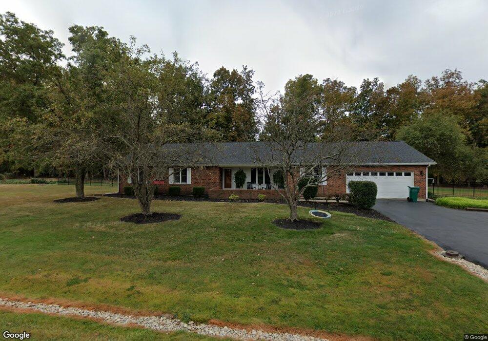
77 Lauray Dr Georgetown, OH 45121
Estimated Value: $244,000 - $321,095
4
Beds
3
Baths
2,018
Sq Ft
$147/Sq Ft
Est. Value
About This Home
This home is located at 77 Lauray Dr, Georgetown, OH 45121 and is currently estimated at $296,774, approximately $147 per square foot. 77 Lauray Dr is a home located in Brown County with nearby schools including Georgetown Elementary School and Georgetown Jr/Sr High School.
Ownership History
Date
Name
Owned For
Owner Type
Purchase Details
Closed on
Sep 13, 2016
Sold by
Utter Michael S and Utter Heather A
Bought by
Mcjoynt Griffith Matthew J and Mcjoynt Griffith Rebecca A
Current Estimated Value
Home Financials for this Owner
Home Financials are based on the most recent Mortgage that was taken out on this home.
Original Mortgage
$143,200
Outstanding Balance
$112,821
Interest Rate
3.43%
Mortgage Type
New Conventional
Estimated Equity
$183,953
Purchase Details
Closed on
Sep 12, 2001
Sold by
Hauke William A
Bought by
Utter Michael S and Utter Heather A
Home Financials for this Owner
Home Financials are based on the most recent Mortgage that was taken out on this home.
Original Mortgage
$150,350
Interest Rate
7.03%
Mortgage Type
New Conventional
Create a Home Valuation Report for This Property
The Home Valuation Report is an in-depth analysis detailing your home's value as well as a comparison with similar homes in the area
Home Values in the Area
Average Home Value in this Area
Purchase History
| Date | Buyer | Sale Price | Title Company |
|---|---|---|---|
| Mcjoynt Griffith Matthew J | $179,000 | Stewart Title Company | |
| Utter Michael S | $155,000 | -- |
Source: Public Records
Mortgage History
| Date | Status | Borrower | Loan Amount |
|---|---|---|---|
| Open | Mcjoynt Griffith Matthew J | $143,200 | |
| Previous Owner | Utter Michael S | $150,350 |
Source: Public Records
Tax History
| Year | Tax Paid | Tax Assessment Tax Assessment Total Assessment is a certain percentage of the fair market value that is determined by local assessors to be the total taxable value of land and additions on the property. | Land | Improvement |
|---|---|---|---|---|
| 2024 | $3,064 | $86,450 | $8,550 | $77,900 |
| 2023 | $3,065 | $65,560 | $7,230 | $58,330 |
| 2022 | $2,585 | $65,560 | $7,230 | $58,330 |
| 2021 | $2,561 | $65,560 | $7,230 | $58,330 |
| 2020 | $2,265 | $54,640 | $6,030 | $48,610 |
| 2019 | $2,249 | $54,640 | $6,030 | $48,610 |
| 2018 | $2,235 | $54,640 | $6,030 | $48,610 |
| 2017 | $1,703 | $49,130 | $6,640 | $42,490 |
| 2016 | $1,702 | $49,130 | $6,640 | $42,490 |
| 2015 | $1,724 | $49,130 | $6,640 | $42,490 |
| 2014 | $1,775 | $48,520 | $6,030 | $42,490 |
| 2013 | $1,769 | $48,520 | $6,030 | $42,490 |
Source: Public Records
Map
Nearby Homes
- 155 Free Soil Rd
- 20 Douglas Cir
- 175 Douglas Cir
- 20 Heritage Hill Dr
- 25 Douglas Ln
- 470 Free Soil Rd
- 505 S Water St
- 666 E State St
- 708 E State St
- 510 W State St
- 406 E North St
- 0 St Rt 221 & Footbridge Unit 1826509
- 405 N Main St
- 60 New St
- 399 Elmwood Ct
- 508 Mount Orab Pike
- 427 Kenwood Ave
- 1 N Kenwood Ave
- 2 N Kenwood Ave
- 7029 Free Soil Rd
Your Personal Tour Guide
Ask me questions while you tour the home.