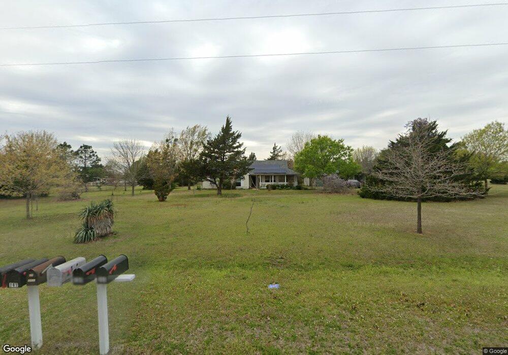
77 Le Neta Dr Whitesboro, TX 76273
Estimated Value: $316,281 - $371,000
--
Bed
--
Bath
1,408
Sq Ft
$244/Sq Ft
Est. Value
About This Home
This home is located at 77 Le Neta Dr, Whitesboro, TX 76273 and is currently estimated at $343,641, approximately $244 per square foot. 77 Le Neta Dr is a home located in Grayson County with nearby schools including J.W. Hayes Primary School, Whitesboro Intermediate School, and Whitesboro Middle School.
Ownership History
Date
Name
Owned For
Owner Type
Purchase Details
Closed on
Nov 24, 2004
Sold by
Bobby J & Mary A Coffin Revocable Living and Living Mary A Coffin Revocable
Bought by
Coffin Bobby J and Coffin Mary A
Current Estimated Value
Home Financials for this Owner
Home Financials are based on the most recent Mortgage that was taken out on this home.
Original Mortgage
$165,000
Interest Rate
4.03%
Mortgage Type
FHA
Create a Home Valuation Report for This Property
The Home Valuation Report is an in-depth analysis detailing your home's value as well as a comparison with similar homes in the area
Home Values in the Area
Average Home Value in this Area
Purchase History
| Date | Buyer | Sale Price | Title Company |
|---|---|---|---|
| Coffin Bobby J | -- | -- |
Source: Public Records
Mortgage History
| Date | Status | Borrower | Loan Amount |
|---|---|---|---|
| Closed | Coffin Bobby J | $165,000 | |
| Closed | Coffin Bobby J | $165,000 |
Source: Public Records
Tax History Compared to Growth
Tax History
| Year | Tax Paid | Tax Assessment Tax Assessment Total Assessment is a certain percentage of the fair market value that is determined by local assessors to be the total taxable value of land and additions on the property. | Land | Improvement |
|---|---|---|---|---|
| 2025 | $337 | $270,243 | -- | -- |
| 2024 | $3,887 | $245,675 | $0 | $0 |
| 2023 | $337 | $223,341 | $0 | $0 |
| 2022 | $3,228 | $203,037 | $0 | $0 |
| 2021 | $3,318 | $184,579 | $52,673 | $131,906 |
| 2020 | $3,152 | $170,223 | $43,596 | $126,627 |
| 2019 | $3,086 | $155,546 | $48,239 | $107,307 |
| 2018 | $2,918 | $143,976 | $34,848 | $109,128 |
| 2017 | $2,876 | $139,949 | $34,848 | $105,101 |
| 2016 | $2,718 | $132,260 | $30,011 | $102,249 |
| 2015 | $691 | $136,130 | $30,011 | $106,119 |
| 2014 | $831 | $135,541 | $30,011 | $105,530 |
Source: Public Records
Map
Nearby Homes
- 1052 Bones Chapel Rd
- TBD Bones Chapel Rd
- 790 Bones Chapel Rd
- 3285 Roland Rd
- 400 Wild Wood Ln
- 262 Briar Creek Rd
- 205 Anderson Rd
- 993 County Line Rd
- 873 Anderson Rd
- 20ac Us Hwy 377
- 53 ac U S Highway 82
- US U S Highway 82
- 313 Texoma Dr
- 203 Red River Dr
- 216 Red River Rd
- 2403 Evelyn Rd
- 2208 Sundance Rd
- 2026 Sundance Rd
- 2151 Sundance Rd
- 2256 Sundance Rd
- 1165 Bones Chapel Rd
- 1191 Bones Chapel Rd
- 1123 Marcelle Ln
- 141 Le Neta Dr
- 67 Marcelle Ln
- 1047 Bones Chapel Rd
- 1247 Bones Chapel Rd
- 941 Bones Chapel Rd
- 4125 Roland Rd
- 333 Le Neta Dr
- 1364 Bones Chapel Rd
- 54 W Acres Rd
- 54 West Acres Rd
- 1448 Bones Chapel Rd
- 167 W Acres Rd
- 180 Le Neta Dr
- 936 Bones Chapel Rd
- 260 West Acres Rd
- 21 W Acres Rd
- 21 West Acres Rd