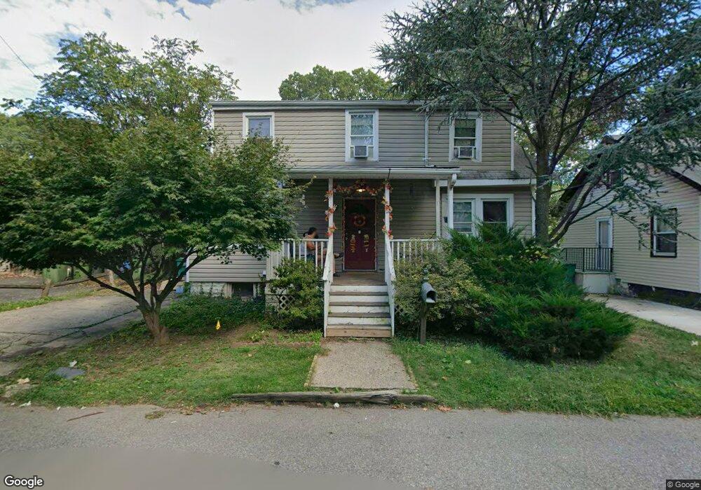
77 Lloyd St Edison, NJ 08817
Estimated Value: $373,471 - $444,000
2
Beds
1
Bath
704
Sq Ft
$571/Sq Ft
Est. Value
About This Home
This home is located at 77 Lloyd St, Edison, NJ 08817 and is currently estimated at $401,868, approximately $570 per square foot. 77 Lloyd St is a home located in Middlesex County with nearby schools including Lindeneau Elementary School, Thomas Jefferson Middle School, and Edison High School.
Ownership History
Date
Name
Owned For
Owner Type
Purchase Details
Closed on
Feb 6, 2024
Sold by
Dtam Properties Llc
Bought by
Jones Willie D
Current Estimated Value
Home Financials for this Owner
Home Financials are based on the most recent Mortgage that was taken out on this home.
Original Mortgage
$170,000
Outstanding Balance
$166,996
Interest Rate
6.61%
Mortgage Type
New Conventional
Estimated Equity
$234,872
Purchase Details
Closed on
Oct 15, 2012
Sold by
Andrews David W and Andrews Beverly J
Bought by
Dtam Properties Llc
Create a Home Valuation Report for This Property
The Home Valuation Report is an in-depth analysis detailing your home's value as well as a comparison with similar homes in the area
Home Values in the Area
Average Home Value in this Area
Purchase History
| Date | Buyer | Sale Price | Title Company |
|---|---|---|---|
| Jones Willie D | -- | Alliance Title | |
| Jones Willie D | -- | Alliance Title | |
| Dtam Properties Llc | $115,000 | Westcor Land Title Ins Co |
Source: Public Records
Mortgage History
| Date | Status | Borrower | Loan Amount |
|---|---|---|---|
| Open | Jones Willie D | $170,000 | |
| Closed | Jones Willie D | $170,000 |
Source: Public Records
Tax History
| Year | Tax Paid | Tax Assessment Tax Assessment Total Assessment is a certain percentage of the fair market value that is determined by local assessors to be the total taxable value of land and additions on the property. | Land | Improvement |
|---|---|---|---|---|
| 2025 | $5,864 | $98,500 | $68,800 | $29,700 |
| 2024 | $5,832 | $98,500 | $68,800 | $29,700 |
| 2023 | $5,832 | $98,500 | $68,800 | $29,700 |
| 2022 | $5,834 | $98,500 | $68,800 | $29,700 |
| 2021 | $5,814 | $98,500 | $68,800 | $29,700 |
| 2020 | $5,761 | $98,500 | $68,800 | $29,700 |
| 2019 | $5,437 | $98,500 | $68,800 | $29,700 |
| 2018 | $5,342 | $98,500 | $68,800 | $29,700 |
| 2017 | $5,293 | $98,500 | $68,800 | $29,700 |
| 2016 | $5,197 | $98,500 | $68,800 | $29,700 |
| 2015 | $4,998 | $98,500 | $68,800 | $29,700 |
| 2014 | $4,852 | $98,500 | $68,800 | $29,700 |
Source: Public Records
Map
Nearby Homes
- 226 Wellington Place
- 40 Foyer St
- 46 Foyer St
- 72 Fox Rd Unit 1B
- 78 Fox Rd Unit 2A
- 21 York Dr Unit 3B
- 15 York Dr Unit 2A
- 15 York Dr Unit 1B
- 23 Morse Ave
- 14 York Dr Unit 4B
- 6 York Dr Unit 5A
- 93 Fox Rd Unit 6A
- 93 Fox Rd Unit 2B
- 59 Oakland Ave
- 45 Loring Ave
- 65 Orange St
- 58 Fern St
- 125 Tunison Rd
- 12 N Pennington Rd
- 32 N Pennington Rd
Your Personal Tour Guide
Ask me questions while you tour the home.