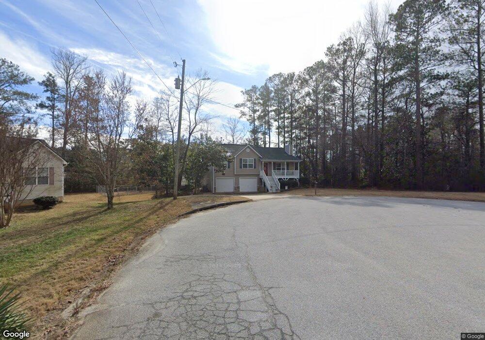
77 McAuls Ct Rockmart, GA 30153
Estimated Value: $254,000 - $274,000
3
Beds
2
Baths
1,265
Sq Ft
$207/Sq Ft
Est. Value
About This Home
This home is located at 77 McAuls Ct, Rockmart, GA 30153 and is currently estimated at $262,200, approximately $207 per square foot. 77 McAuls Ct is a home located in Paulding County with nearby schools including Sara M. Ragsdale Elementary School, Carl Scoggins Sr. Middle School, and Paulding County High School.
Ownership History
Date
Name
Owned For
Owner Type
Purchase Details
Closed on
Nov 29, 2005
Sold by
J C Properties Inc
Bought by
Wilson Grace L
Current Estimated Value
Home Financials for this Owner
Home Financials are based on the most recent Mortgage that was taken out on this home.
Original Mortgage
$95,920
Outstanding Balance
$56,214
Interest Rate
7.1%
Mortgage Type
New Conventional
Estimated Equity
$205,986
Create a Home Valuation Report for This Property
The Home Valuation Report is an in-depth analysis detailing your home's value as well as a comparison with similar homes in the area
Home Values in the Area
Average Home Value in this Area
Purchase History
| Date | Buyer | Sale Price | Title Company |
|---|---|---|---|
| Wilson Grace L | $119,900 | -- |
Source: Public Records
Mortgage History
| Date | Status | Borrower | Loan Amount |
|---|---|---|---|
| Open | Wilson Grace L | $95,920 |
Source: Public Records
Tax History Compared to Growth
Tax History
| Year | Tax Paid | Tax Assessment Tax Assessment Total Assessment is a certain percentage of the fair market value that is determined by local assessors to be the total taxable value of land and additions on the property. | Land | Improvement |
|---|---|---|---|---|
| 2024 | $2,401 | $99,748 | $12,000 | $87,748 |
| 2023 | $2,653 | $104,308 | $12,000 | $92,308 |
| 2022 | $2,177 | $85,400 | $12,000 | $73,400 |
| 2021 | $1,990 | $70,356 | $8,000 | $62,356 |
| 2020 | $1,851 | $64,160 | $8,000 | $56,160 |
| 2019 | $1,629 | $55,908 | $8,000 | $47,908 |
| 2018 | $1,313 | $45,440 | $8,000 | $37,440 |
| 2017 | $1,330 | $45,400 | $8,000 | $37,400 |
| 2016 | $1,148 | $39,840 | $8,000 | $31,840 |
| 2015 | $1,210 | $41,160 | $8,000 | $33,160 |
| 2014 | $994 | $33,360 | $8,000 | $25,360 |
| 2013 | -- | $29,440 | $8,000 | $21,440 |
Source: Public Records
Map
Nearby Homes
- 4790 Georgia 101
- 35 Ravenwood Dr
- 790 Presley Farm Pkwy
- 716 Presley Farm Pkwy
- 662 Presley Farm Pkwy
- 540 Presley Farm Pkwy
- 642 Presley Farm Pkwy
- 461 Barnwood Dr
- 164 Puckett Rd
- 516 Barnwood Dr
- 194 Spring Leaf Dr
- 110 Conifer Ln
- 61 Fairfax Dr
- 355 Spring Leaf Dr
- 23 Shadow Ridge Dr
- 1153 Old Yorkville Rd
- 89 Farm Brook Ln
- 434 Spring Leaf Dr
- 129 Woodwind Dr
- 61 McAuls Ct
- 320 Ables Dr
- 56 McAuls Ct
- 0 McAuls Ct Unit 8314421
- 4790 Highway 101 N
- 35 McAuls Ct
- 0 McAuls Ct
- 14 McAuls Ct
- 34 Presley Farm Pkwy
- 70 Tanner Farm Dr
- 52 Presley Farm Pkwy
- 15 Lofty Pine Ln Unit 1
- 15 Lofty Pine Ln
- 4877 Highway 101 N
- 4877 Highway 101 N
- 59 Tanner Farm Dr
- 19 Presley Farm Pkwy
- 0 Stanford Path
- 64 Presley Farm Pkwy
- 70 Presley Farm Pkwy