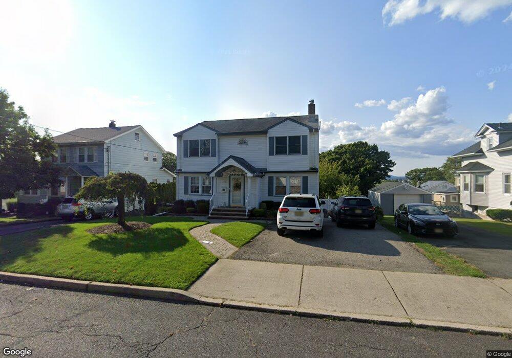
77 Oak Grove Ave Hasbrouck Heights, NJ 07604
Estimated Value: $859,000
--
Bed
--
Bath
2,000
Sq Ft
$430/Sq Ft
Est. Value
About This Home
This home is located at 77 Oak Grove Ave, Hasbrouck Heights, NJ 07604 and is currently estimated at $859,000, approximately $429 per square foot. 77 Oak Grove Ave is a home located in Bergen County with nearby schools including Hasbrouck Heights High School and Corpus Christi School.
Ownership History
Date
Name
Owned For
Owner Type
Purchase Details
Closed on
Apr 28, 2015
Sold by
Ryan Rosemary T and Shockley Rosemary T
Bought by
Littlejohn Alexandra E
Current Estimated Value
Home Financials for this Owner
Home Financials are based on the most recent Mortgage that was taken out on this home.
Original Mortgage
$395,000
Outstanding Balance
$304,404
Interest Rate
3.69%
Mortgage Type
New Conventional
Estimated Equity
$554,596
Create a Home Valuation Report for This Property
The Home Valuation Report is an in-depth analysis detailing your home's value as well as a comparison with similar homes in the area
Home Values in the Area
Average Home Value in this Area
Purchase History
| Date | Buyer | Sale Price | Title Company |
|---|---|---|---|
| Littlejohn Alexandra E | $495,000 | Westcor Land Title Ins Co |
Source: Public Records
Mortgage History
| Date | Status | Borrower | Loan Amount |
|---|---|---|---|
| Open | Littlejohn Alexandra E | $395,000 |
Source: Public Records
Tax History Compared to Growth
Tax History
| Year | Tax Paid | Tax Assessment Tax Assessment Total Assessment is a certain percentage of the fair market value that is determined by local assessors to be the total taxable value of land and additions on the property. | Land | Improvement |
|---|---|---|---|---|
| 2025 | $16,406 | $678,000 | $232,100 | $445,900 |
| 2024 | $15,874 | $642,100 | $232,100 | $410,000 |
| 2023 | $15,557 | $616,000 | $222,100 | $393,900 |
| 2022 | $15,557 | $577,900 | $204,600 | $373,300 |
| 2021 | $15,060 | $533,300 | $192,100 | $341,200 |
| 2020 | $14,578 | $506,900 | $184,600 | $322,300 |
| 2019 | $14,162 | $497,800 | $182,100 | $315,700 |
| 2018 | $13,938 | $488,700 | $179,600 | $309,100 |
| 2017 | $13,695 | $479,500 | $177,100 | $302,400 |
| 2016 | $14,216 | $468,400 | $167,100 | $301,300 |
| 2015 | $13,736 | $468,400 | $167,100 | $301,300 |
| 2014 | $13,352 | $468,400 | $167,100 | $301,300 |
Source: Public Records
Map
Nearby Homes
- 35 Franklin Ave
- 30 Woodside Ave
- 14 Jefferson Ave Unit 16
- 74 Kipp Ave
- 2 Passaic Ave
- 38 Springfield Ave
- 208 Jefferson Ave
- 25 Roosevelt Dr
- 27 Roosevelt Dr
- 95 Mckinley Ave
- 8800 Boulevard Unit 5F
- 8800 Boulevard Unit 7K
- 8800 Boulevard Unit 4B
- 66 Terhune Ave Unit 14
- 129 Eisenhower Ln Unit 2109
- 43 Wesmont Dr Unit 1712
- 73 Wesmont Dr Unit 1811
- 110 Harrison Ave
- 117 Central Ave Unit A
- 117 Central Ave
- 75 Oak Grove Ave
- 85 Oak Grove Ave
- 63 Division Ave
- 79 Oak Grove Ave
- 64 Walter Ave
- 59 Division Ave
- 103 Division Ave
- 102 Walter Ave
- 60 Walter Ave
- 63 Oak Grove Ave
- 55 Division Ave
- 107 Division Ave
- 104 Walter Ave
- 56 Walter Ave
- 66 Division Ave
- 91 Oak Grove Ave
- 51 Division Ave
- 62 Division Ave
- 59 Oak Grove Ave
- 102 Division Ave