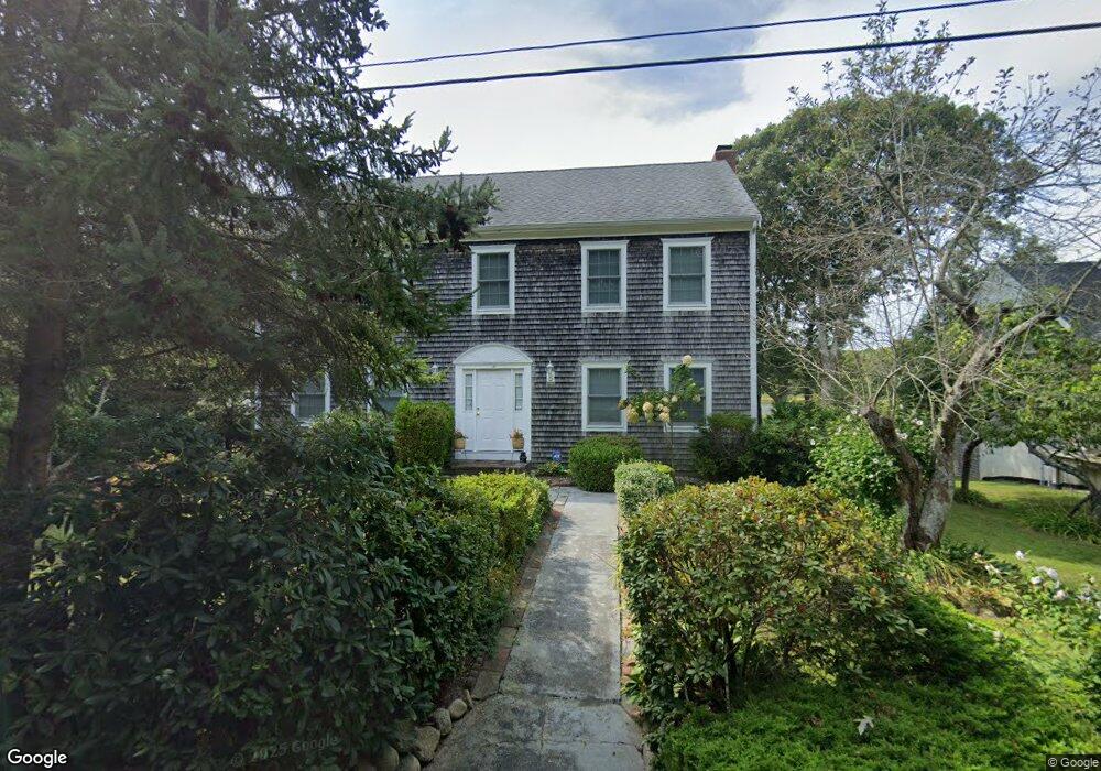
77 Paola Dr East Falmouth, MA 02536
East Falmouth NeighborhoodEstimated Value: $920,000 - $1,169,675
3
Beds
2
Baths
2,870
Sq Ft
$363/Sq Ft
Est. Value
About This Home
This home is located at 77 Paola Dr, East Falmouth, MA 02536 and is currently estimated at $1,042,919, approximately $363 per square foot. 77 Paola Dr is a home located in Barnstable County with nearby schools including East Falmouth Elementary School, Morse Pond School, and Lawrence School.
Create a Home Valuation Report for This Property
The Home Valuation Report is an in-depth analysis detailing your home's value as well as a comparison with similar homes in the area
Home Values in the Area
Average Home Value in this Area
Tax History Compared to Growth
Tax History
| Year | Tax Paid | Tax Assessment Tax Assessment Total Assessment is a certain percentage of the fair market value that is determined by local assessors to be the total taxable value of land and additions on the property. | Land | Improvement |
|---|---|---|---|---|
| 2025 | $5,885 | $1,002,500 | $499,800 | $502,700 |
| 2024 | $6,021 | $958,800 | $499,800 | $459,000 |
| 2023 | $5,753 | $831,300 | $487,800 | $343,500 |
| 2022 | $5,152 | $640,000 | $348,800 | $291,200 |
| 2021 | $5,068 | $596,200 | $348,800 | $247,400 |
| 2020 | $4,849 | $564,500 | $317,100 | $247,400 |
| 2019 | $4,812 | $562,200 | $317,100 | $245,100 |
| 2018 | $4,791 | $557,100 | $317,100 | $240,000 |
| 2017 | $4,676 | $548,200 | $317,100 | $231,100 |
| 2016 | $4,588 | $548,200 | $317,100 | $231,100 |
| 2015 | $4,490 | $548,200 | $317,100 | $231,100 |
| 2014 | $4,438 | $544,500 | $317,100 | $227,400 |
Source: Public Records
Map
Nearby Homes
- 42 Hanson Cir
- 27 Emerald Ln
- 0 Tobey Ln
- 231 Edgewater Dr W
- 285 Edgewater Dr W
- 30 Weatherglass Ln
- 0 Elsies Way Unit 22505181
- 0 Elsies Way Unit 73443603
- 23 N Bournes Pond Rd
- 23 N Bournes Pond Rd
- 53 Eel River Rd
- 15 Ovington Dr
- 45 Green Pond Rd
- 14 Old Meeting House Rd
- 11 Pershing Dr
- 15 Pershing Dr
- 7 Yale Dr
- 52 Bacon Farm Rd
- 9 Theroux Dr
- 67 Vidal Ave