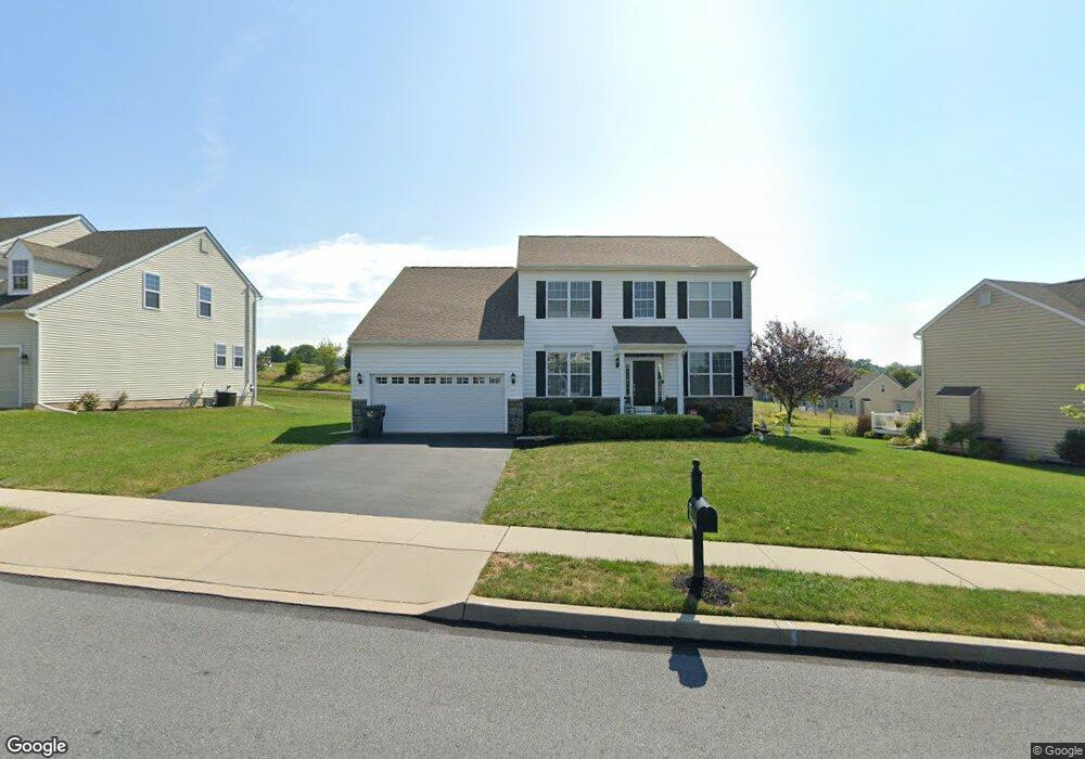
77 Putter Ln Pottstown, PA 19464
Limerick Township NeighborhoodEstimated Value: $584,962 - $758,000
4
Beds
3
Baths
2,304
Sq Ft
$292/Sq Ft
Est. Value
About This Home
This home is located at 77 Putter Ln, Pottstown, PA 19464 and is currently estimated at $672,241, approximately $291 per square foot. 77 Putter Ln is a home with nearby schools including Evans Elementary School, Spring-Ford Middle School 8th Grade Center, and Spring-Ford Middle School 5/6/7 Grade Center.
Ownership History
Date
Name
Owned For
Owner Type
Purchase Details
Closed on
Apr 28, 2011
Sold by
Dewey Properties Inc
Bought by
Durante Robert J
Current Estimated Value
Home Financials for this Owner
Home Financials are based on the most recent Mortgage that was taken out on this home.
Original Mortgage
$337,497
Outstanding Balance
$234,545
Interest Rate
4.88%
Estimated Equity
$437,696
Create a Home Valuation Report for This Property
The Home Valuation Report is an in-depth analysis detailing your home's value as well as a comparison with similar homes in the area
Home Values in the Area
Average Home Value in this Area
Purchase History
| Date | Buyer | Sale Price | Title Company |
|---|---|---|---|
| Durante Robert J | $326,085 | None Available |
Source: Public Records
Mortgage History
| Date | Status | Borrower | Loan Amount |
|---|---|---|---|
| Open | Durante Robert J | $337,497 |
Source: Public Records
Tax History Compared to Growth
Tax History
| Year | Tax Paid | Tax Assessment Tax Assessment Total Assessment is a certain percentage of the fair market value that is determined by local assessors to be the total taxable value of land and additions on the property. | Land | Improvement |
|---|---|---|---|---|
| 2025 | $7,032 | $181,860 | -- | -- |
| 2024 | $7,032 | $181,860 | -- | -- |
| 2023 | $6,710 | $181,860 | $0 | $0 |
| 2022 | $6,482 | $181,860 | $0 | $0 |
| 2021 | $6,329 | $181,860 | $0 | $0 |
| 2020 | $6,169 | $181,860 | $0 | $0 |
| 2019 | $6,056 | $181,860 | $0 | $0 |
| 2018 | $4,683 | $181,860 | $0 | $0 |
| 2017 | $5,944 | $181,860 | $0 | $0 |
| 2016 | $5,874 | $181,860 | $0 | $0 |
| 2015 | $5,619 | $181,860 | $0 | $0 |
| 2014 | $5,619 | $181,860 | $0 | $0 |
Source: Public Records
Map
Nearby Homes
- 20 Bunker Way
- 1180 Rupert Rd
- 1629 Rupert Rd
- 1687 Rupert Rd
- 0 Industrial Pkwy Unit PAMC2142810
- 1060 Oakdale Dr
- 847 Rivendell Ln
- 2933 E High St
- 3000 E High St Unit 1
- 2672 Crownview Rd
- 90 Kurtz Rd
- 217 S Park Rd
- 0 Steinmetz Rd
- 2580 Allison Dr Unit 3
- 172 Oak Creek Dr
- 17 Lightcap Rd
- 2576 Swamp Pike
- 2126 Deer Ridge Dr
- 110 Nelson Ln
- 59 Houck Rd