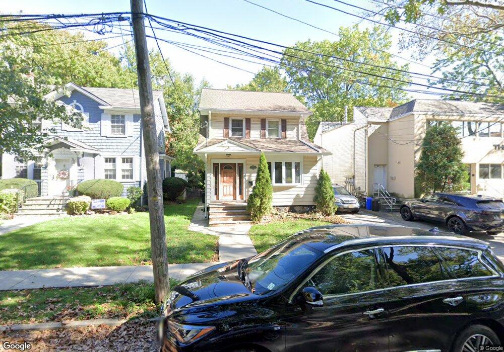
77 Randall Ave Staten Island, NY 10301
Randall Manor NeighborhoodEstimated Value: $732,000 - $860,000
3
Beds
2
Baths
1,160
Sq Ft
$676/Sq Ft
Est. Value
About This Home
This home is located at 77 Randall Ave, Staten Island, NY 10301 and is currently estimated at $783,936, approximately $675 per square foot. 77 Randall Ave is a home located in Richmond County with nearby schools including P.S. 45 John Tyler, Is 61 William A Morris, and Curtis High School.
Ownership History
Date
Name
Owned For
Owner Type
Purchase Details
Closed on
Apr 2, 2020
Sold by
Bulger William P
Bought by
Bulger Colleen Erica and The Bulger Family Trust
Current Estimated Value
Purchase Details
Closed on
Oct 20, 2003
Sold by
Robinson Scott and Robinson Megann
Bought by
Bulger William P
Home Financials for this Owner
Home Financials are based on the most recent Mortgage that was taken out on this home.
Original Mortgage
$276,000
Interest Rate
6.05%
Mortgage Type
Purchase Money Mortgage
Purchase Details
Closed on
May 8, 2001
Sold by
Robinson Steven W and Robinson Rosalie
Bought by
Robinson Scott and Robinson Megann
Home Financials for this Owner
Home Financials are based on the most recent Mortgage that was taken out on this home.
Original Mortgage
$144,000
Interest Rate
7.05%
Purchase Details
Closed on
Apr 8, 1995
Sold by
Disalvo Joseph and Disalvo Mary
Bought by
Disalvo Joseph and Disalvo Mary
Create a Home Valuation Report for This Property
The Home Valuation Report is an in-depth analysis detailing your home's value as well as a comparison with similar homes in the area
Home Values in the Area
Average Home Value in this Area
Purchase History
| Date | Buyer | Sale Price | Title Company |
|---|---|---|---|
| Bulger Colleen Erica | -- | None Available | |
| Bulger William P | $376,000 | -- | |
| Robinson Scott | $180,000 | Custom Title Services Inc | |
| Disalvo Joseph | -- | -- |
Source: Public Records
Mortgage History
| Date | Status | Borrower | Loan Amount |
|---|---|---|---|
| Previous Owner | Bulger William P | $276,000 | |
| Previous Owner | Robinson Scott | $144,000 |
Source: Public Records
Tax History Compared to Growth
Tax History
| Year | Tax Paid | Tax Assessment Tax Assessment Total Assessment is a certain percentage of the fair market value that is determined by local assessors to be the total taxable value of land and additions on the property. | Land | Improvement |
|---|---|---|---|---|
| 2025 | $6,835 | $47,280 | $10,676 | $36,604 |
| 2024 | $4,902 | $42,060 | $11,322 | $30,738 |
| 2023 | $6,451 | $33,520 | $9,168 | $24,352 |
| 2022 | $6,246 | $42,600 | $13,440 | $29,160 |
| 2021 | $6,400 | $36,720 | $13,440 | $23,280 |
| 2020 | $6,328 | $37,320 | $13,440 | $23,880 |
| 2019 | $5,884 | $35,280 | $13,440 | $21,840 |
| 2018 | $5,397 | $27,933 | $11,652 | $16,281 |
| 2017 | $5,259 | $27,270 | $10,967 | $16,303 |
| 2016 | $4,996 | $26,541 | $12,649 | $13,892 |
| 2015 | $4,417 | $26,080 | $13,355 | $12,725 |
| 2014 | $4,417 | $24,606 | $12,600 | $12,006 |
Source: Public Records
Map
Nearby Homes
- 776 Brighton Ave
- 171 Silver Lake Rd
- 215 Hart Blvd Unit 3L
- 72 Gregg Place
- 414 Castleton Ave
- 58-62 University Place
- 435 Castleton Ave
- 112 Delafield Ave
- 525 Castleton Ave Unit 1C
- 328 Stanley Ave
- 26 Valencia Ave
- 585 Castleton Ave Unit 1c
- 310 Brighton Ave
- 372 Sharon Ave
- 260 Brighton Ave
- 279 Stanley Ave
- 54 City Blvd
- 251 Castleton Ave
- 0 Stanley Ave
- 354 Hoyt Ave
- 75 Randall Ave
- 81 Randall Ave
- 269 Forest Ave
- 71 Randall Ave
- 255 Forest Ave
- 255 Forest Ave Unit 3B
- 255 Forest Ave Unit 1C
- 255 Forest Ave Unit 2D
- 255 Forest Ave Unit 2E
- 255 Forest Ave Unit 3A
- 255 Forest Ave Unit 1B
- 255 Forest Ave Unit 3E
- 255 Forest Ave Unit 2B
- 255 Forest Ave Unit 2A
- 255 Forest Ave Unit 3D
- 255 Forest Ave Unit 1A
- 255 Forest Ave Unit 3C
- 255 Forest Ave Unit 2C
- 69 Randall Ave
- 122-124 Ridgewood Place