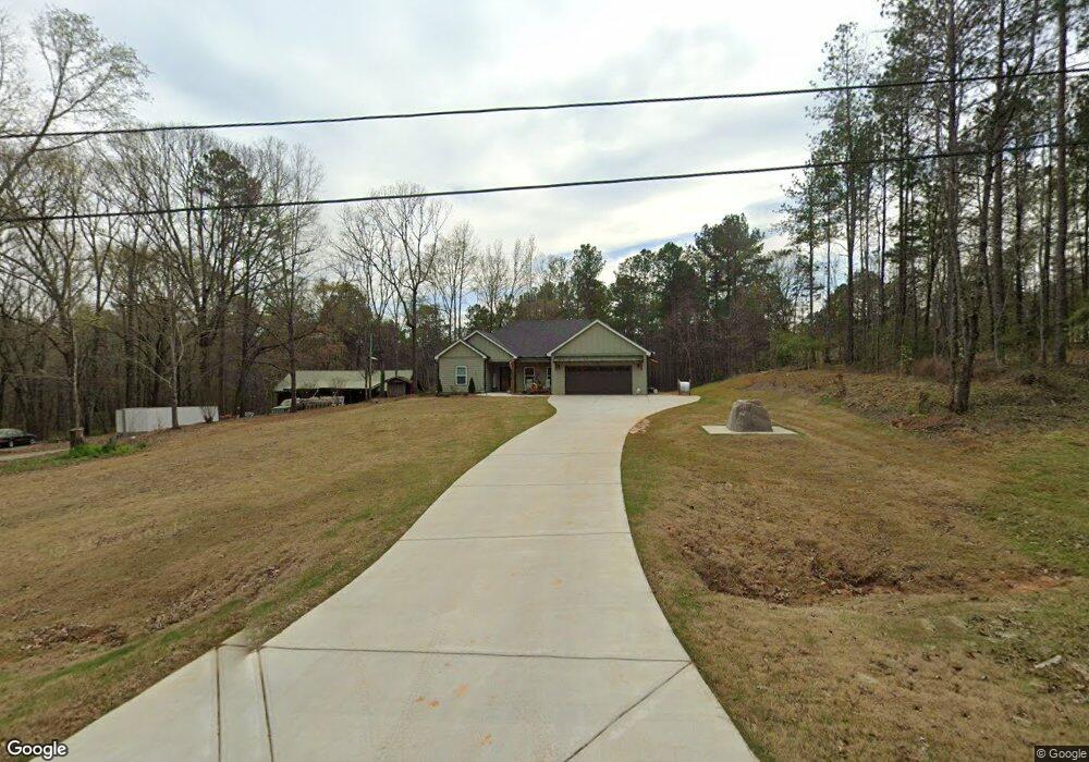
77 Riverbend Dr Lagrange, GA 30240
Estimated Value: $308,350 - $353,000
3
Beds
2
Baths
1,677
Sq Ft
$197/Sq Ft
Est. Value
About This Home
This home is located at 77 Riverbend Dr, Lagrange, GA 30240 and is currently estimated at $329,838, approximately $196 per square foot. 77 Riverbend Dr is a home with nearby schools including Hillcrest Elementary School, Franklin Forest Elementary School, and Hollis Hand Elementary School.
Ownership History
Date
Name
Owned For
Owner Type
Purchase Details
Closed on
Sep 24, 2020
Sold by
Mitchell Connie G
Bought by
Carrell Jamie D and Carrell Misty
Current Estimated Value
Home Financials for this Owner
Home Financials are based on the most recent Mortgage that was taken out on this home.
Original Mortgage
$25,500
Outstanding Balance
$17,444
Interest Rate
2.9%
Mortgage Type
New Conventional
Estimated Equity
$312,394
Purchase Details
Closed on
Jun 14, 2002
Sold by
Ernest C Burch
Bought by
Mitchell Connie G
Purchase Details
Closed on
Apr 21, 1994
Sold by
Freida Freida I and Freida K
Bought by
Ernest C Burch
Purchase Details
Closed on
Apr 15, 1994
Sold by
Blizzard T E
Bought by
Freida Freida I and Freida K
Purchase Details
Closed on
Oct 16, 1992
Bought by
Blizzard T E
Purchase Details
Closed on
Apr 17, 1981
Create a Home Valuation Report for This Property
The Home Valuation Report is an in-depth analysis detailing your home's value as well as a comparison with similar homes in the area
Purchase History
| Date | Buyer | Sale Price | Title Company |
|---|---|---|---|
| Carrell Jamie D | $30,000 | -- | |
| Mitchell Connie G | -- | -- | |
| Ernest C Burch | $13,500 | -- | |
| Freida Freida I | -- | -- | |
| Blizzard T E | -- | -- | |
| -- | -- | -- |
Source: Public Records
Mortgage History
| Date | Status | Borrower | Loan Amount |
|---|---|---|---|
| Open | Carrell Jamie D | $25,500 |
Source: Public Records
Tax History
| Year | Tax Paid | Tax Assessment Tax Assessment Total Assessment is a certain percentage of the fair market value that is determined by local assessors to be the total taxable value of land and additions on the property. | Land | Improvement |
|---|---|---|---|---|
| 2025 | $3,409 | $125,000 | $20,000 | $105,000 |
| 2024 | $2,911 | $106,720 | $20,000 | $86,720 |
| 2023 | $2,888 | $105,880 | $20,000 | $85,880 |
| 2022 | $2,822 | $101,120 | $20,000 | $81,120 |
| 2021 | $302 | $10,000 | $10,000 | $0 |
| 2020 | $302 | $10,000 | $10,000 | $0 |
| 2019 | $302 | $10,000 | $10,000 | $0 |
| 2018 | $181 | $6,000 | $6,000 | $0 |
| 2017 | $181 | $6,000 | $6,000 | $0 |
| 2016 | $181 | $6,000 | $6,000 | $0 |
| 2015 | $181 | $6,000 | $6,000 | $0 |
| 2014 | $182 | $6,000 | $6,000 | $0 |
| 2013 | -- | $6,000 | $6,000 | $0 |
Source: Public Records
Map
Nearby Homes
- 0 River Club Dr Unit 10311961
- 116 Firefly Run
- 110 Firefly Run
- 96 Firefly Run
- 56 Firefly Run
- 147 Wolf Creek Cove
- 135 Copper Creek Dr
- 178 Wolf Creek Cove
- 155 Indian Bend Dr
- 14 Firefly Run
- 5 Firefly Run
- 115 Wolf Creek Cove
- 105 Wolf Creek Cove
- 40 Wolf Creek Cove
- 100 Wolf Creek Cove
- 144 Wolf Creek Cove
- 111 Indian Bend Dr
- 65 Indian Bend Dr
- 120 Copper Creek Dr
- 107 Edgemont Ct
- 71 Riverbend Dr
- 83 Riverbend Dr
- 89 Riverbend Dr
- 95 Riverbend Dr
- 63 Riverbend Dr
- 107 Riverbend Dr
- 117 Hubbard Rd
- 136 Riverbend Dr
- 21 Riverbend Dr
- 137 Riverbend Dr
- 127 Hubbard Rd
- 30 Riverbend Dr
- 145 Riverbend Dr
- 151 Hubbard Rd Unit 3LOTS
- 151 Hubbard Rd Unit 2,4
- 31 Hubbard Rd
- 150 Hubbard Rd Unit 1
- 207 Riverbend Dr
- 3987 Mooty Bridge Rd
- 3961 Mooty Bridge Rd
Your Personal Tour Guide
Ask me questions while you tour the home.