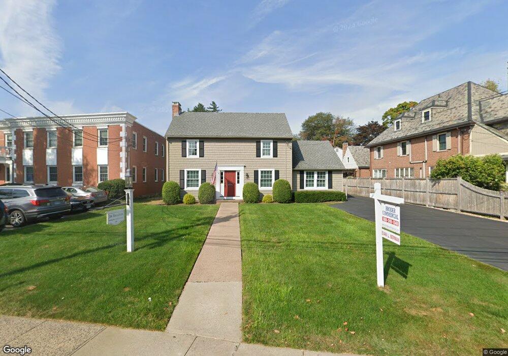
77 S Main St West Hartford, CT 06107
Estimated Value: $697,261
--
Bed
1
Bath
1,978
Sq Ft
$353/Sq Ft
Est. Value
About This Home
This home is located at 77 S Main St, West Hartford, CT 06107 and is currently estimated at $697,261, approximately $352 per square foot. 77 S Main St is a home located in Hartford County with nearby schools including Webster Hill School, Sedgwick Middle School, and Conard High School.
Ownership History
Date
Name
Owned For
Owner Type
Purchase Details
Closed on
Dec 3, 2024
Sold by
Bbb Attorneys Llc
Bought by
77 S Main Street Llc
Current Estimated Value
Purchase Details
Closed on
Oct 30, 2024
Sold by
Hallinan Properties Llc
Bought by
Bbb Attorneys Llc
Purchase Details
Closed on
Feb 23, 2012
Sold by
Center Holdings Llc
Bought by
Hallinan Props Llc
Home Financials for this Owner
Home Financials are based on the most recent Mortgage that was taken out on this home.
Original Mortgage
$245,000
Interest Rate
3.89%
Mortgage Type
Commercial
Purchase Details
Closed on
Dec 19, 2002
Sold by
Felson Charles H
Bought by
Center Holdings Llc
Create a Home Valuation Report for This Property
The Home Valuation Report is an in-depth analysis detailing your home's value as well as a comparison with similar homes in the area
Home Values in the Area
Average Home Value in this Area
Purchase History
| Date | Buyer | Sale Price | Title Company |
|---|---|---|---|
| 77 S Main Street Llc | -- | None Available | |
| 77 S Main Street Llc | -- | None Available | |
| Bbb Attorneys Llc | $648,500 | None Available | |
| Bbb Attorneys Llc | $648,500 | None Available | |
| Hallinan Props Llc | $420,000 | -- | |
| Hallinan Props Llc | $420,000 | -- | |
| Center Holdings Llc | $290,000 | -- | |
| Center Holdings Llc | $290,000 | -- |
Source: Public Records
Mortgage History
| Date | Status | Borrower | Loan Amount |
|---|---|---|---|
| Previous Owner | Center Holdings Llc | $245,000 | |
| Previous Owner | Center Holdings Llc | $196,000 |
Source: Public Records
Tax History Compared to Growth
Tax History
| Year | Tax Paid | Tax Assessment Tax Assessment Total Assessment is a certain percentage of the fair market value that is determined by local assessors to be the total taxable value of land and additions on the property. | Land | Improvement |
|---|---|---|---|---|
| 2025 | $18,595 | $415,260 | $204,000 | $211,260 |
| 2024 | $17,586 | $415,260 | $204,000 | $211,260 |
| 2023 | $16,992 | $415,260 | $204,000 | $211,260 |
| 2022 | $16,893 | $415,260 | $204,000 | $211,260 |
| 2021 | $14,678 | $346,010 | $177,300 | $168,710 |
| 2020 | $14,463 | $346,010 | $177,300 | $168,710 |
| 2019 | $14,463 | $346,010 | $177,310 | $168,700 |
| 2018 | $14,186 | $346,010 | $177,310 | $168,700 |
| 2017 | $14,200 | $346,010 | $177,310 | $168,700 |
| 2016 | $13,104 | $331,660 | $145,460 | $186,200 |
| 2015 | $12,706 | $331,660 | $145,460 | $186,200 |
| 2014 | $12,394 | $331,660 | $145,460 | $186,200 |
Source: Public Records
Map
Nearby Homes
- 1640 Boulevard
- 2 Arapahoe Rd Unit 313
- 2 Arapahoe Rd Unit 308
- 2 Arapahoe Rd Unit 611
- 2 Arapahoe Rd Unit 601
- 2 Arapahoe Rd Unit 510
- 2 Arapahoe Rd Unit 505
- 2 Arapahoe Rd Unit 604
- 2 Arapahoe Rd Unit 609
- 2 Arapahoe Rd Unit 607
- 2 Arapahoe Rd Unit 312
- 2 Arapahoe Rd Unit 603
- 2 Arapahoe Rd Unit 605
- 2 Arapahoe Rd Unit 613
- 2 Arapahoe Rd Unit 612
- 2 Arapahoe Rd Unit 310
- 2 Arapahoe Rd Unit 515
- 2 Arapahoe Rd Unit 606
- 2 Arapahoe Rd Unit 610
- 2 Arapahoe Rd Unit 415