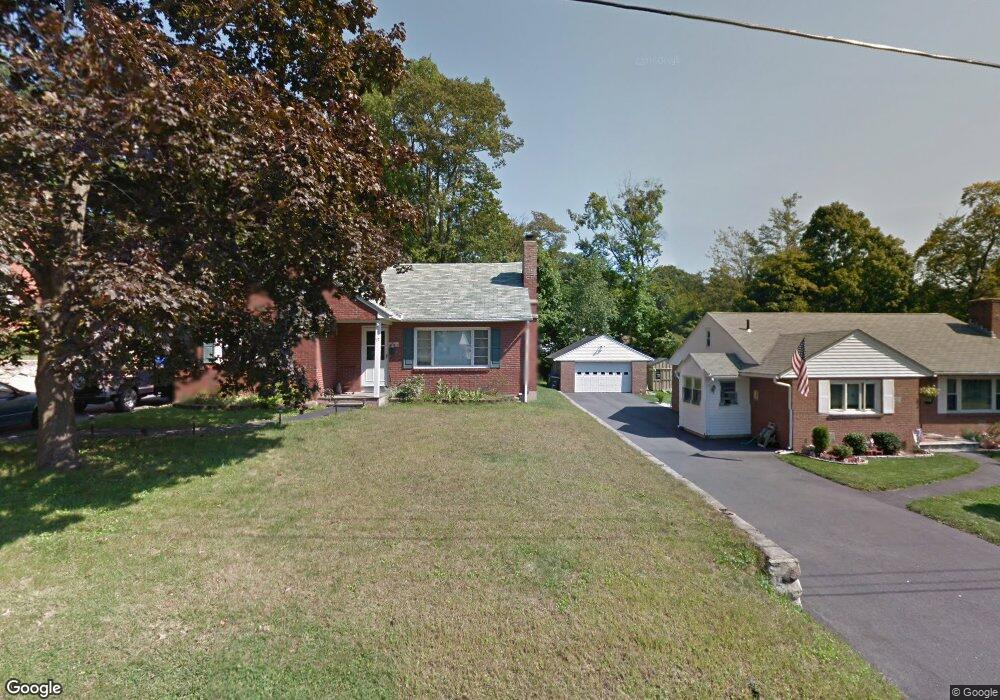
77 Visconti Ave Torrington, CT 06790
Estimated Value: $274,000 - $339,000
2
Beds
1
Bath
1,221
Sq Ft
$251/Sq Ft
Est. Value
About This Home
This home is located at 77 Visconti Ave, Torrington, CT 06790 and is currently estimated at $306,731, approximately $251 per square foot. 77 Visconti Ave is a home located in Litchfield County with nearby schools including Torrington Middle School, Torrington High School, and St. John Paul the Great Academy.
Ownership History
Date
Name
Owned For
Owner Type
Purchase Details
Closed on
Sep 1, 2005
Sold by
Stoner Douglas A and Stoner Cheryl L
Bought by
Kozikowski Gary J and Kozikowski Carole A
Current Estimated Value
Home Financials for this Owner
Home Financials are based on the most recent Mortgage that was taken out on this home.
Original Mortgage
$199,500
Outstanding Balance
$106,465
Interest Rate
5.81%
Estimated Equity
$200,266
Purchase Details
Closed on
Sep 14, 2001
Sold by
Emanuel Michele and Hall Corrine
Bought by
Stoner Douglas A and Stoner Cheryl L
Home Financials for this Owner
Home Financials are based on the most recent Mortgage that was taken out on this home.
Original Mortgage
$111,600
Interest Rate
6.99%
Create a Home Valuation Report for This Property
The Home Valuation Report is an in-depth analysis detailing your home's value as well as a comparison with similar homes in the area
Home Values in the Area
Average Home Value in this Area
Purchase History
| Date | Buyer | Sale Price | Title Company |
|---|---|---|---|
| Kozikowski Gary J | $210,000 | -- | |
| Stoner Douglas A | $124,000 | -- |
Source: Public Records
Mortgage History
| Date | Status | Borrower | Loan Amount |
|---|---|---|---|
| Open | Stoner Douglas A | $199,500 | |
| Previous Owner | Stoner Douglas A | $124,000 | |
| Previous Owner | Stoner Douglas A | $111,600 |
Source: Public Records
Tax History
| Year | Tax Paid | Tax Assessment Tax Assessment Total Assessment is a certain percentage of the fair market value that is determined by local assessors to be the total taxable value of land and additions on the property. | Land | Improvement |
|---|---|---|---|---|
| 2025 | $5,897 | $153,370 | $30,520 | $122,850 |
| 2024 | $4,481 | $93,410 | $30,550 | $62,860 |
| 2023 | $4,480 | $93,410 | $30,550 | $62,860 |
| 2022 | $4,403 | $93,410 | $30,550 | $62,860 |
| 2021 | $4,313 | $93,410 | $30,550 | $62,860 |
| 2020 | $4,313 | $93,410 | $30,550 | $62,860 |
| 2019 | $4,081 | $88,400 | $33,950 | $54,450 |
| 2018 | $4,081 | $88,400 | $33,950 | $54,450 |
| 2017 | $4,044 | $88,400 | $33,950 | $54,450 |
| 2016 | $4,044 | $88,400 | $33,950 | $54,450 |
| 2015 | $4,044 | $88,400 | $33,950 | $54,450 |
| 2014 | $4,035 | $111,100 | $45,500 | $65,600 |
Source: Public Records
Map
Nearby Homes
- 38 Surrey Ln Unit 38
- 839 Main St Unit 56
- 839 Main St Unit 98
- 839 Main St Unit 78
- 839 Main St Unit 104
- 71 Doman Dr
- 0 Queens Rd
- 27 Surrey Ln Unit d27
- 682 Main St
- 23 Benham St
- 277 Brightwood Ave
- 75 Hunter Ct Unit 75
- 79 Hunter Ct
- 0 Stoneridge Dr
- 67 Amherst St
- 00 Winthrop St & E Elm St
- 130 N Elm St
- 483 Charles St
- 279 E Elm St
- 408 Main St
Your Personal Tour Guide
Ask me questions while you tour the home.