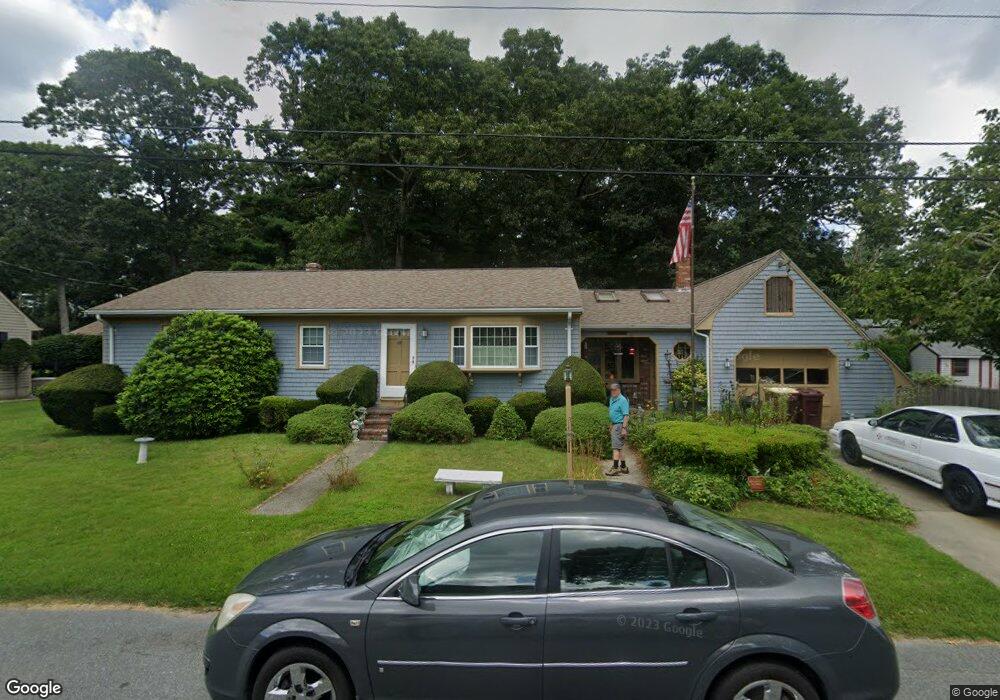
77 Wamsutta Ave Acushnet, MA 02743
Upper Acushnet NeighborhoodEstimated Value: $447,308 - $486,000
3
Beds
1
Bath
1,788
Sq Ft
$266/Sq Ft
Est. Value
About This Home
This home is located at 77 Wamsutta Ave, Acushnet, MA 02743 and is currently estimated at $475,077, approximately $265 per square foot. 77 Wamsutta Ave is a home located in Bristol County with nearby schools including Acushnet Elementary School, Albert F Ford Middle School, and Alma Del Mar Charter School.
Create a Home Valuation Report for This Property
The Home Valuation Report is an in-depth analysis detailing your home's value as well as a comparison with similar homes in the area
Home Values in the Area
Average Home Value in this Area
Tax History Compared to Growth
Tax History
| Year | Tax Paid | Tax Assessment Tax Assessment Total Assessment is a certain percentage of the fair market value that is determined by local assessors to be the total taxable value of land and additions on the property. | Land | Improvement |
|---|---|---|---|---|
| 2025 | $3,853 | $357,100 | $119,100 | $238,000 |
| 2024 | $3,755 | $329,100 | $112,900 | $216,200 |
| 2023 | $3,641 | $303,400 | $102,400 | $201,000 |
| 2022 | $3,616 | $272,500 | $96,100 | $176,400 |
| 2021 | $3,499 | $253,000 | $96,100 | $156,900 |
| 2020 | $3,440 | $246,800 | $89,900 | $156,900 |
| 2019 | $3,288 | $231,900 | $85,700 | $146,200 |
| 2018 | $3,177 | $220,300 | $85,700 | $134,600 |
| 2017 | $3,076 | $213,000 | $85,700 | $127,300 |
| 2016 | $2,990 | $205,800 | $85,700 | $120,100 |
| 2015 | $2,836 | $198,600 | $85,700 | $112,900 |
Source: Public Records
Map
Nearby Homes