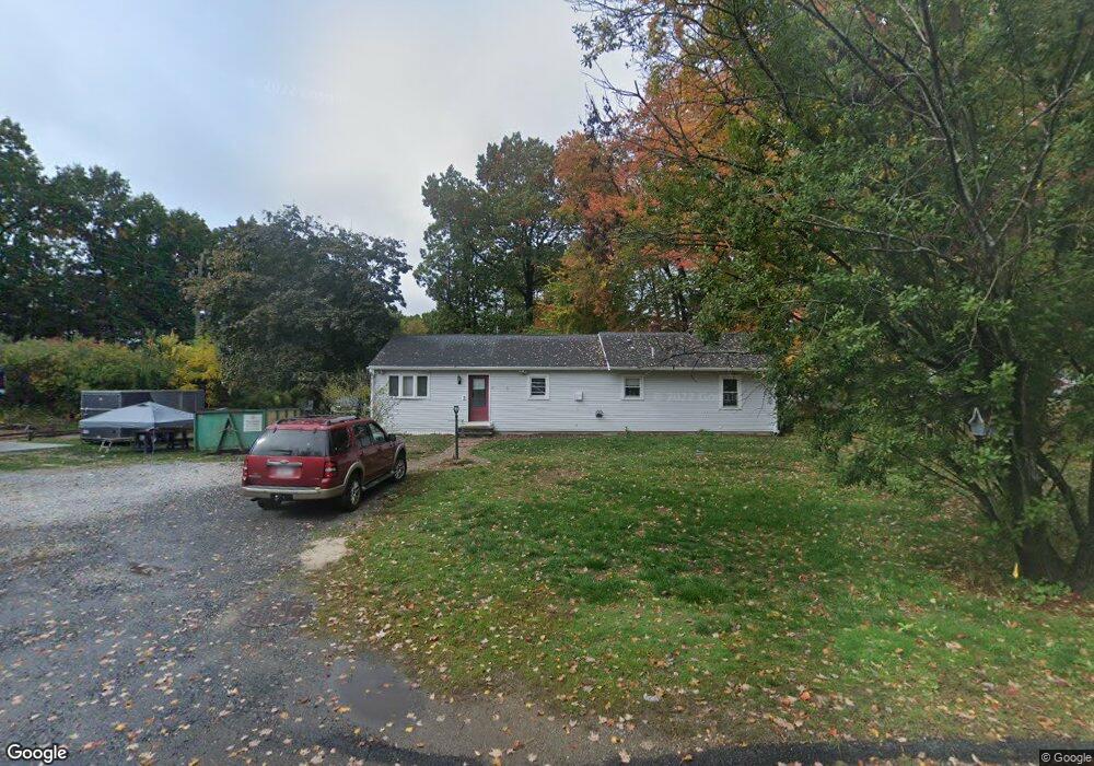
77 White St Leominster, MA 01453
Estimated Value: $362,000 - $484,000
3
Beds
1
Bath
1,482
Sq Ft
$287/Sq Ft
Est. Value
About This Home
This home is located at 77 White St, Leominster, MA 01453 and is currently estimated at $425,540, approximately $287 per square foot. 77 White St is a home located in Worcester County with nearby schools including Leominster High School, St. Anna Catholic School, and St. Leo School.
Ownership History
Date
Name
Owned For
Owner Type
Purchase Details
Closed on
May 14, 2021
Sold by
Fortuna Jerry and Fortuna Marie B
Bought by
Dobbs Stacy H and Dobbs Wesley J
Current Estimated Value
Home Financials for this Owner
Home Financials are based on the most recent Mortgage that was taken out on this home.
Original Mortgage
$260,000
Outstanding Balance
$235,625
Interest Rate
3.1%
Mortgage Type
Purchase Money Mortgage
Estimated Equity
$189,915
Purchase Details
Closed on
Dec 7, 1999
Sold by
Masley Franklin T
Bought by
Fortuna Jerry and Fortuna Marie B
Purchase Details
Closed on
Jun 29, 1990
Sold by
Lane Kenneth J
Bought by
Masley Franklin T
Create a Home Valuation Report for This Property
The Home Valuation Report is an in-depth analysis detailing your home's value as well as a comparison with similar homes in the area
Home Values in the Area
Average Home Value in this Area
Purchase History
| Date | Buyer | Sale Price | Title Company |
|---|---|---|---|
| Dobbs Stacy H | $325,000 | None Available | |
| Fortuna Jerry | $111,000 | -- | |
| Masley Franklin T | $124,900 | -- |
Source: Public Records
Mortgage History
| Date | Status | Borrower | Loan Amount |
|---|---|---|---|
| Open | Dobbs Stacy H | $260,000 | |
| Previous Owner | Masley Franklin T | $140,000 | |
| Previous Owner | Masley Franklin T | $25,000 | |
| Previous Owner | Masley Franklin T | $111,500 |
Source: Public Records
Tax History Compared to Growth
Tax History
| Year | Tax Paid | Tax Assessment Tax Assessment Total Assessment is a certain percentage of the fair market value that is determined by local assessors to be the total taxable value of land and additions on the property. | Land | Improvement |
|---|---|---|---|---|
| 2025 | $5,000 | $356,400 | $110,400 | $246,000 |
| 2024 | $4,812 | $331,600 | $105,300 | $226,300 |
| 2023 | $4,856 | $312,500 | $91,600 | $220,900 |
| 2022 | $4,668 | $281,900 | $79,700 | $202,200 |
| 2021 | $4,436 | $244,700 | $62,100 | $182,600 |
| 2020 | $4,220 | $234,700 | $62,100 | $172,600 |
| 2019 | $4,029 | $217,300 | $59,200 | $158,100 |
| 2018 | $3,918 | $202,700 | $57,500 | $145,200 |
| 2017 | $3,672 | $186,100 | $53,800 | $132,300 |
| 2016 | $3,519 | $179,700 | $53,800 | $125,900 |
| 2015 | $3,338 | $171,700 | $53,800 | $117,900 |
| 2014 | $3,055 | $161,700 | $75,300 | $86,400 |
Source: Public Records
Map
Nearby Homes
- 301 Ridgewood Dr
- 295 Ridgewood Dr
- 294 Ridgewood Dr
- 51 White St
- 284 Ridgewood Dr
- 263 Ridgewood Dr
- 39 White St
- 375 Harvard St
- 262 Ridgewood Dr
- 249 Ridgewood Dr
- 238 Ridgewood Dr
- 25 White St
- 233 Ridgewood Dr
- 58 Parkdale Ave
- 75 Parkdale Ave
- 225 Ridgewood Dr
- 44 Parkdale Ave
- 7 White St
- 318 Harvard St
- 292 Harvard St