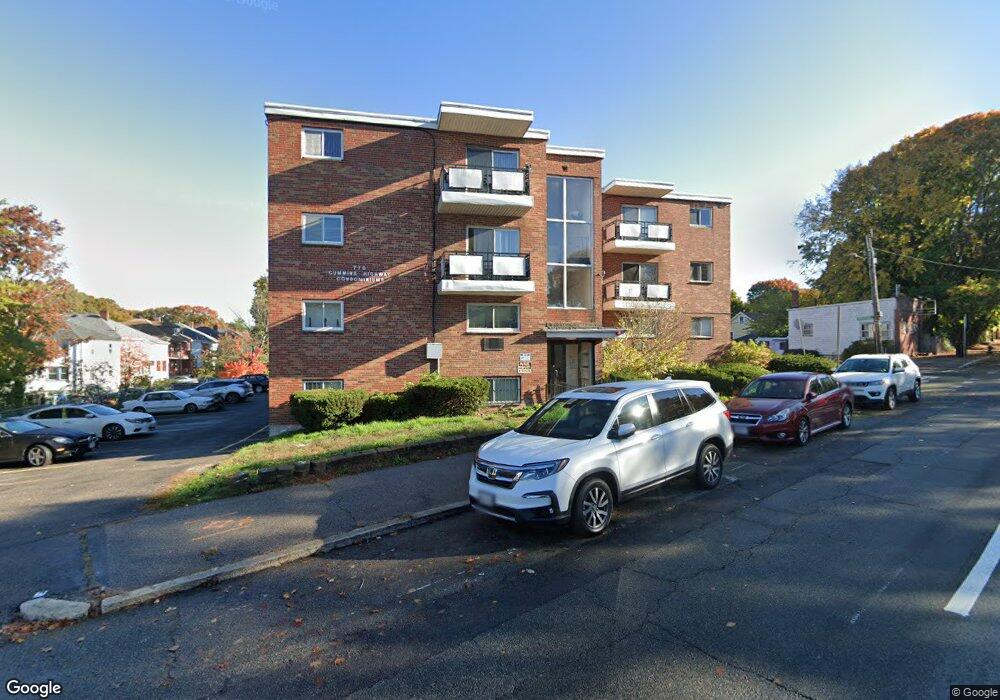
770 Cummins Hwy Unit 10 Mattapan, MA 02126
Southern Mattapan NeighborhoodEstimated Value: $271,853 - $306,000
1
Bed
1
Bath
652
Sq Ft
$439/Sq Ft
Est. Value
About This Home
This home is located at 770 Cummins Hwy Unit 10, Mattapan, MA 02126 and is currently estimated at $286,213, approximately $438 per square foot. 770 Cummins Hwy Unit 10 is a home located in Suffolk County with nearby schools including KIPP Academy Boston Charter School and Berea Seventh-day Adventist Academy.
Ownership History
Date
Name
Owned For
Owner Type
Purchase Details
Closed on
Apr 28, 1995
Sold by
Chase Manhattan Mtg
Bought by
New World Rt
Current Estimated Value
Home Financials for this Owner
Home Financials are based on the most recent Mortgage that was taken out on this home.
Original Mortgage
$8,000
Interest Rate
8.33%
Mortgage Type
Purchase Money Mortgage
Purchase Details
Closed on
Nov 8, 1994
Sold by
Reid Glendale
Bought by
Chase Manhattan Mtg
Create a Home Valuation Report for This Property
The Home Valuation Report is an in-depth analysis detailing your home's value as well as a comparison with similar homes in the area
Home Values in the Area
Average Home Value in this Area
Purchase History
| Date | Buyer | Sale Price | Title Company |
|---|---|---|---|
| New World Rt | $9,500 | -- | |
| New World Rt | $9,500 | -- | |
| Chase Manhattan Mtg | $17,100 | -- | |
| Chase Manhattan Mtg | $17,100 | -- |
Source: Public Records
Mortgage History
| Date | Status | Borrower | Loan Amount |
|---|---|---|---|
| Closed | New World Rt | $8,000 |
Source: Public Records
Tax History Compared to Growth
Tax History
| Year | Tax Paid | Tax Assessment Tax Assessment Total Assessment is a certain percentage of the fair market value that is determined by local assessors to be the total taxable value of land and additions on the property. | Land | Improvement |
|---|---|---|---|---|
| 2025 | $2,250 | $194,300 | $0 | $194,300 |
| 2024 | $2,424 | $222,400 | $0 | $222,400 |
| 2023 | $2,317 | $215,700 | $0 | $215,700 |
| 2022 | $2,193 | $201,600 | $0 | $201,600 |
| 2021 | $2,029 | $190,200 | $0 | $190,200 |
| 2020 | $1,400 | $132,600 | $0 | $132,600 |
| 2019 | $1,271 | $120,600 | $0 | $120,600 |
| 2018 | $1,264 | $120,600 | $0 | $120,600 |
| 2017 | $1,204 | $113,700 | $0 | $113,700 |
| 2016 | $1,214 | $110,400 | $0 | $110,400 |
| 2015 | $1,148 | $94,800 | $0 | $94,800 |
| 2014 | $1,157 | $92,000 | $0 | $92,000 |
Source: Public Records
Map
Nearby Homes
- 770 Cummins Hwy Unit 1
- 770 Cummins Hwy Unit 22
- 10 Brockton St
- 95 Woodhaven St
- 839-843 Cummins Hwy
- 90 Hollingsworth St
- 231 Itasca St
- 48-50 Rockdale St
- 23 Caton St
- 100 Itasca St
- 34 Ridlon Rd
- 20 Monterey Ave
- 1465 Blue Hill Ave
- 60 and 64 Monterey Ave
- 645 River St
- 25 Alpine St Unit 7
- 116 Almont St
- 179 Hebron St
- 72 Livermore St
- 12 Hiawatha Rd
- 770 Cummins Hwy Unit 28
- 770 Cummins Hwy Unit 27
- 770 Cummins Hwy Unit 26
- 770 Cummins Hwy Unit 25
- 770 Cummins Hwy Unit 24
- 770 Cummins Hwy Unit 23
- 770 Cummins Hwy Unit 21
- 770 Cummins Hwy Unit 20
- 770 Cummins Hwy Unit 19
- 770 Cummins Hwy Unit 18
- 770 Cummins Hwy Unit 17
- 770 Cummins Hwy Unit 16
- 770 Cummins Hwy Unit 15
- 770 Cummins Hwy Unit 14
- 770 Cummins Hwy Unit 12A
- 770 Cummins Hwy Unit 11
- 770 Cummins Hwy Unit 9
- 770 Cummins Hwy Unit 8
- 770 Cummins Hwy Unit 7
- 770 Cummins Hwy Unit 6