Estimated Value: $216,000 - $331,000
2
Beds
2
Baths
1,352
Sq Ft
$196/Sq Ft
Est. Value
About This Home
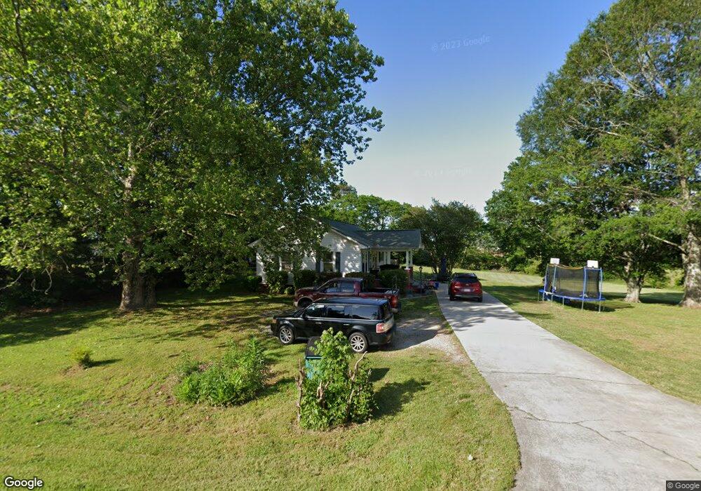
This home is located at 770 Duncan Bridge Rd, Alto, GA 30510 and is currently estimated at $264,559, approximately $195 per square foot. 770 Duncan Bridge Rd is a home located in Habersham County with nearby schools including Baldwin Elementary School, South Habersham Middle School, and Habersham Success Academy.
Ownership History
Date
Name
Owned For
Owner Type
Purchase Details
Closed on
Jul 28, 2017
Sold by
Shore Miriam G
Bought by
Gpm Llc
Current Estimated Value
Home Financials for this Owner
Home Financials are based on the most recent Mortgage that was taken out on this home.
Original Mortgage
$88,000
Outstanding Balance
$46,934
Interest Rate
3.88%
Mortgage Type
New Conventional
Estimated Equity
$217,625
Purchase Details
Closed on
Mar 1, 2016
Sold by
Shore Glenn P
Bought by
Shore Miriam G and Doster Glenda
Purchase Details
Closed on
May 9, 2014
Sold by
Doster Glenda
Bought by
Shore Miriam
Create a Home Valuation Report for This Property
The Home Valuation Report is an in-depth analysis detailing your home's value as well as a comparison with similar homes in the area
Home Values in the Area
Average Home Value in this Area
Purchase History
| Date | Buyer | Sale Price | Title Company |
|---|---|---|---|
| Gpm Llc | $110,000 | -- | |
| Shore Miriam G | -- | -- | |
| Shore Miriam | -- | -- |
Source: Public Records
Mortgage History
| Date | Status | Borrower | Loan Amount |
|---|---|---|---|
| Open | Gpm Llc | $88,000 |
Source: Public Records
Tax History Compared to Growth
Tax History
| Year | Tax Paid | Tax Assessment Tax Assessment Total Assessment is a certain percentage of the fair market value that is determined by local assessors to be the total taxable value of land and additions on the property. | Land | Improvement |
|---|---|---|---|---|
| 2025 | $2,764 | $84,692 | $21,705 | $62,987 |
| 2024 | $1,523 | $58,680 | $17,488 | $41,192 |
| 2023 | $1,293 | $51,732 | $17,488 | $34,244 |
| 2022 | $1,012 | $38,812 | $9,472 | $29,340 |
| 2021 | $933 | $35,928 | $9,472 | $26,456 |
| 2020 | $869 | $32,308 | $9,472 | $22,836 |
| 2019 | $870 | $32,308 | $9,472 | $22,836 |
| 2018 | $863 | $32,308 | $9,472 | $22,836 |
| 2017 | $150 | $21,176 | $7,288 | $13,888 |
| 2016 | $130 | $52,940 | $7,288 | $13,888 |
| 2015 | -- | $52,940 | $7,288 | $13,888 |
| 2014 | $128 | $53,040 | $7,288 | $13,928 |
| 2013 | -- | $21,944 | $8,016 | $13,928 |
Source: Public Records
Map
Nearby Homes
- 179 Sunset Oaks Dr
- 190 Sunset Oaks Dr
- 1246 Duncan Bridge Rd
- 0 State Route 365 Unit 10496178
- 0 State Route 365 Unit 10496183
- 429 Hubert Harris Rd
- 0 Hubert Harris
- 290 Magnolia Villas Dr
- 420 Magnolia Grove Place
- 150 Magnolia Villas Dr
- Plan 2628 at Magnolia Villas
- Plan 1709 at Magnolia Villas
- Plan 1522 at Magnolia Villas
- Plan 2030 at Magnolia Villas
- Plan 1727 at Magnolia Villas
- Plan 1634 at Magnolia Villas
- Plan 2709 at Magnolia Villas
- Plan 1643 at Magnolia Villas
- Plan 3105 at Magnolia Villas
- Plan 2121 at Magnolia Villas
- 0 Duncan Bridge Rd Unit 8812829
- 3420A Duncan Bridge Rd
- 2117 Duncan Bridge Rd
- 761 Duncan Bridge Rd
- 462 Mallard Pond Cir
- 462 Mallard Pond Cir Unit 26
- 458 Mallard Pond Cir
- 524 Industrial Park Rd
- 480 Mallard Pond Cir
- 480 Mallard Pond Cir Unit 27
- 444 Mallard Pond Cir
- 471 Mallard Pond Cir
- 422 Mallard Pond Cir
- 410 Mallard Pond Cir
- 483 Mallard Pond Cir
- 445 Mallard Pond Cir
- 850 Duncan Bridge Rd
- 689 Duncan Bridge Rd
- 0 Mallard Pond Cir Unit LOT 28 7047126
- 0 Mallard Pond Cir Unit 7473920