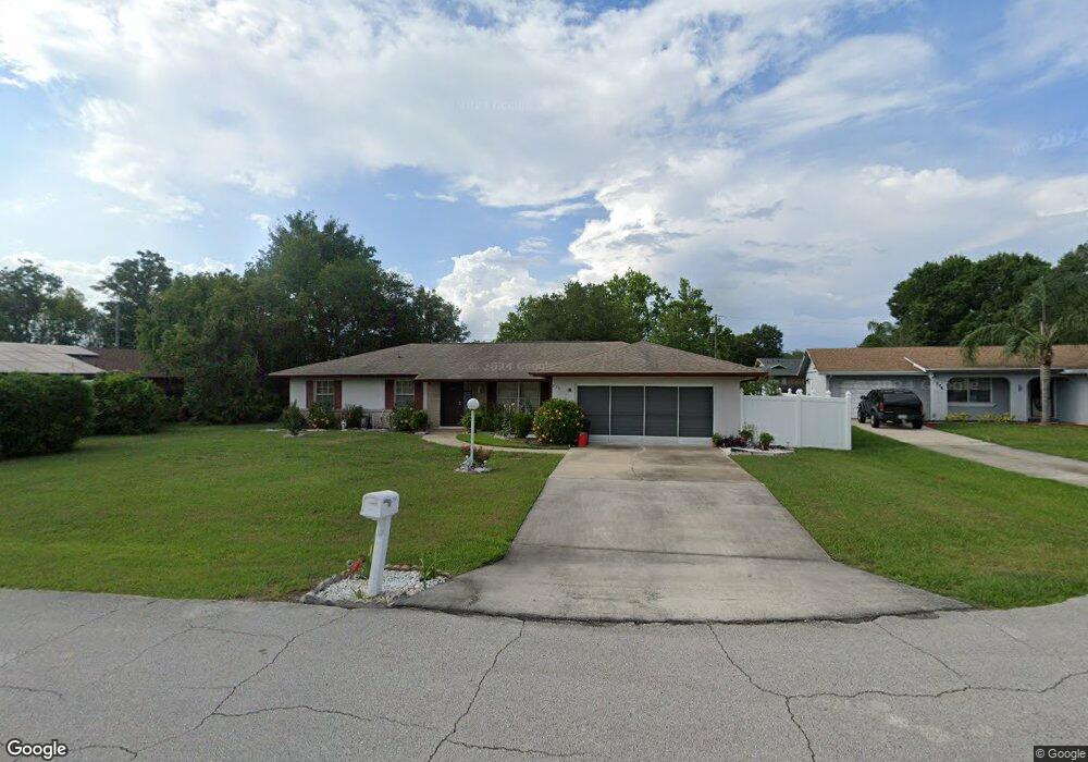
770 Gordon Ct Deltona, FL 32725
Estimated Value: $242,000 - $282,000
2
Beds
2
Baths
1,407
Sq Ft
$184/Sq Ft
Est. Value
About This Home
This home is located at 770 Gordon Ct, Deltona, FL 32725 and is currently estimated at $258,841, approximately $183 per square foot. 770 Gordon Ct is a home located in Volusia County with nearby schools including Spirit Elementary School, Deltona Middle School, and Deltona High School.
Ownership History
Date
Name
Owned For
Owner Type
Purchase Details
Closed on
Mar 14, 2023
Sold by
Wailes Violet
Bought by
Wailes Violet and Williams Howard Errick
Current Estimated Value
Purchase Details
Closed on
Dec 12, 1997
Sold by
Elias David P
Bought by
Wailes Violet
Home Financials for this Owner
Home Financials are based on the most recent Mortgage that was taken out on this home.
Original Mortgage
$51,040
Interest Rate
7.26%
Purchase Details
Closed on
Sep 7, 1993
Sold by
Hobbie Marjorie M
Bought by
Elias Victor M
Purchase Details
Closed on
Feb 15, 1979
Bought by
Wailes Violet
Create a Home Valuation Report for This Property
The Home Valuation Report is an in-depth analysis detailing your home's value as well as a comparison with similar homes in the area
Home Values in the Area
Average Home Value in this Area
Purchase History
| Date | Buyer | Sale Price | Title Company |
|---|---|---|---|
| Wailes Violet | $100 | None Listed On Document | |
| Wailes Violet | $62,400 | -- | |
| Elias Victor M | $62,000 | -- | |
| Wailes Violet | $3,800 | -- |
Source: Public Records
Mortgage History
| Date | Status | Borrower | Loan Amount |
|---|---|---|---|
| Previous Owner | Wailes Violet | $51,040 |
Source: Public Records
Tax History
| Year | Tax Paid | Tax Assessment Tax Assessment Total Assessment is a certain percentage of the fair market value that is determined by local assessors to be the total taxable value of land and additions on the property. | Land | Improvement |
|---|---|---|---|---|
| 2026 | $621 | $57,956 | -- | -- |
| 2025 | $621 | $57,956 | -- | -- |
| 2024 | $488 | $56,323 | -- | -- |
| 2023 | $488 | $54,683 | $0 | $0 |
| 2022 | $514 | $53,090 | $0 | $0 |
| 2021 | $523 | $51,544 | $0 | $0 |
| 2020 | $524 | $50,832 | $0 | $0 |
| 2019 | $531 | $49,689 | $0 | $0 |
| 2018 | $514 | $48,763 | $0 | $0 |
| 2017 | $487 | $47,760 | $0 | $0 |
| 2016 | $468 | $46,778 | $0 | $0 |
| 2015 | -- | $46,453 | $0 | $0 |
| 2014 | -- | $46,084 | $0 | $0 |
Source: Public Records
Map
Nearby Homes
- 1877 Veronica Ave
- 668 Elwood St
- 1834 Tripoli Ave
- 768 Sullivan St
- 683 Gainsboro St
- 857 S Atmore Cir
- 908 Vercelli St
- 1878 Viking Ave
- 1991 Tilburg Ave
- 674 Gainsboro St
- 2089 N Normandy Blvd
- 2091 Oldham Ave
- 2078 Kelso Ave
- 1007 Sullivan St
- 2102 Nedra Ave
- 1712 Ansley Ct
- 637 S Glancy Dr
- 1670 Tiffin Ave
- 2106 E Gloria Dr
- 987 Trumbull St
- 778 Gordon Ct
- 1901 N Normandy Blvd
- 783 Elwood St
- 775 Elwood St
- 791 Elwood St
- 1887 N Normandy Blvd
- 782 Gordon Ct
- 1921 N Normandy Blvd
- 775 Gordon Ct
- 785 Gordon Ct
- 1879 N Normandy Blvd
- 774 Elwood St
- 782 Elwood St
- 1894 N Normandy Blvd Unit 3
- 1910 Veronica Ave
- 1902 Veronica Ave
- 776 Swallow St
- 790 Elwood St
- 766 Elwood St
- 1886 N Normandy Blvd
Your Personal Tour Guide
Ask me questions while you tour the home.