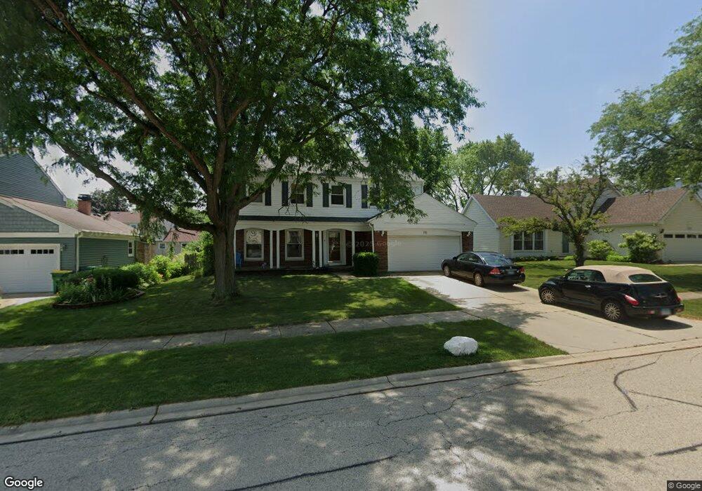
770 Kingsbridge Way Buffalo Grove, IL 60089
Prairie Park-Lake County NeighborhoodEstimated Value: $558,690 - $586,000
4
Beds
3
Baths
2,103
Sq Ft
$273/Sq Ft
Est. Value
About This Home
This home is located at 770 Kingsbridge Way, Buffalo Grove, IL 60089 and is currently estimated at $573,173, approximately $272 per square foot. 770 Kingsbridge Way is a home located in Lake County with nearby schools including Prairie Elementary School, Twin Groves Middle School, and Adlai E Stevenson High School.
Ownership History
Date
Name
Owned For
Owner Type
Purchase Details
Closed on
Nov 17, 2004
Sold by
Kosari Jamshid and Khoshnodi Mandana
Bought by
Kaiz Barrett M and Kaiz Jennifer L
Current Estimated Value
Home Financials for this Owner
Home Financials are based on the most recent Mortgage that was taken out on this home.
Original Mortgage
$324,000
Outstanding Balance
$160,932
Interest Rate
5.71%
Mortgage Type
Purchase Money Mortgage
Estimated Equity
$412,241
Purchase Details
Closed on
Oct 27, 1995
Sold by
Tabloff Steven S and Tabloff Sheri L
Bought by
Kosari Jamshid and Khoshnodi Mandana
Home Financials for this Owner
Home Financials are based on the most recent Mortgage that was taken out on this home.
Original Mortgage
$198,000
Interest Rate
7.65%
Create a Home Valuation Report for This Property
The Home Valuation Report is an in-depth analysis detailing your home's value as well as a comparison with similar homes in the area
Home Values in the Area
Average Home Value in this Area
Purchase History
| Date | Buyer | Sale Price | Title Company |
|---|---|---|---|
| Kaiz Barrett M | $405,000 | -- | |
| Kosari Jamshid | $220,000 | Chicago Title Insurance Co |
Source: Public Records
Mortgage History
| Date | Status | Borrower | Loan Amount |
|---|---|---|---|
| Open | Kaiz Barrett M | $324,000 | |
| Previous Owner | Kosari Jamshid | $198,000 | |
| Closed | Kaiz Barrett M | $60,750 |
Source: Public Records
Tax History Compared to Growth
Tax History
| Year | Tax Paid | Tax Assessment Tax Assessment Total Assessment is a certain percentage of the fair market value that is determined by local assessors to be the total taxable value of land and additions on the property. | Land | Improvement |
|---|---|---|---|---|
| 2024 | $14,634 | $167,655 | $37,478 | $130,177 |
| 2023 | $13,472 | $150,662 | $33,679 | $116,983 |
| 2022 | $13,472 | $135,204 | $30,223 | $104,981 |
| 2021 | $12,962 | $133,746 | $29,897 | $103,849 |
| 2020 | $12,657 | $134,202 | $29,999 | $104,203 |
| 2019 | $12,482 | $133,707 | $29,888 | $103,819 |
| 2018 | $11,906 | $131,690 | $29,537 | $102,153 |
| 2017 | $11,681 | $128,617 | $28,848 | $99,769 |
| 2016 | $11,376 | $123,161 | $27,624 | $95,537 |
| 2015 | $11,075 | $115,179 | $25,834 | $89,345 |
| 2014 | $10,376 | $106,819 | $27,746 | $79,073 |
| 2012 | $10,297 | $107,033 | $27,802 | $79,231 |
Source: Public Records
Map
Nearby Homes
- 327 Lasalle Ln
- 890 Knollwood Dr
- 1546 Brandywyn Ln
- 1265 Devonshire Rd
- 614 Lyon Ct
- 538 Lasalle Ct
- 437 Caren Dr
- 1141 Devonshire Rd
- 1032 Courtland Dr Unit 9
- 1118 Larraway Dr
- 950 Belmar Ln
- 1903 Sheridan Rd
- 5107 N Arlington Heights Rd
- 931 Shady Grove Ln
- 1901 Brandywyn Ln
- 1113 Lockwood Dr
- 12 Cloverdale Ct
- 5255 Danbury Ct
- 1998 Sheridan Ct
- 1324 Fairfax Ln Unit B32
- 760 Kingsbridge Way
- 780 Kingsbridge Way Unit 2
- 771 Heatherdown Way
- 761 Heatherdown Way
- 781 Heatherdown Way
- 750 Kingsbridge Way
- 790 Kingsbridge Way
- 771 Kingsbridge Way
- 751 Heatherdown Way
- 761 Kingsbridge Way
- 781 Kingsbridge Way
- 791 Heatherdown Way Unit 2
- 791 Kingsbridge Way
- 741 Heatherdown Way
- 801 Kingsbridge Way Unit 2
- 801 Heatherdown Way Unit 2
- 730 Kingsbridge Way
- 810 Kingsbridge Way
- 760 Heatherdown Way
- 770 Heatherdown Way