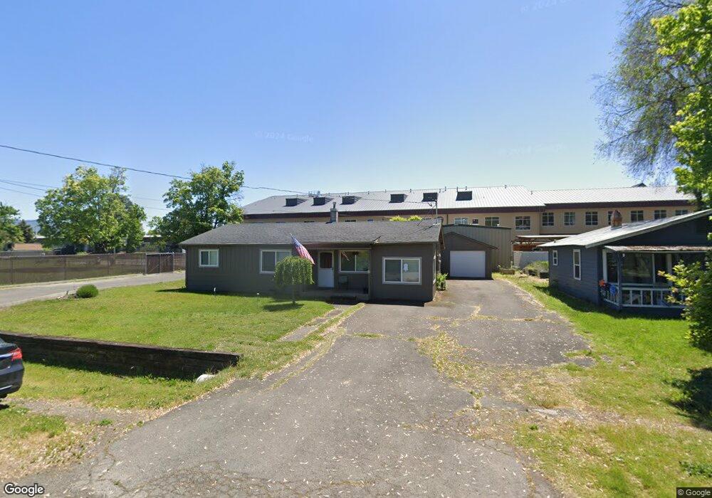
770 Lawnsdale Rd Medford, OR 97504
Northwest Medford NeighborhoodEstimated Value: $322,000 - $373,000
3
Beds
2
Baths
1,240
Sq Ft
$282/Sq Ft
Est. Value
About This Home
This home is located at 770 Lawnsdale Rd, Medford, OR 97504 and is currently estimated at $349,826, approximately $282 per square foot. 770 Lawnsdale Rd is a home located in Jackson County with nearby schools including Wilson Elementary School, Hedrick Middle School, and North Medford High School.
Ownership History
Date
Name
Owned For
Owner Type
Purchase Details
Closed on
Dec 15, 2005
Sold by
Tompkins Howard J and Tompkins Cynthia F
Bought by
Nelson Frederick M and Nelson Christine C
Current Estimated Value
Home Financials for this Owner
Home Financials are based on the most recent Mortgage that was taken out on this home.
Original Mortgage
$264,000
Outstanding Balance
$161,176
Interest Rate
7.87%
Mortgage Type
Fannie Mae Freddie Mac
Estimated Equity
$188,650
Purchase Details
Closed on
Jun 21, 2001
Sold by
Scoggins James R and Scoggins Wilma J
Bought by
Tompkins Howard J and Tompkins Cynthia F
Home Financials for this Owner
Home Financials are based on the most recent Mortgage that was taken out on this home.
Original Mortgage
$76,000
Interest Rate
7.15%
Purchase Details
Closed on
Feb 14, 2000
Sold by
Scoggins James and Scoggins Wilma
Bought by
Scoggins James R and Scoggins Wilma J
Create a Home Valuation Report for This Property
The Home Valuation Report is an in-depth analysis detailing your home's value as well as a comparison with similar homes in the area
Home Values in the Area
Average Home Value in this Area
Purchase History
| Date | Buyer | Sale Price | Title Company |
|---|---|---|---|
| Nelson Frederick M | $330,000 | Lawyers Title | |
| Tompkins Howard J | $95,000 | Amerititle | |
| Scoggins James R | -- | -- |
Source: Public Records
Mortgage History
| Date | Status | Borrower | Loan Amount |
|---|---|---|---|
| Open | Nelson Frederick M | $264,000 | |
| Previous Owner | Tompkins Howard J | $76,000 |
Source: Public Records
Tax History Compared to Growth
Tax History
| Year | Tax Paid | Tax Assessment Tax Assessment Total Assessment is a certain percentage of the fair market value that is determined by local assessors to be the total taxable value of land and additions on the property. | Land | Improvement |
|---|---|---|---|---|
| 2025 | $2,480 | $170,990 | $127,870 | $43,120 |
| 2024 | $2,480 | $166,010 | $124,150 | $41,860 |
| 2023 | $2,404 | $161,180 | $120,540 | $40,640 |
| 2022 | $2,345 | $161,180 | $120,540 | $40,640 |
| 2021 | $2,285 | $156,490 | $117,030 | $39,460 |
| 2020 | $2,236 | $151,940 | $113,630 | $38,310 |
| 2019 | $2,184 | $143,230 | $107,120 | $36,110 |
| 2018 | $2,128 | $139,060 | $104,000 | $35,060 |
| 2017 | $2,089 | $139,060 | $104,000 | $35,060 |
| 2016 | $2,103 | $131,080 | $98,030 | $33,050 |
| 2015 | $2,022 | $131,080 | $98,030 | $33,050 |
| 2014 | $1,869 | $116,810 | $87,780 | $29,030 |
Source: Public Records
Map
Nearby Homes
- 811 O'Hare Pkwy
- 246 Reanna Way
- 529 Black Bear Dr
- 2772 Merriman Rd
- 450 Midway Rd Unit 16
- 450 Midway Rd Unit 5
- 3119 Merriman Rd
- 2621 Merriman Rd Unit 3000
- 2587 Merriman Rd Unit 3200
- 2573 Merriman Rd Unit 3300
- 2605 Merriman Rd Unit 3101
- 2252 Table Rock Rd Unit 128
- 2252 Table Rock Rd Unit 97
- 2252 Table Rock Rd Unit SPC 102
- 2252 Table Rock Rd Unit SPC 228
- 2252 Table Rock Rd Unit SPC 100
- 2252 Table Rock Rd Unit SPC 232
- 2336 Table Rock Rd
- 191 Mellecker Way
- 460 Federal Way
- 762 Lawnsdale Rd
- 786 Lawnsdale Rd
- 752 Lawnsdale Rd
- 742 Lawnsdale Rd
- 777 Lawnsdale Rd
- 763 Lawnsdale Rd
- 886 Chevy Way
- 787 Lawnsdale Rd
- 740 Lawnsdale Rd
- 830 Lawnsdale Rd
- 743 Lawnsdale Rd
- 811 Lawnsdale Rd
- 717 Lawnsdale Rd
- 852 Lawnsdale Rd
- 778 Gilman Rd
- 943 Automation Way
- 786 Gilman Rd
- 762 Gilman Rd
- 709 Lawnsdale Rd
- 847 Lawnsdale Rd