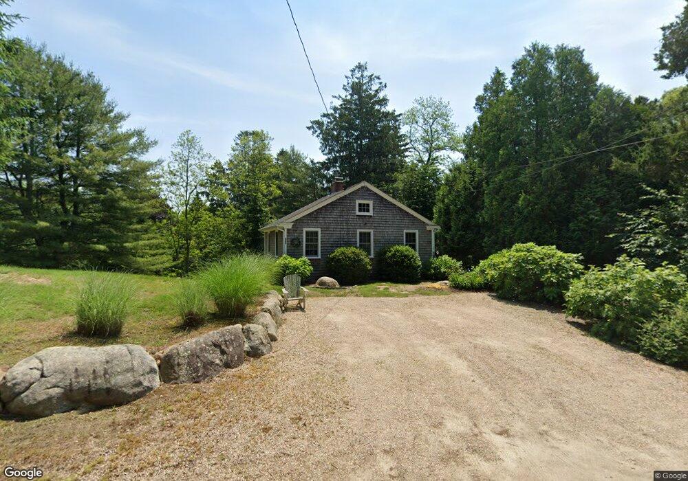
770 Post Rd Wakefield, RI 02879
Estimated Value: $489,000 - $576,662
2
Beds
2
Baths
924
Sq Ft
$592/Sq Ft
Est. Value
About This Home
This home is located at 770 Post Rd, Wakefield, RI 02879 and is currently estimated at $546,916, approximately $591 per square foot. 770 Post Rd is a home located in Washington County with nearby schools including South Kingstown High School and South Shore School.
Ownership History
Date
Name
Owned For
Owner Type
Purchase Details
Closed on
Jul 11, 2008
Sold by
Weinstein Jonathan
Bought by
Boyle Barbara J
Current Estimated Value
Purchase Details
Closed on
Feb 23, 2007
Sold by
Taylor Donna Lynn
Bought by
Weinstein Jonathan
Create a Home Valuation Report for This Property
The Home Valuation Report is an in-depth analysis detailing your home's value as well as a comparison with similar homes in the area
Home Values in the Area
Average Home Value in this Area
Purchase History
| Date | Buyer | Sale Price | Title Company |
|---|---|---|---|
| Boyle Barbara J | $255,000 | -- | |
| Weinstein Jonathan | $130,000 | -- |
Source: Public Records
Mortgage History
| Date | Status | Borrower | Loan Amount |
|---|---|---|---|
| Open | Weinstein Jonathan | $175,000 | |
| Closed | Weinstein Jonathan | $207,000 | |
| Closed | Weinstein Jonathan | $10,000 |
Source: Public Records
Tax History
| Year | Tax Paid | Tax Assessment Tax Assessment Total Assessment is a certain percentage of the fair market value that is determined by local assessors to be the total taxable value of land and additions on the property. | Land | Improvement |
|---|---|---|---|---|
| 2025 | $4,111 | $459,800 | $275,000 | $184,800 |
| 2024 | $4,343 | $393,000 | $245,500 | $147,500 |
| 2023 | $4,343 | $393,000 | $245,500 | $147,500 |
| 2022 | $4,303 | $393,000 | $245,500 | $147,500 |
| 2021 | $3,628 | $251,100 | $154,000 | $97,100 |
| 2020 | $3,628 | $251,100 | $154,000 | $97,100 |
| 2019 | $3,628 | $251,100 | $154,000 | $97,100 |
| 2018 | $3,631 | $231,600 | $148,100 | $83,500 |
| 2017 | $3,546 | $231,600 | $148,100 | $83,500 |
| 2016 | $3,495 | $231,600 | $148,100 | $83,500 |
| 2015 | $3,469 | $223,500 | $134,800 | $88,700 |
| 2014 | $3,460 | $223,500 | $134,800 | $88,700 |
Source: Public Records
Map
Nearby Homes
- 380 Camp Fuller Rd
- 100 Spartina Cove Way
- 35 Whittier Dr
- 37 Whittier Dr
- 262 Wood Hill Rd
- 35 Abbey Rd
- 66 Christopher St
- 39 Secluded Dr
- 23 Rockland Dr
- 17 Goose Island Rd
- 480 Sand Plains Trail Unit D68
- 39 Hazard Ave
- 260 Sweet Allen Farm Rd Unit 3
- 2321 Post Rd
- 45 Cherry Ln Unit C
- 131 Columbia St
- 48 Stone Bridge Dr
- 1808 Ministerial Rd
- 28 Palm Beach Ave
- 14 E Pointe Ct Unit 14
- 740 Post Rd
- 754 Post Rd
- 980 Post Rd
- 771 Post Rd
- 823 Post Rd
- 733 Post Rd
- 700 Post Rd
- 827 Post Rd
- 825 Post Rd
- 697 Post Rd
- 111 Wood Hollow Rd
- 690 Post Rd
- 1543 Comd Oliver Hazard Perry Hwy
- 1543 Commodore Perry Hwy
- 847 Post Rd
- 860 Post Rd
- 681 Post Rd
- 666 Post Rd
- 1519 Comd Oliver Hazard Perry Hwy
- 110 Wood Hollow Rd
Your Personal Tour Guide
Ask me questions while you tour the home.