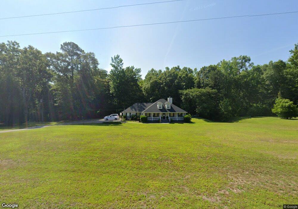
770 Quail Roost Dr Unit 6 Quincy, FL 32352
Estimated Value: $209,000 - $349,000
3
Beds
2
Baths
1,944
Sq Ft
$148/Sq Ft
Est. Value
About This Home
This home is located at 770 Quail Roost Dr Unit 6, Quincy, FL 32352 and is currently estimated at $287,435, approximately $147 per square foot. 770 Quail Roost Dr Unit 6 is a home located in Gadsden County.
Ownership History
Date
Name
Owned For
Owner Type
Purchase Details
Closed on
May 13, 2019
Sold by
Ventry Anna Jo Bristol
Bought by
Mount David R and Mount Jean R
Current Estimated Value
Purchase Details
Closed on
Jun 19, 2018
Sold by
Ventry Robert Marcus
Bought by
Bristol Anna Jo
Purchase Details
Closed on
Dec 12, 2016
Sold by
Bristol Clifford S and Bristol Lisa G
Bought by
Ventry Robert Marcus and Ventry Anna B
Purchase Details
Closed on
Dec 1, 2016
Bought by
Ventry Anna B and Ventry Robert M
Purchase Details
Closed on
Feb 25, 2015
Sold by
Bristol Clifford S and Bristol Lisa G
Bought by
Bristol Clifford S and Bristol Lisa G
Purchase Details
Closed on
Mar 9, 2004
Sold by
Wilson Barbara C
Bought by
Bristol Clifford S and Bristol Lisa G
Home Financials for this Owner
Home Financials are based on the most recent Mortgage that was taken out on this home.
Original Mortgage
$100,000
Interest Rate
5.68%
Mortgage Type
Unknown
Create a Home Valuation Report for This Property
The Home Valuation Report is an in-depth analysis detailing your home's value as well as a comparison with similar homes in the area
Home Values in the Area
Average Home Value in this Area
Purchase History
| Date | Buyer | Sale Price | Title Company |
|---|---|---|---|
| Mount David R | $185,000 | Attorney | |
| Bristol Anna Jo | -- | Attorney | |
| Ventry Robert Marcus | -- | Attorney | |
| Ventry Anna B | $100 | -- | |
| Bristol Clifford S | $15,000 | None Available | |
| Bristol Clifford S | $168,000 | First American Title Ins Co |
Source: Public Records
Mortgage History
| Date | Status | Borrower | Loan Amount |
|---|---|---|---|
| Previous Owner | Bristol Clifford S | $100,000 |
Source: Public Records
Tax History Compared to Growth
Tax History
| Year | Tax Paid | Tax Assessment Tax Assessment Total Assessment is a certain percentage of the fair market value that is determined by local assessors to be the total taxable value of land and additions on the property. | Land | Improvement |
|---|---|---|---|---|
| 2024 | $1,639 | $159,400 | -- | -- |
| 2023 | $1,582 | $154,758 | $0 | $0 |
| 2022 | $1,595 | $150,251 | $0 | $0 |
| 2021 | $1,576 | $145,875 | $0 | $0 |
| 2020 | $1,543 | $143,861 | $15,000 | $128,861 |
| 2019 | $1,604 | $145,453 | $15,000 | $130,453 |
| 2018 | $1,633 | $145,453 | $0 | $0 |
| 2017 | $1,637 | $145,203 | $0 | $0 |
| 2016 | $1,691 | $146,796 | $0 | $0 |
| 2015 | $2,375 | $148,388 | $0 | $0 |
| 2014 | $2,411 | $149,980 | $0 | $0 |
Source: Public Records
Map
Nearby Homes
- Tbd Quail Roost Dr
- 2861 Solomon Dairy Rd
- XXXX Red Bird Rd
- 000 Solomon Dairy Rd
- 171 Beech Ave
- 244 Beech Ave
- 212 Beech Ave
- 2nd Street
- 0 Juniper Creek Rd Unit 772830
- 0 Grrensboro Hwy Unit 375316
- XX Railroad St
- 0300 Shade Farm Rd
- 0200 Shade Farm Rd
- 379 Glory Rd
- 45 Inez Way
- 75,60,22 Inez Way
- 22 Inez Way
- 75 Inez Way
- 60 Inez Way
- XX Hardaway Hwy
- 770 Quail Roost Dr
- 740 Quail Roost Dr
- 810 Quail Roost Dr
- 775 Quail Roost Dr
- 828 Quail Roost Dr
- 380 Quail Roost Dr
- 0 Xxx Quail Roost Dr
- 735 Quail Roost Dr
- 831 Quail Roost Dr
- 866 Quail Roost Dr
- 695 Quail Roost Dr Unit 6
- 695 Quail Roost Dr
- 654 Quail Roost Dr
- 0 Quail Roost Dr Unit 370789
- 0 Quail Roost Dr Unit MFROM667763
- 0 Quail Roost Dr Unit R10934693
- 0 Quail Roost Dr Unit 311897
- 0 Quail Roost Dr Unit 295322
- 0 Quail Roost Dr Unit 286942
- 0 Quail Roost Dr Unit ~ 238227