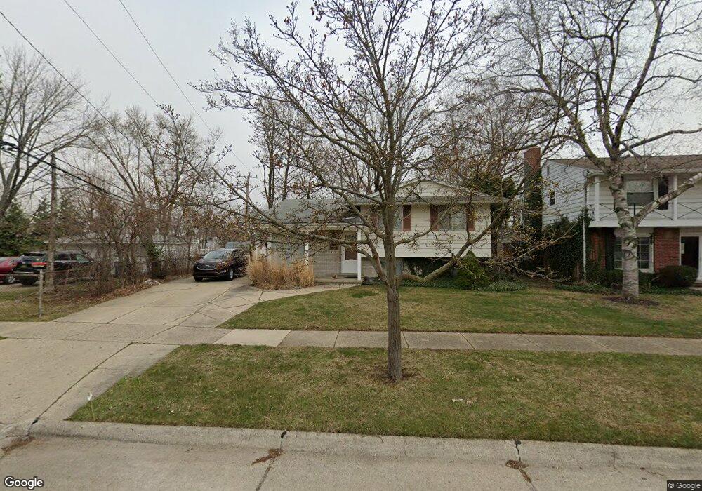
770 Shenandoah Dr Clawson, MI 48017
Estimated Value: $346,118 - $364,000
3
Beds
2
Baths
1,434
Sq Ft
$248/Sq Ft
Est. Value
About This Home
This home is located at 770 Shenandoah Dr, Clawson, MI 48017 and is currently estimated at $355,780, approximately $248 per square foot. 770 Shenandoah Dr is a home located in Oakland County with nearby schools including Clawson Middle School, Clawson High School, and Japhet School.
Ownership History
Date
Name
Owned For
Owner Type
Purchase Details
Closed on
Apr 14, 2004
Sold by
Andrews Michael J and Andrews Julie M
Bought by
Andrews Michael J and Michael J Andrews Revocable Trust
Current Estimated Value
Purchase Details
Closed on
Sep 6, 2002
Sold by
Gipson Vicki L
Bought by
Andrews Michael J
Purchase Details
Closed on
Mar 27, 2001
Sold by
Manzella Jeffrey
Bought by
Gipson Vicki L
Purchase Details
Closed on
Jan 5, 2001
Sold by
Johnson Carol A
Bought by
Manzella Jeffrey A
Home Financials for this Owner
Home Financials are based on the most recent Mortgage that was taken out on this home.
Original Mortgage
$147,150
Interest Rate
7.58%
Create a Home Valuation Report for This Property
The Home Valuation Report is an in-depth analysis detailing your home's value as well as a comparison with similar homes in the area
Home Values in the Area
Average Home Value in this Area
Purchase History
| Date | Buyer | Sale Price | Title Company |
|---|---|---|---|
| Andrews Michael J | -- | -- | |
| Andrews Michael J | $185,000 | -- | |
| Gipson Vicki L | -- | -- | |
| Manzella Jeffrey A | $154,900 | -- |
Source: Public Records
Mortgage History
| Date | Status | Borrower | Loan Amount |
|---|---|---|---|
| Previous Owner | Manzella Jeffrey A | $147,150 | |
| Closed | Andrews Michael J | -- |
Source: Public Records
Tax History
| Year | Tax Paid | Tax Assessment Tax Assessment Total Assessment is a certain percentage of the fair market value that is determined by local assessors to be the total taxable value of land and additions on the property. | Land | Improvement |
|---|---|---|---|---|
| 2025 | $3,689 | $152,170 | $0 | $0 |
| 2024 | $3,525 | $144,380 | $0 | $0 |
| 2023 | $3,379 | $134,830 | $0 | $0 |
| 2022 | $3,406 | $124,790 | $0 | $0 |
| 2021 | $3,336 | $116,510 | $0 | $0 |
| 2020 | $3,232 | $109,660 | $0 | $0 |
| 2019 | $3,340 | $103,760 | $0 | $0 |
| 2018 | $3,317 | $97,170 | $0 | $0 |
| 2017 | $3,297 | $93,660 | $0 | $0 |
| 2016 | $3,337 | $87,740 | $0 | $0 |
| 2015 | -- | $80,030 | $0 | $0 |
| 2014 | -- | $69,470 | $0 | $0 |
| 2011 | -- | $64,010 | $0 | $0 |
Source: Public Records
Map
Nearby Homes
- 816 W Baker Ave
- 822 Phillips Ave
- 930 Elmsford Dr
- 1109 Kenilworth Place
- 1087 N Stephen Ave
- 609 John M Ave
- 5065 Crooks Rd Unit 49
- 2130 Wickham St Unit 4
- 4905 Coventry St
- 4921 N Crooks Rd Unit N-10
- 4909 Crooks Rd Unit D6
- 4909 Crooks Rd Unit 4
- 4905 Crooks A2 Rd
- 1451 Kenilworth Place
- 4921 Crooks Rd Unit N 3
- 4921 Crooks Rd Unit M-10
- 659 W Maple Rd
- 114 Knollwood Blvd
- 57 W Elmwood Ave
- 124 Leroy Ave
- 760 Shenandoah Dr
- 941 W Elmwood Ave
- 746 Shenandoah Dr
- 805 N Selfridge Blvd
- 817 N Selfridge Blvd
- 745 N Selfridge Blvd
- 1009 W Elmwood Ave
- 921 W Elmwood Ave
- 735 N Selfridge Blvd
- 736 Shenandoah Dr
- 763 Shenandoah Dr
- 725 N Selfridge Blvd
- 0 Shenandoah Dr
- 55 Shenandoah Dr
- 907 W Elmwood Ave
- 753 Shenandoah Dr
- 1021 W Elmwood Ave
- 728 Shenandoah Dr
- 715 N Selfridge Blvd
- 743 Shenandoah Dr
Your Personal Tour Guide
Ask me questions while you tour the home.