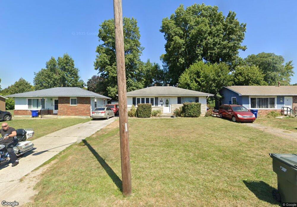
770 Stockbridge Rd Columbus, OH 43207
Obetz-Lockbourne NeighborhoodEstimated Value: $181,000 - $191,000
3
Beds
1
Bath
910
Sq Ft
$204/Sq Ft
Est. Value
About This Home
This home is located at 770 Stockbridge Rd, Columbus, OH 43207 and is currently estimated at $185,420, approximately $203 per square foot. 770 Stockbridge Rd is a home located in Franklin County with nearby schools including Parsons Elementary School, Buckeye Middle School, and Marion-Franklin High School.
Ownership History
Date
Name
Owned For
Owner Type
Purchase Details
Closed on
Sep 28, 2001
Sold by
Marcum Esther L
Bought by
Garland Gary N
Current Estimated Value
Home Financials for this Owner
Home Financials are based on the most recent Mortgage that was taken out on this home.
Original Mortgage
$78,000
Outstanding Balance
$34,093
Interest Rate
8.5%
Mortgage Type
Purchase Money Mortgage
Estimated Equity
$151,327
Purchase Details
Closed on
May 24, 2000
Sold by
Estate Of Robert O Marcum
Bought by
Marcum Esther Lucille
Purchase Details
Closed on
Jun 1, 1993
Create a Home Valuation Report for This Property
The Home Valuation Report is an in-depth analysis detailing your home's value as well as a comparison with similar homes in the area
Home Values in the Area
Average Home Value in this Area
Purchase History
| Date | Buyer | Sale Price | Title Company |
|---|---|---|---|
| Garland Gary N | $78,000 | Title First Agency Inc | |
| Marcum Esther Lucille | -- | -- | |
| -- | -- | -- |
Source: Public Records
Mortgage History
| Date | Status | Borrower | Loan Amount |
|---|---|---|---|
| Open | Garland Gary N | $78,000 |
Source: Public Records
Tax History Compared to Growth
Tax History
| Year | Tax Paid | Tax Assessment Tax Assessment Total Assessment is a certain percentage of the fair market value that is determined by local assessors to be the total taxable value of land and additions on the property. | Land | Improvement |
|---|---|---|---|---|
| 2024 | $2,572 | $57,300 | $17,610 | $39,690 |
| 2023 | $2,539 | $57,295 | $17,605 | $39,690 |
| 2022 | $1,340 | $25,840 | $9,420 | $16,420 |
| 2021 | $1,343 | $25,840 | $9,420 | $16,420 |
| 2020 | $1,344 | $25,840 | $9,420 | $16,420 |
| 2019 | $1,338 | $22,050 | $8,190 | $13,860 |
| 2018 | $1,318 | $22,050 | $8,190 | $13,860 |
| 2017 | $1,385 | $22,050 | $8,190 | $13,860 |
| 2016 | $1,433 | $21,630 | $3,850 | $17,780 |
| 2015 | $1,301 | $21,630 | $3,850 | $17,780 |
| 2014 | $1,304 | $21,630 | $3,850 | $17,780 |
| 2013 | $678 | $22,785 | $4,060 | $18,725 |
Source: Public Records
Map
Nearby Homes
- 780 Basswood Rd
- 3302 Hilock Place
- 696 Williams Rd
- 884 Bruckner Rd
- 0 Williams Rd
- 1124 Rumsey Rd
- 1633-1635 E Greenway Ave
- 1085 Williams Rd
- 3573 S Champion Ave
- 445 Basswood Rd
- 1138 Hilock Rd Unit 35
- 3380 Parsons Ave
- 1118 Maplewood Rd
- 3414 Parsons Ave
- 3785 S Ohio Ave
- 1068 Tobi Dr
- 256 Rumsey Rd Unit 258
- 3735 Christie Rd W
- 525 Ashwood Rd
- 3691 Ferman Rd
- 778 Stockbridge Rd
- 758 Stockbridge Rd
- 790 Stockbridge Rd
- 738 Stockbridge Rd
- 798 Stockbridge Rd
- 759 Basswood Rd
- 769 Basswood Rd
- 749 Basswood Rd
- 810 Stockbridge Rd
- 779 Basswood Rd
- 739 Basswood Rd
- 728 Stockbridge Rd
- 765 Stockbridge Rd
- 789 Basswood Rd
- 757 Stockbridge Rd
- 777 Stockbridge Rd
- 729 Basswood Rd
- 785 Stockbridge Rd
- 818 Stockbridge Rd
- 731 Stockbridge Rd