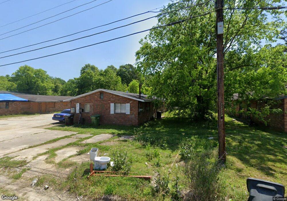
770 Terminal Ct Columbus, GA 31906
Carver Heights NeighborhoodEstimated Value: $176,972
8
Beds
4
Baths
2,650
Sq Ft
$67/Sq Ft
Est. Value
About This Home
This home is located at 770 Terminal Ct, Columbus, GA 31906 and is currently priced at $176,972, approximately $66 per square foot. 770 Terminal Ct is a home located in Muscogee County with nearby schools including Dorothy Height Elementary School, Rothschild Leadership Academy, and Carver High School.
Ownership History
Date
Name
Owned For
Owner Type
Purchase Details
Closed on
Oct 23, 2025
Sold by
Brim Lauren and Terminal St Holdings Llc
Bought by
Kiavi Funding Inc
Current Estimated Value
Purchase Details
Closed on
Feb 16, 2024
Sold by
Ryder Robert R
Bought by
Terminal St Holdings Llc
Home Financials for this Owner
Home Financials are based on the most recent Mortgage that was taken out on this home.
Original Mortgage
$105,600
Interest Rate
6.77%
Mortgage Type
Construction
Purchase Details
Closed on
Jan 23, 2024
Sold by
Ryder Rumrico
Bought by
Ryder Robert R
Home Financials for this Owner
Home Financials are based on the most recent Mortgage that was taken out on this home.
Original Mortgage
$105,600
Interest Rate
6.77%
Mortgage Type
Construction
Create a Home Valuation Report for This Property
The Home Valuation Report is an in-depth analysis detailing your home's value as well as a comparison with similar homes in the area
Home Values in the Area
Average Home Value in this Area
Purchase History
| Date | Buyer | Sale Price | Title Company |
|---|---|---|---|
| Kiavi Funding Inc | $67,500 | None Listed On Document | |
| Terminal St Holdings Llc | $80,000 | None Listed On Document | |
| Ryder Robert R | -- | None Listed On Document |
Source: Public Records
Mortgage History
| Date | Status | Borrower | Loan Amount |
|---|---|---|---|
| Previous Owner | Terminal St Holdings Llc | $105,600 |
Source: Public Records
Tax History
| Year | Tax Paid | Tax Assessment Tax Assessment Total Assessment is a certain percentage of the fair market value that is determined by local assessors to be the total taxable value of land and additions on the property. | Land | Improvement |
|---|---|---|---|---|
| 2025 | $1,293 | $33,021 | $8,780 | $24,241 |
| 2024 | $592 | $15,129 | $8,780 | $6,349 |
| 2023 | $596 | $15,129 | $8,780 | $6,349 |
| 2022 | $502 | $12,296 | $8,780 | $3,516 |
| 2021 | $560 | $12,296 | $8,780 | $3,516 |
| 2020 | $502 | $12,296 | $8,780 | $3,516 |
| 2019 | $504 | $12,296 | $8,780 | $3,516 |
| 2018 | $504 | $12,296 | $8,780 | $3,516 |
| 2017 | $1,004 | $24,418 | $8,780 | $15,638 |
| 2016 | $617 | $14,960 | $2,400 | $12,560 |
| 2015 | $247 | $14,960 | $2,400 | $12,560 |
| 2014 | $247 | $14,960 | $2,400 | $12,560 |
| 2013 | -- | $14,960 | $2,400 | $12,560 |
Source: Public Records
Map
Nearby Homes
- 758 Terminal Ct
- 3403 Terminal Ct
- 3319 Decatur St
- 760 Illges Rd
- 937 Diggs Ave
- 1043 Vera Dr
- 944 Booker Ave
- 827 Brighton Rd
- 3110 Morehouse St
- 1035 Fisk Ave
- 3122 Glenwood Dr
- 3035 Morehouse St
- 547 Fair Oaks Dr
- 1104 Dunbar Ave
- 2833 Thomas St
- 2831 Thomas St
- 2829 Thomas St
- 1072 Rigdon Rd
- 2902 Hood St
- 2810 Baldwin St
- 770 Terminal Ct Unit 3
- 770 Terminal Ct Unit 1
- 770 Terminal Ct Unit 2
- 770 Terminal Ct
- 764 Terminal St Unit 2
- 776 Terminal Ct
- 764 Terminal Ct
- 758 Terminal St Unit 2
- 758 Terminal St Unit 3
- 758 Terminal St Unit 4
- 758 Terminal Ct Unit 2
- 758 Terminal Ct Unit 4
- 782 Terminal St Unit 1
- 782 Terminal St Unit 2
- 782 Terminal Ct Unit 3
- 3414 Terminal St Unit 4
- 3414 Terminal St Unit 3
- 3414 Terminal St Unit 1
- 784 Terminal Ct Unit 10
- 784 Terminal Ct Unit 11
Your Personal Tour Guide
Ask me questions while you tour the home.