Estimated Value: $322,535 - $392,000
3
Beds
2
Baths
2,565
Sq Ft
$134/Sq Ft
Est. Value
About This Home
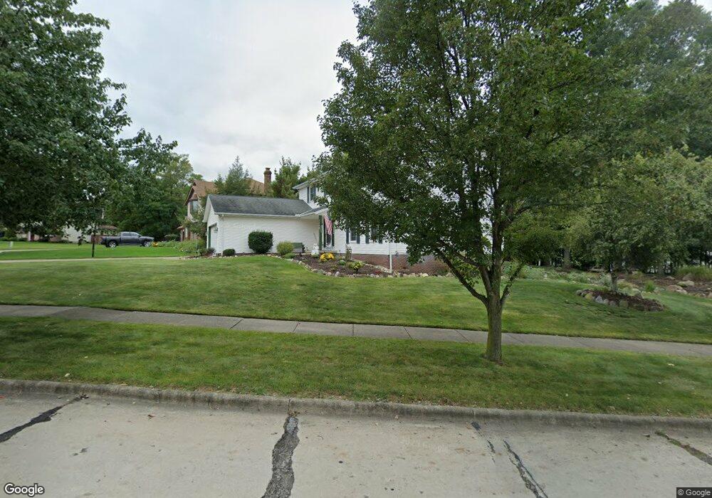
This home is located at 7700 Parkside Dr, Parma, OH 44130 and is currently estimated at $344,134, approximately $134 per square foot. 7700 Parkside Dr is a home located in Cuyahoga County with nearby schools including Pleasant Valley Elementary School, Greenbriar Middle School, and Valley Forge High School.
Ownership History
Date
Name
Owned For
Owner Type
Purchase Details
Closed on
Sep 24, 2021
Sold by
Stonitsch Richard and Stonitsch Richard H
Bought by
Stonitsch Richard H and Stonitsch Sandra R
Current Estimated Value
Purchase Details
Closed on
Jun 12, 1985
Bought by
Stonitsch Richard
Purchase Details
Closed on
Mar 1, 1984
Bought by
Continental Fed S&L Assoc
Purchase Details
Closed on
Aug 13, 1982
Bought by
Cfssp Properties
Purchase Details
Closed on
Jul 24, 1978
Bought by
Royalton Hoertz Devel Co
Purchase Details
Closed on
Jan 1, 1977
Bought by
Pearl Masonry Co
Create a Home Valuation Report for This Property
The Home Valuation Report is an in-depth analysis detailing your home's value as well as a comparison with similar homes in the area
Home Values in the Area
Average Home Value in this Area
Purchase History
| Date | Buyer | Sale Price | Title Company |
|---|---|---|---|
| Stonitsch Richard H | -- | Abstract Title | |
| Stonitsch Richard | $13,900 | -- | |
| Continental Fed S&L Assoc | -- | -- | |
| Cfssp Properties | -- | -- | |
| Royalton Hoertz Devel Co | -- | -- | |
| Pearl Masonry Co | -- | -- |
Source: Public Records
Tax History Compared to Growth
Tax History
| Year | Tax Paid | Tax Assessment Tax Assessment Total Assessment is a certain percentage of the fair market value that is determined by local assessors to be the total taxable value of land and additions on the property. | Land | Improvement |
|---|---|---|---|---|
| 2024 | $5,595 | $94,675 | $16,030 | $78,645 |
| 2023 | $5,019 | $72,980 | $13,620 | $59,360 |
| 2022 | $4,976 | $72,980 | $13,620 | $59,360 |
| 2021 | $5,159 | $72,980 | $13,620 | $59,360 |
| 2020 | $4,855 | $61,320 | $11,450 | $49,880 |
| 2019 | $4,675 | $175,200 | $32,700 | $142,500 |
| 2018 | $4,705 | $61,320 | $11,450 | $49,880 |
| 2017 | $4,590 | $55,930 | $9,450 | $46,480 |
| 2016 | $4,560 | $55,930 | $9,450 | $46,480 |
| 2015 | $4,394 | $55,930 | $9,450 | $46,480 |
| 2014 | $4,394 | $55,930 | $9,450 | $46,480 |
Source: Public Records
Map
Nearby Homes
- 7706 Wake Robin Dr
- 8501 Pin Oak Dr
- 8400 Vista Ln
- 9616 W Pleasant Valley Rd
- 8175 Tanglewood Ln
- 7957 Pamela Dr
- 10260 Terrace Ct
- 11183 Johnson Dr
- 9530 Tilby Rd
- 11000 W Sprague Rd
- 11339 Gordon Dr
- 9581 Tilby Rd
- 7730 Lime Ln
- 8414 York Rd
- Rosecliff Plan at South Pointe - Townhomes
- Caroline w/ Covered Rear Porch Plan at South Pointe - Townhomes
- 7351 S Pointe Ln
- 7580 S Pointe Ln
- 7987 Ridge Rd
- 7032 Brandywine Rd
- 7708 Parkside Dr
- 0 Parkside Dr
- 9401 Running Brook Dr
- 9407 Running Brook Dr
- 7705 Arbor Dr
- 9415 Running Brook Dr
- 9311 Running Brook Dr
- 7717 Parkside Dr
- 9501 Running Brook Dr
- 7712 Arbor Dr
- 7709 Arbor Dr
- 7724 Parkside Dr
- 9303 Running Brook Dr
- 9303 Running Brook Dr Unit D
- 7715 Arbor Dr
- 9505 Running Brook Dr
- 7732 Parkside Dr
- 7590 Parkside Dr
- 9215 Running Brook Dr
- 7737 Parkside Dr