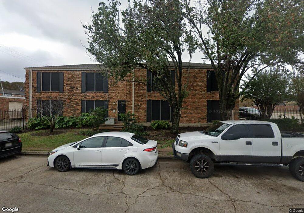
7703 Moonmist Unit B Dr Unit B Houston, TX 77036
Sharpstown NeighborhoodEstimated Value: $82,905 - $114,000
2
Beds
2
Baths
904
Sq Ft
$104/Sq Ft
Est. Value
About This Home
This home is located at 7703 Moonmist Unit B Dr Unit B, Houston, TX 77036 and is currently estimated at $93,726, approximately $103 per square foot. 7703 Moonmist Unit B Dr Unit B is a home located in Harris County with nearby schools including Neff Elementary School, Sugar Grove Academy, and Sharpstown High School.
Ownership History
Date
Name
Owned For
Owner Type
Purchase Details
Closed on
Oct 18, 2024
Sold by
Kukowsky Eileen
Bought by
Nguyen Pham Nga
Current Estimated Value
Purchase Details
Closed on
Jul 31, 2018
Sold by
Kukowsky Keith Phillip
Bought by
Kukowsky Eileen
Purchase Details
Closed on
Jan 23, 2018
Sold by
Agado Felipe
Bought by
Kukowsky Keith Phillip
Purchase Details
Closed on
Nov 23, 2011
Sold by
Kukowsky Eileen
Bought by
Agado Felipe
Purchase Details
Closed on
Oct 4, 2010
Sold by
Calhoun James A
Bought by
Kukowsky Eileen
Create a Home Valuation Report for This Property
The Home Valuation Report is an in-depth analysis detailing your home's value as well as a comparison with similar homes in the area
Home Values in the Area
Average Home Value in this Area
Purchase History
| Date | Buyer | Sale Price | Title Company |
|---|---|---|---|
| Nguyen Pham Nga | -- | American Title Company | |
| Kukowsky Eileen | -- | None Available | |
| Kukowsky Keith Phillip | -- | None Available | |
| Agado Felipe | -- | None Available | |
| Kukowsky Eileen | -- | None Available |
Source: Public Records
Tax History Compared to Growth
Tax History
| Year | Tax Paid | Tax Assessment Tax Assessment Total Assessment is a certain percentage of the fair market value that is determined by local assessors to be the total taxable value of land and additions on the property. | Land | Improvement |
|---|---|---|---|---|
| 2025 | $1,598 | $81,265 | $15,440 | $65,825 |
| 2024 | $1,598 | $81,265 | $15,440 | $65,825 |
| 2023 | $1,598 | $63,660 | $12,095 | $51,565 |
| 2022 | $1,453 | $63,660 | $12,095 | $51,565 |
| 2021 | $1,484 | $63,660 | $12,095 | $51,565 |
| 2020 | $1,261 | $50,412 | $9,578 | $40,834 |
| 2019 | $1,316 | $50,412 | $9,578 | $40,834 |
| 2018 | $1,276 | $50,412 | $9,578 | $40,834 |
| 2017 | $1,315 | $50,412 | $9,578 | $40,834 |
| 2016 | $704 | $0 | $0 | $0 |
| 2015 | $694 | $27,000 | $5,130 | $21,870 |
| 2014 | $694 | $27,000 | $5,130 | $21,870 |
Source: Public Records
Map
Nearby Homes
- 6403 Fondren Rd Unit D25
- 7655 Bellerive Dr Unit 3
- 6103 Fondren Rd Unit 7
- 7807 Bellerive Dr
- 7520 Hornwood Dr
- 7520 Hornwood Dr Unit 1204
- 7520 Hornwood Dr Unit 205
- 7520 Hornwood Dr Unit 1003
- 7520 Hornwood Dr Unit 906
- 7510 Hornwood Dr Unit 1606
- 7510 Hornwood Dr Unit 1207
- 7510 Hornwood Dr Unit 505
- 7510 Hornwood Dr Unit 201
- 7802 Gulfton St
- 8223 Golf Green Cir
- 6000 Reims Rd Unit 3009
- 6000 Reims Rd Unit 3207
- 6000 Reims Rd Unit 3105
- 6000 Reims Rd Unit 2202
- 6000 Reims Rd Unit 4108
- 7703 Moonmist Dr
- 7703 Moonmist Dr
- 7703 Moonmist Dr
- 7703 Moonmist Dr
- 7703 Moonmist Unit B Dr
- 7703 Moonmist Dr Unit B
- 7703 Moonmist Dr Unit D
- 6307 Fondren Rd Unit D
- 6307 Fondren Rd
- 6307 Fondren Rd
- 6307 Fondren Rd
- 6307 Fondren Rd Unit 6
- 6307 Fondren Rd Unit B
- 6311 Fondren Rd
- 6311 Fondren Rd
- 6311 Fondren Rd
- 6311 Fondren Rd
- 6311 Fondren Rd
- 6311 Fondren Rd Unit B
- 6311 Fondren Rd Unit D