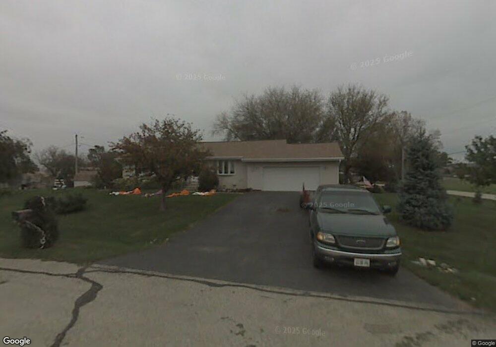
7704 Broadview Ct Spring Grove, IL 60081
Estimated Value: $237,289 - $327,000
Studio
--
Bath
1,296
Sq Ft
$205/Sq Ft
Est. Value
About This Home
This home is located at 7704 Broadview Ct, Spring Grove, IL 60081 and is currently estimated at $265,822, approximately $205 per square foot. 7704 Broadview Ct is a home located in McHenry County with nearby schools including Spring Grove Elementary School, Nippersink Middle School, and Richmond-Burton High School.
Ownership History
Date
Name
Owned For
Owner Type
Purchase Details
Closed on
Dec 6, 1993
Sold by
Smid Charles J and Smid Dorothy A
Bought by
Kersten Walter M and Miller Linda R
Current Estimated Value
Home Financials for this Owner
Home Financials are based on the most recent Mortgage that was taken out on this home.
Original Mortgage
$91,000
Interest Rate
6.95%
Create a Home Valuation Report for This Property
The Home Valuation Report is an in-depth analysis detailing your home's value as well as a comparison with similar homes in the area
Home Values in the Area
Average Home Value in this Area
Purchase History
| Date | Buyer | Sale Price | Title Company |
|---|---|---|---|
| Kersten Walter M | $114,000 | -- |
Source: Public Records
Mortgage History
| Date | Status | Borrower | Loan Amount |
|---|---|---|---|
| Closed | Kersten Walter M | $91,000 |
Source: Public Records
Tax History
| Year | Tax Paid | Tax Assessment Tax Assessment Total Assessment is a certain percentage of the fair market value that is determined by local assessors to be the total taxable value of land and additions on the property. | Land | Improvement |
|---|---|---|---|---|
| 2024 | $4,709 | $69,575 | $15,071 | $54,504 |
| 2023 | $4,547 | $63,602 | $13,777 | $49,825 |
| 2022 | $4,441 | $57,268 | $12,405 | $44,863 |
| 2021 | $4,289 | $54,965 | $11,906 | $43,059 |
| 2020 | $4,211 | $52,887 | $11,456 | $41,431 |
| 2019 | $4,154 | $51,188 | $11,088 | $40,100 |
| 2018 | $4,178 | $49,073 | $10,630 | $38,443 |
| 2017 | $4,163 | $46,732 | $10,123 | $36,609 |
| 2016 | $4,078 | $43,814 | $9,491 | $34,323 |
| 2013 | -- | $41,427 | $8,974 | $32,453 |
Source: Public Records
Map
Nearby Homes
- 1992 Red Oak Ln
- LOT 9 Mayo Ct
- 2003 Red Oak Ln
- 2150 U S 12
- 1876 Red Oak Ln
- Lot 36 Red Oak Ln
- 2214 Main Street Rd
- 7393 English Oak Ln
- 7389 English Oak Ln
- 7377 English Oak Ln
- 7381 English Oak Ln
- 1979 Red Oak Ln
- 7388 English Oak Ln
- 7373 English Oak Ln
- 1975 Red Oak Ln
- 1971 Red Oak Ln
- 1852 Red Oak Ln
- Lot 65,66,&64 Main Street Rd
- 1848 Red Oak Ln
- 2617 Spring Leaf Dr
- 2202 Westward Dr
- 7716 Broadview Ct
- 7711 Broadview Ct
- 7713 Broadview Ct
- 2116 Westward Dr
- 7715 Broadview Ct
- 7717 Broadview Ct
- 2213 Westward Dr
- 7702 Utility St
- 7708 Utility Ct
- 7615 Blivin St
- 2208 U S 12
- 7710 Utility St
- 2208 N Us Highway 12
- 2112 Westward Dr
- 2215 Westward Dr
- 7701 Blivin St
- 7712 Utility Ct
- 7712 Utility St
- 2214 U S 12
Your Personal Tour Guide
Ask me questions while you tour the home.