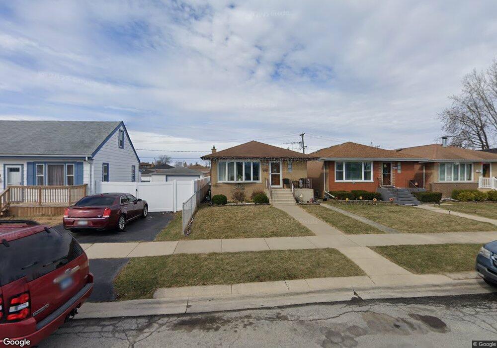
7706 Massasoit Ave Burbank, IL 60459
Estimated Value: $300,011 - $323,000
3
Beds
2
Baths
1,104
Sq Ft
$282/Sq Ft
Est. Value
About This Home
This home is located at 7706 Massasoit Ave, Burbank, IL 60459 and is currently estimated at $311,753, approximately $282 per square foot. 7706 Massasoit Ave is a home located in Cook County with nearby schools including J.B. Kennedy Elementary School, Reavis High School, and St Albert the Great Catholic School.
Ownership History
Date
Name
Owned For
Owner Type
Purchase Details
Closed on
Jan 12, 2018
Sold by
Opitz Carol S and Opitz Louis G
Bought by
Chicago Title Land Trust Company and Trust Number 8002376769
Current Estimated Value
Purchase Details
Closed on
Aug 3, 2012
Sold by
Opitz Louis G and Opitz Carol S
Bought by
Opitz Louis G and Opitz Carol S
Purchase Details
Closed on
Mar 26, 2012
Sold by
Opitz Louis G and Opitz Louis
Bought by
Opitz Louis G and Opitz Carol S
Home Financials for this Owner
Home Financials are based on the most recent Mortgage that was taken out on this home.
Original Mortgage
$125,200
Interest Rate
3.91%
Mortgage Type
New Conventional
Create a Home Valuation Report for This Property
The Home Valuation Report is an in-depth analysis detailing your home's value as well as a comparison with similar homes in the area
Home Values in the Area
Average Home Value in this Area
Purchase History
| Date | Buyer | Sale Price | Title Company |
|---|---|---|---|
| Chicago Title Land Trust Company | -- | Chicago Title Land Trust Com | |
| Opitz Louis G | -- | None Available | |
| Opitz Louis G | -- | Prairie Title |
Source: Public Records
Mortgage History
| Date | Status | Borrower | Loan Amount |
|---|---|---|---|
| Previous Owner | Opitz Louis G | $125,200 |
Source: Public Records
Tax History
| Year | Tax Paid | Tax Assessment Tax Assessment Total Assessment is a certain percentage of the fair market value that is determined by local assessors to be the total taxable value of land and additions on the property. | Land | Improvement |
|---|---|---|---|---|
| 2025 | $6,108 | $21,083 | $3,506 | $17,577 |
| 2024 | $6,108 | $21,083 | $3,506 | $17,577 |
| 2023 | $6,387 | $23,001 | $3,506 | $19,495 |
| 2022 | $6,387 | $16,562 | $3,044 | $13,518 |
| 2021 | $3,899 | $16,562 | $3,044 | $13,518 |
| 2020 | $3,908 | $16,562 | $3,044 | $13,518 |
| 2019 | $3,408 | $15,684 | $2,767 | $12,917 |
| 2018 | $3,307 | $15,684 | $2,767 | $12,917 |
| 2017 | $3,234 | $15,684 | $2,767 | $12,917 |
| 2016 | $2,498 | $11,370 | $2,306 | $9,064 |
| 2015 | $2,332 | $11,370 | $2,306 | $9,064 |
| 2014 | $2,292 | $11,370 | $2,306 | $9,064 |
| 2013 | $3,516 | $16,205 | $2,306 | $13,899 |
Source: Public Records
Map
Nearby Homes
- 5834 W 77th St Unit 104
- 7814 Major Ave
- 7843 Massasoit Ave
- 7836 Monitor Ave
- 7807 Parkside Ave
- 5822 W 79th St
- 7808 Central Ave
- 5841 W 75th Place
- 7544 Mason Ave
- 7827 Meade Ave
- 7851 Moody Ave
- 8033 Austin Ave
- 6124 W 79th St
- 7723 Melvina Ave
- 5831 W 81st Place
- 7624 Lockwood Ave
- 8121 Mcvicker Ave
- 5242 W 79th St Unit 3D
- 6117 W 81st St
- 8215 Austin Ave
- 7704 Massasoit Ave
- 7702 Massasoit Ave
- 7710 Massasoit Ave
- 7710 Massasoit Ave
- 7716 Massasoit Ave
- 7726 Massasoit Ave
- 7707 Menard Ave
- 7705 Menard Ave
- 7709 Menard Ave
- 7728 Massasoit Ave
- 7711 Menard Ave
- 7713 Menard Ave
- 7701 Menard Ave
- 7701 Menard Ave
- 7730 Massasoit Ave
- 7715 Menard Ave
- 7715 Menard Ave
- 7707 Massasoit Ave
- 7709 Massasoit Ave
- 7705 Massasoit Ave
Your Personal Tour Guide
Ask me questions while you tour the home.