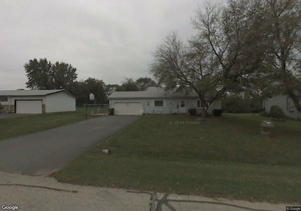
7709 Utility St Spring Grove, IL 60081
Estimated Value: $304,000 - $415,000
3
Beds
--
Bath
2,184
Sq Ft
$161/Sq Ft
Est. Value
About This Home
This home is located at 7709 Utility St, Spring Grove, IL 60081 and is currently estimated at $350,687, approximately $160 per square foot. 7709 Utility St is a home located in McHenry County with nearby schools including Spring Grove Elementary School, Nippersink Middle School, and Richmond-Burton High School.
Ownership History
Date
Name
Owned For
Owner Type
Purchase Details
Closed on
Nov 22, 2006
Sold by
Matteo Anthony
Bought by
Tiso Matteo Roberta
Current Estimated Value
Purchase Details
Closed on
Mar 11, 1998
Sold by
Medrow Karen L
Bought by
Matteo Anthony J and Tiso Matteo Roberta
Home Financials for this Owner
Home Financials are based on the most recent Mortgage that was taken out on this home.
Original Mortgage
$122,000
Interest Rate
7.23%
Create a Home Valuation Report for This Property
The Home Valuation Report is an in-depth analysis detailing your home's value as well as a comparison with similar homes in the area
Home Values in the Area
Average Home Value in this Area
Purchase History
| Date | Buyer | Sale Price | Title Company |
|---|---|---|---|
| Tiso Matteo Roberta | -- | None Available | |
| Matteo Anthony J | $127,000 | Chicago Title Insurance Co |
Source: Public Records
Mortgage History
| Date | Status | Borrower | Loan Amount |
|---|---|---|---|
| Previous Owner | Matteo Anthony J | $122,000 |
Source: Public Records
Tax History
| Year | Tax Paid | Tax Assessment Tax Assessment Total Assessment is a certain percentage of the fair market value that is determined by local assessors to be the total taxable value of land and additions on the property. | Land | Improvement |
|---|---|---|---|---|
| 2024 | $5,249 | $76,628 | $15,071 | $61,557 |
| 2023 | $5,075 | $70,050 | $13,777 | $56,273 |
| 2022 | $4,943 | $63,074 | $12,405 | $50,669 |
| 2021 | $4,777 | $60,537 | $11,906 | $48,631 |
| 2020 | $4,692 | $58,248 | $11,456 | $46,792 |
| 2019 | $4,630 | $56,376 | $11,088 | $45,288 |
| 2018 | $4,660 | $54,047 | $10,630 | $43,417 |
| 2017 | $4,647 | $51,469 | $10,123 | $41,346 |
| 2016 | $4,557 | $48,255 | $9,491 | $38,764 |
| 2013 | -- | $45,626 | $8,974 | $36,652 |
Source: Public Records
Map
Nearby Homes
- 2150 U S 12
- 1992 Red Oak Ln
- 2214 Main Street Rd
- 2003 Red Oak Ln
- LOT 9 Mayo Ct
- 1876 Red Oak Ln
- Lot 36 Red Oak Ln
- 7393 English Oak Ln
- 7377 English Oak Ln
- 7389 English Oak Ln
- 7381 English Oak Ln
- 7373 English Oak Ln
- 1979 Red Oak Ln
- 7388 English Oak Ln
- 7416 Briar Ct
- 2617 Spring Leaf Dr
- 1975 Red Oak Ln
- 1971 Red Oak Ln
- 7404 Briar Ct
- 1852 Red Oak Ln
- 7703 Utility St
- 7711 Utility St
- 7710 Finch St
- 2300 Westward Dr
- 7718 Finch St
- 7712 Utility Ct
- 7710 Utility St
- 7712 Utility St
- 2314 Westward Dr
- 7708 Utility Ct
- 7702 Utility St
- 7717 Broadview Ct
- 7715 Broadview Ct
- 7713 Broadview Ct
- 2302 U S 12 Unit REAR
- 2302 U S 12
- 7711 Broadview Ct
- 2318 Westward Dr
- 2215 Westward Dr
- 2310 N Us Highway 12
Your Personal Tour Guide
Ask me questions while you tour the home.