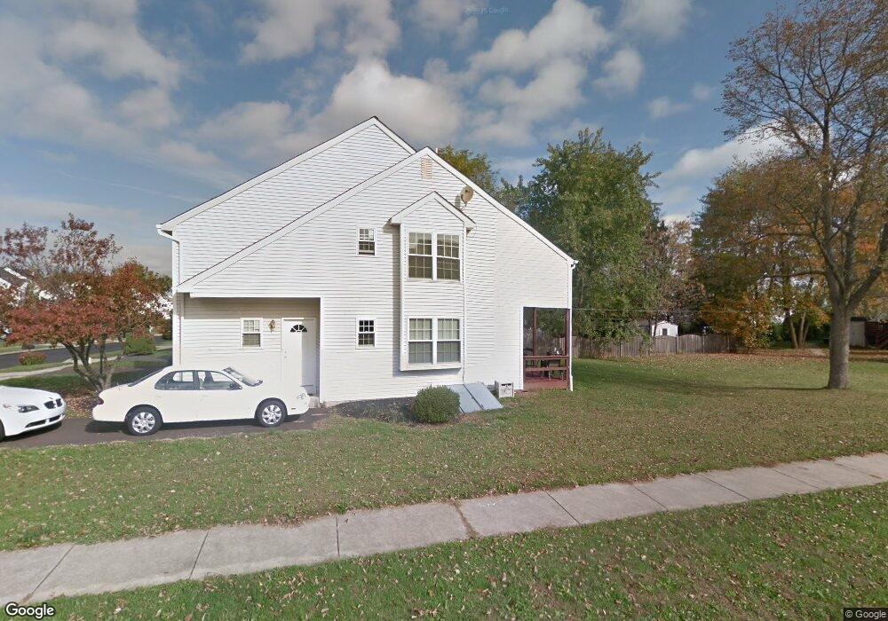
771 Brian Way Lansdale, PA 19446
Upper Gwynedd Township NeighborhoodEstimated Value: $383,000 - $638,000
4
Beds
2
Baths
1,828
Sq Ft
$287/Sq Ft
Est. Value
About This Home
This home is located at 771 Brian Way, Lansdale, PA 19446 and is currently estimated at $524,741, approximately $287 per square foot. 771 Brian Way is a home located in Montgomery County with nearby schools including Inglewood Elementary School, Penndale Middle School, and North Penn Senior High School.
Ownership History
Date
Name
Owned For
Owner Type
Purchase Details
Closed on
Nov 10, 2021
Sold by
Patel Manisha N
Bought by
Patel Manisha Nishith and Patel Nishith K
Current Estimated Value
Purchase Details
Closed on
Nov 2, 2012
Sold by
Valenti Michael
Bought by
Patel Manisha N
Purchase Details
Closed on
Mar 18, 2004
Sold by
Diblasi Paul
Bought by
Valenti Michael
Home Financials for this Owner
Home Financials are based on the most recent Mortgage that was taken out on this home.
Original Mortgage
$146,400
Interest Rate
5.58%
Create a Home Valuation Report for This Property
The Home Valuation Report is an in-depth analysis detailing your home's value as well as a comparison with similar homes in the area
Home Values in the Area
Average Home Value in this Area
Purchase History
| Date | Buyer | Sale Price | Title Company |
|---|---|---|---|
| Patel Manisha Nishith | -- | None Available | |
| Patel Manisha N | $300,000 | None Available | |
| Valenti Michael | $183,000 | -- |
Source: Public Records
Mortgage History
| Date | Status | Borrower | Loan Amount |
|---|---|---|---|
| Previous Owner | Valenti Michael | $146,400 |
Source: Public Records
Tax History Compared to Growth
Tax History
| Year | Tax Paid | Tax Assessment Tax Assessment Total Assessment is a certain percentage of the fair market value that is determined by local assessors to be the total taxable value of land and additions on the property. | Land | Improvement |
|---|---|---|---|---|
| 2025 | $4,756 | $129,600 | $47,320 | $82,280 |
| 2024 | $4,756 | $129,600 | $47,320 | $82,280 |
| 2023 | $4,533 | $129,600 | $47,320 | $82,280 |
| 2022 | $4,371 | $129,600 | $47,320 | $82,280 |
| 2021 | $4,256 | $129,600 | $47,320 | $82,280 |
| 2020 | $4,145 | $129,600 | $47,320 | $82,280 |
| 2019 | $3,794 | $129,600 | $47,320 | $82,280 |
| 2018 | $4,070 | $129,600 | $47,320 | $82,280 |
| 2017 | $3,898 | $129,600 | $47,320 | $82,280 |
| 2016 | $3,848 | $129,600 | $47,320 | $82,280 |
| 2015 | $3,673 | $129,600 | $47,320 | $82,280 |
| 2014 | $3,673 | $129,600 | $47,320 | $82,280 |
Source: Public Records
Map
Nearby Homes
- 168 Eric Ln
- 180 Providence Ln
- 134 State St
- 209 Providence Ln
- 818 Green St
- 160 Church Rd
- 10 Wheatley Walk
- 846 Fulton Ave
- 719 N Sumneytown Pike Unit 4
- 1622 Samantha Ct
- 1231 Meadowview Cir
- 418 Jefferson St
- 380 E Hancock St Unit 103B
- 380 E Hancock St Unit 102B
- 380 E Hancock St Unit 101B
- 380 E Hancock St Unit 100B
- 380 E Hancock St Unit 104A
- 380 E Hancock St Unit 103A
- 380 E Hancock St Unit 102A
- 380 E Hancock St Unit 101A