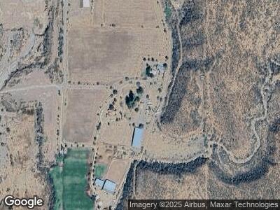
771 E Del Chi Dr Payson, AZ 85541
Estimated Value: $296,000 - $337,000
2
Beds
1
Bath
1,497
Sq Ft
$211/Sq Ft
Est. Value
About This Home
This home is located at 771 E Del Chi Dr, Payson, AZ 85541 and is currently estimated at $316,387, approximately $211 per square foot. 771 E Del Chi Dr is a home located in Gila County with nearby schools including Tonto Basin Elementary School.
Ownership History
Date
Name
Owned For
Owner Type
Purchase Details
Closed on
Jun 7, 2023
Sold by
Gaughan Maureen
Bought by
Garcia Family Living Trust
Current Estimated Value
Purchase Details
Closed on
Apr 18, 2014
Sold by
Nstl Water Development Usa
Bought by
Gressley Jacob Alan
Purchase Details
Closed on
Feb 10, 2011
Sold by
The Bank Of New York Mellon
Bought by
Gressley Jacob A
Purchase Details
Closed on
Dec 3, 2009
Sold by
Gressley Randy L
Bought by
The Bank Of New York Mellon
Purchase Details
Closed on
Aug 22, 2006
Sold by
Gressley Randy Lee
Bought by
Gressley Forrest Dayl and Gressley Randy Lee
Purchase Details
Closed on
Sep 14, 2005
Sold by
Gressley Forrest D
Bought by
Gressley Randy L
Home Financials for this Owner
Home Financials are based on the most recent Mortgage that was taken out on this home.
Original Mortgage
$200,000
Interest Rate
6.87%
Mortgage Type
New Conventional
Create a Home Valuation Report for This Property
The Home Valuation Report is an in-depth analysis detailing your home's value as well as a comparison with similar homes in the area
Home Values in the Area
Average Home Value in this Area
Purchase History
| Date | Buyer | Sale Price | Title Company |
|---|---|---|---|
| Garcia Family Living Trust | -- | Pioneer Title | |
| Gressley Jacob Alan | -- | -- | |
| Gressley Jacob A | $36,000 | Pioneer Title Agency | |
| The Bank Of New York Mellon | $157,500 | Pioneer Title Agency | |
| Gressley Forrest Dayl | -- | None Available | |
| Gressley Randy L | $250,000 | First American Title |
Source: Public Records
Mortgage History
| Date | Status | Borrower | Loan Amount |
|---|---|---|---|
| Previous Owner | Gressley Jacob A | $110,900 | |
| Previous Owner | Gressley Randy L | $200,000 |
Source: Public Records
Tax History Compared to Growth
Tax History
| Year | Tax Paid | Tax Assessment Tax Assessment Total Assessment is a certain percentage of the fair market value that is determined by local assessors to be the total taxable value of land and additions on the property. | Land | Improvement |
|---|---|---|---|---|
| 2025 | $1,558 | -- | -- | -- |
| 2024 | $1,558 | $22,289 | $3,125 | $19,164 |
| 2023 | $1,558 | $15,063 | $2,773 | $12,290 |
| 2022 | $1,573 | $15,213 | $2,385 | $12,828 |
| 2021 | $1,510 | $15,213 | $2,385 | $12,828 |
| 2020 | $1,438 | $0 | $0 | $0 |
| 2019 | $1,369 | $0 | $0 | $0 |
| 2018 | $1,304 | $0 | $0 | $0 |
| 2017 | $1,242 | $0 | $0 | $0 |
| 2016 | $1,145 | $0 | $0 | $0 |
| 2015 | $1,346 | $0 | $0 | $0 |
Source: Public Records
Map
Nearby Homes
- 009D Gun Creek
- 725 Gun Creek
- 57560 N Az Highway 188
- 073 W Sierra Ancha Way
- 249 S Old Highway 188
- Parcel 4 Ros Map 5317 Fs Rd184 -- Unit Parcel 4 ROS 5317
- B2 W Rodeo Dr
- 0000 S Forest Service 184 Rd
- 0000 S Forest Rd 184 --
- 176 D Grimes Rd
- 230 E Morning Glory Ln
- 302 S Hohokam Ln
- Parcel 4 Ros Map 5317 Fs Rd184
- 404 Grimes Rd
- 348 Old Mill Rd
- 397 Ewing Trail
- 46415 Arizona 188
- 364 E Greenback Cir
- 216 N Greenback Dr
- 875 S Accuracy Way
